1990s Maps of Henefer, Utah
Explore 5 historic maps of Henefer from the 1990s. These maps offer a rare glimpse into what life looked like during the 1990s — showing old roads, neighborhoods, homes, and landmarks that have changed or disappeared over time.
Whether you're researching your family's past, planning a metal detecting trip, or studying how Henefer's landscape evolved across the 1990s, these high-resolution maps are a powerful tool for exploring the history of this region.
- Focus on a specific era: All maps on this page are from the 1990s, giving you a focused view of this time period.
- See what’s changed: Compare century-old streets, trails, and buildings to today's modern landscape using overlays and satellite layers.
- Research with precision: Use these maps for genealogy, historical research, land use analysis, or educational projects.
- View, download, or print: Maps are fully viewable online in high resolution, and can be downloaded or printed for your own records.
Start exploring Henefer's history through authentic maps from the 1990s. This is your window into the past.
Henefer, UT maps
(5)- 1991 Map of Henefer
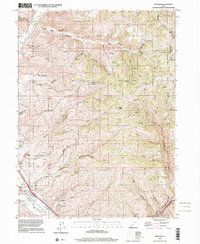
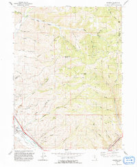 1991 Henefer1991 Print · USGSHenefer and its surrounding river valley are captured in the early nineties, showing a landscape defined by the Weber River and the rugged canyons of Summit County. Local historians can locate the Pioneer Monument, numerous claypits, and remote points like China Town and Windy Knoll.
 - 1991 Map of Devils Slide
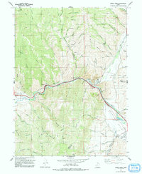 1991 Devils Slide1991 Print · USGSUpper Weber Canyon and Henefer Valley appear in the early 1990s as a vital transportation and industrial corridor. Local researchers can trace the Mormon Pioneers route alongside the Union Pacific and landmarks like the Devils Slide and the Cement Plant.
 - 1997 Map of Devils Slide, 2001 Print
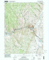 1997 Devils Slide2001 Print · USGSThe Morgan and Summit county border area in the late nineties shows a landscape of industrial limestone extraction and river-corridor settlement. Genealogists and local historians can trace the Mormon Pioneers route or locate landmarks in Henefer and Croydon.
 - 1997 Map of Coalville, 2001 Print
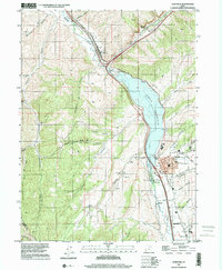 1997 Coalville2001 Print · USGSThe Weber River valley in the late nineties shows a landscape defined by water management and transit. Trace the shoreline of Echo Reservoir and locate historic markers in Coalville, from the Rodeo Grounds to the Cem.
 - 1997 Map of Henefer, 2001 Print
 1997 Henefer2001 Print · USGSThe Morgan and Summit county lines meet near the settlement of Henefer in the late 1990s as the river valley supports both ranching and industry. Trace the local landscape through the Pioneer Monument, old Claypits, and the remote northern canyon at China Town.
End of results
Showing maps 1-5 of 5
Top cities near Henefer
Frequently asked questions
- What are the different types of historical maps available for Henefer?
- What is the oldest map of Henefer?
- Where can I purchase historical maps of Henefer for my home or office?
- Where can I download high-res historical maps of Henefer?
- Are there historical topographic maps available for Henefer?
- Is there historical aerial imagery available for Henefer?
- Where are historical maps of Henefer sourced from?