1950s Maps of Eagle Mountain, Utah
Explore 9 historic maps of Eagle Mountain from the 1950s. These maps offer a rare glimpse into what life looked like during the 1950s — showing old roads, neighborhoods, homes, and landmarks that have changed or disappeared over time.
Whether you're researching your family's past, planning a metal detecting trip, or studying how Eagle Mountain's landscape evolved across the 1950s, these high-resolution maps are a powerful tool for exploring the history of this region.
- Focus on a specific era: All maps on this page are from the 1950s, giving you a focused view of this time period.
- See what’s changed: Compare century-old streets, trails, and buildings to today's modern landscape using overlays and satellite layers.
- Research with precision: Use these maps for genealogy, historical research, land use analysis, or educational projects.
- View, download, or print: Maps are fully viewable online in high resolution, and can be downloaded or printed for your own records.
Start exploring Eagle Mountain's history through authentic maps from the 1950s. This is your window into the past.
Eagle Mountain, UT maps
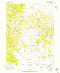
(9)- 1950 Map of Soldiers Pass, 1952 Print
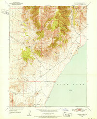 1950 Soldiers Pass1952 Print · USGSThe western shores of Utah Lake appear at mid-century, featuring the remnants of early settlement and mountain passage. Genealogists and historians can trace the Mosida (Site) area and locate industrial markers like the Mine Tunnel and Pumice Pit.3 unique versions available
 - 1950 Map of West Mountain, 1959 Print
 1950 West Mountain1959 Print · USGSThe shores of Utah Lake and the industrial corridors of the southern valley come into focus during the mid-century. Genealogists and historians can trace the rail lines of the Union Pacific and locate historic sites like Mosida (Site) and the Keigley Quarry.2 unique versions available
 - 1951 Map of Jordan Narrows, 1952 Print
 1951 Jordan Narrows1952 Print · USGSThe Jordan River valley at the Salt Lake and Utah County border was a hub of irrigation and rail in the early fifties. Genealogists and local historians can trace the foundations of Bluffdale, the boundaries of Camp Williams, and the site of the Utah State Prison.6 unique versions available
 - 1951 Map of Saratoga Springs, 1952 Print
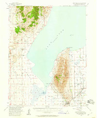
 1951 Saratoga Springs1952 Print · USGSThe northern shore of Utah Lake and the foothills of the Lake Mountains appear here in the early fifties. Researchers can trace the water works of the Murdock Pumping Sta and locate the historic Clay Pits or the settlement at Landrock.6 unique versions available
 - 1953 Map of Tooele, 1968 Print
 1953 Tooele1968 Print · USGSTooele County is shown here in the 1950s, a vast landscape transitioning between the industrial growth of the Salt Lake Valley and isolated military testing grounds. Researchers can trace the routes of the Western Pacific railroad and locate historic outposts like Iosepa Ranch and St John Station.3 unique versions available
 - 1954 Map of Tickville Spring, 1956 Print
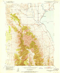
 1954 Tickville Spring1956 Print · USGSThe border of Salt Lake and Utah Counties in the mid-1950s was defined by large-scale land management and natural terrain. Genealogists and historians can trace old water systems and access routes like the Cedar Fort Ditch, Butterfield Tunnel, and Tickville Spring.4 unique versions available
 - 1954 Map of Salt Lake City, 1964 Print
 1954 Salt Lake City1964 Print · USGSThe Wasatch Front and Uinta Mountains are captured here in the mid-fifties, showing the industrial heart of Utah and its high mountain wilderness. Researchers can locate vanished infrastructure and landmarks like the Geneva Steel Plant, Bingham Canyon Mine, and the Utah State Prison.4 unique versions available
 - 1955 Map of Tooele, 1958 Print
 1955 Tooele1958 Print · USGSTooele County and the Great Salt Lake are captured here during the mid-fifties, an era of burgeoning military testing and industrial mining. Researchers can trace the rail sidings at Salduro Station, the grounds of the Deseret Chemical Corps Depot, and the International Smelting Co facilities.3 unique versions available
 - 1958 Map of Salt Lake City
 1958 Salt Lake City1958 Print · USGSThe Wasatch Front and Uinta Basin are captured during a period of significant post-war growth and industrial development. Researchers can trace the mid-century rail lines of the Bamberger RR and locate sites like the Kiegley Limestone Quarry and Camp Williams Military Reservation.
End of results
Showing maps 1-9 of 9
Top cities near Eagle Mountain
- Sandy historical maps
- Lehi historical maps
- South Jordan historical maps
- Saratoga Springs historical maps
- Herriman historical maps
- Riverton historical maps
See more
Top neighborhoods of Eagle Mountain
Frequently asked questions
- What are the different types of historical maps available for Eagle Mountain?
- What is the oldest map of Eagle Mountain?
- Where can I purchase historical maps of Eagle Mountain for my home or office?
- Where can I download high-res historical maps of Eagle Mountain?
- Are there historical topographic maps available for Eagle Mountain?
- Is there historical aerial imagery available for Eagle Mountain?
- Where are historical maps of Eagle Mountain sourced from?