1990s Maps of Heber, Utah
Explore 4 historic maps of Heber from the 1990s. These maps offer a rare glimpse into what life looked like during the 1990s — showing old roads, neighborhoods, homes, and landmarks that have changed or disappeared over time.
Whether you're researching your family's past, planning a metal detecting trip, or studying how Heber's landscape evolved across the 1990s, these high-resolution maps are a powerful tool for exploring the history of this region.
- Focus on a specific era: All maps on this page are from the 1990s, giving you a focused view of this time period.
- See what’s changed: Compare century-old streets, trails, and buildings to today's modern landscape using overlays and satellite layers.
- Research with precision: Use these maps for genealogy, historical research, land use analysis, or educational projects.
- View, download, or print: Maps are fully viewable online in high resolution, and can be downloaded or printed for your own records.
Start exploring Heber's history through authentic maps from the 1990s. This is your window into the past.
Heber, UT maps
(4)- 1993 Map of Charleston
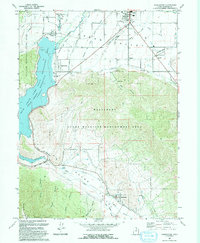 1993 Charleston1993 Print · USGSHeber Valley and Round Valley are shown in the early nineties as the region's agricultural roots met modern expansion. Genealogists and local historians can trace family-named sites like Billy Haws Canyon and landmarks including the Midway Hatchery and Cem.
 - 1997 Map of Francis, 2001 Print
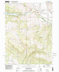 1997 Francis2001 Print · USGSRhodes Valley and the upper Provo River region are captured here in the late nineties, showcasing a landscape shaped by water and high-mountain terrain. You can trace the development of Francis, locate the local Cem, and explore the shoreline of Jordanelle Reservoir.
 - 1998 Map of Charleston, 2000 Print
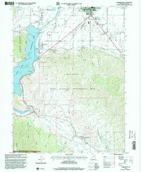 1998 Charleston2000 Print · USGSThe Heber Valley and Round Valley regions are captured here in the late nineties, showing a landscape shaped by water and rail. Researchers can trace the Heber Valley Railroad or find landmarks like Charleston Town Hall and the local Cem.
 - 1999 Map of Heber City, 2001 Print
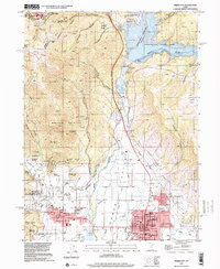 1999 Heber City2001 Print · USGSHeber City and the surrounding valley are shown just before the turn of the millennium as the region prepared for the Winter Olympics. Researchers can trace historic mining operations like the Ontario Mine, explore civic landmarks including the Heber Valley Railroad Depot, and locate the old Mound City (Site).
End of results
Showing maps 1-4 of 4
Top cities near Heber
- Provo historical maps
- Heber City historical maps
- Park City historical maps
- Snyderville historical maps
- Midway historical maps
- Kamas historical maps
See more
Top neighborhoods of Heber
Frequently asked questions
- What are the different types of historical maps available for Heber?
- What is the oldest map of Heber?
- Where can I purchase historical maps of Heber for my home or office?
- Where can I download high-res historical maps of Heber?
- Are there historical topographic maps available for Heber?
- Is there historical aerial imagery available for Heber?
- Where are historical maps of Heber sourced from?