1990s Maps of Addison County, Vermont
Explore 13 historic maps of Addison County from the 1990s. These maps offer a rare glimpse into what life looked like during the 1990s — showing old roads, neighborhoods, homes, and landmarks that have changed or disappeared over time.
Whether you're researching your family's past, planning a metal detecting trip, or studying how Addison County's landscape evolved across the 1990s, these high-resolution maps are a powerful tool for exploring the history of this region.
- Focus on a specific era: All maps on this page are from the 1990s, giving you a focused view of this time period.
- See what’s changed: Compare century-old streets, trails, and buildings to today's modern landscape using overlays and satellite layers.
- Research with precision: Use these maps for genealogy, historical research, land use analysis, or educational projects.
- View, download, or print: Maps are fully viewable online in high resolution, and can be downloaded or printed for your own records.
Start exploring Addison County's history through authentic maps from the 1990s. This is your window into the past.
Addison County, VT maps
(13)- 1997 Map of Lincoln, 2000 Print
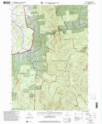 1997 Lincoln2000 Print · USGSNear the close of the twentieth century, the mountain towns of Lincoln and South Lincoln remained deeply tied to the surrounding peaks. Genealogists and hikers can trace the LONG TRAIL past Mt Abraham or locate family sites like Lee Cem and the Lincoln Community Sch.
 - 1997 Map of Rochester, 2000 Print
 1997 Rochester2000 Print · USGSVermont's Green Mountains and river valleys are shown in detail during the late nineties, capturing a transition toward forest recreation and local heritage. Researchers can trace historic sites like the CCC Camp Interpretive Site, St Dennis Ch, and the hamlets of Talcville and Jerusalem.
 - 1997 Map of Brandon, 2000 Print
 1997 Brandon2000 Print · USGSRutland County in the late nineties shows a landscape where historic valley settlements meet the rising Green Mountains. Researchers can trace the legacy of local education and industry through the Brandon State School, numerous Quarry sites, and the Churchill House.
 - 1997 Map of South Mountain, 2000 Print
 1997 South Mountain2000 Print · USGSVermont's Green Mountains and the fertile valley floor meet in this late-nineties survey of Addison County. Genealogists and hikers can trace old boundaries near West Lincoln, locate several rural burial grounds like Maple Cem, and find the Wilderness Entry Point for the Bristol Cliffs Wilderness.
 - 1997 Map of East Middlebury, 2000 Print
 1997 East Middlebury2000 Print · USGSAddison County at the close of the twentieth century shows a landscape defined by the Green Mountains and literary heritage. Researchers can trace the boundaries of Ripton and Salisbury, locating family landmarks like Cooks Cem or the Plain Sch schoolhouse.
 - 1997 Map of Mount Carmel, 2000 Print
 1997 Mount Carmel2000 Print · USGSRutland County's high ridges were meticulously mapped in the late nineties, documenting the intersection of the Green Mountain National Forest and local town boundaries. Researchers can trace remote mountain graveyards like Wetmore Cem and Bump Cem or locate early wilderness landmarks such as The Great Cliff and Boiling Spring.
 - 1997 Map of Hancock, 2000 Print
 1997 Hancock2000 Print · USGSThe White River valley in central Vermont appears here in the late nineties, showing the vital road links between Granville and Hancock. Researchers can locate several family burial sites including Elmwood Cem and South Hollow Cem, or trace the remote Boyden Trail.
 - 1997 Map of Bread Loaf, 2000 Print
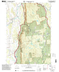
 1997 Bread Loaf2000 Print · USGSThe Green Mountains of Addison and Windsor Counties are shown here at the close of the twentieth century, detailing a landscape of high peaks and deep wilderness. Researchers can locate remote landmarks like Worth Mountain Lodge, the Middlebury College Snow Bowl, and isolated mountain shelters along the Long Trail.
 - 1997 Map of Bristol, 2000 Print
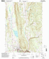 1997 Bristol2000 Print · USGSSettlement in the Green Mountain foothills is captured here during the late twentieth century, showing the rural character of Addison County. Researchers can trace family history through a high density of burial sites like Merrill Cemetery and Hallock Cemetery, or locate community landmarks in Bristol and Rocky Dale.
 - 1997 Map of Warren, 2000 Print
 1997 Warren2000 Print · USGSThe Mad River valley in the late twentieth century reveals a landscape of high-elevation farming and growing mountain recreation. Genealogists and hikers can trace old routes through Roxbury Gap, locate the historic Covered Bridge in Warren, and identify family sites near East Warren.
 - 1997 Map of Mount Ellen, 2000 Print
 1997 Mount Ellen2000 Print · USGSVermont's Green Mountains reveal a landscape of high peaks and winter resorts during the late nineties. Genealogists and hikers can trace the Long Trail past high summits to historic burial grounds like Little Ireland Cem and Jerusalem Cem.
 - 1999 Map of Willsboro, 2000 Print
 1999 Willsboro2000 Print · USGSSettled along the shores of Lake Champlain at the close of the twentieth century, this area features historic villages and mountain peaks. Genealogists can trace family names at Boardman Cem and Barber Cem or locate the Covered Bridge and St Philip Ch.
 - 1999 Map of Westport, 2000 Print
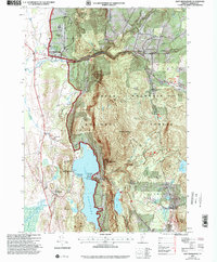
 1999 Westport2000 Print · USGSLake Champlain and the Adirondack foothills met in the final years of the millennium, showing a landscape shaped by recreation and river drainage. Researchers can find lakeside landmarks like Camp Dudley, family burial sites at Riverside Cem, and the winding course of the Boquet River.
End of results
Showing maps 1-13 of 13
Top cities of Addison County
- Middlebury historical maps
- Ferrisburgh historical maps
- Vergennes historical maps
- Bristol historical maps
- Starksboro historical maps
- New Haven historical maps
See more
Frequently asked questions
- What are the different types of historical maps available for Addison County?
- What is the oldest map of Addison County?
- Where can I purchase historical maps of Addison County for my home or office?
- Where can I download high-res historical maps of Addison County?
- Are there historical topographic maps available for Addison County?
- Is there historical aerial imagery available for Addison County?
- Where are historical maps of Addison County sourced from?