1980s Maps of Lyndon, Vermont
Explore 8 historic maps of Lyndon from the 1980s. These maps offer a rare glimpse into what life looked like during the 1980s — showing old roads, neighborhoods, homes, and landmarks that have changed or disappeared over time.
Whether you're researching your family's past, planning a metal detecting trip, or studying how Lyndon's landscape evolved across the 1980s, these high-resolution maps are a powerful tool for exploring the history of this region.
- Focus on a specific era: All maps on this page are from the 1980s, giving you a focused view of this time period.
- See what’s changed: Compare century-old streets, trails, and buildings to today's modern landscape using overlays and satellite layers.
- Research with precision: Use these maps for genealogy, historical research, land use analysis, or educational projects.
- View, download, or print: Maps are fully viewable online in high resolution, and can be downloaded or printed for your own records.
Start exploring Lyndon's history through authentic maps from the 1980s. This is your window into the past.
Lyndon, VT maps
(8)- 1983 Map of St. Johnsbury
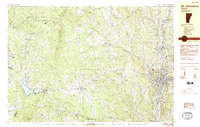 1983 St. Johnsbury1983 Print · USGSCaledonia County's rail and river corridors are captured in the early eighties as the region balanced its industrial heritage with expanding highway infrastructure. Genealogists can locate family sites from Greenbank Hollow to Walden, including the Pope Cem and the Noyesville Sch.2 unique versions available
 - 1986 Map of Mount Washington
 1986 Mount Washington1986 Print · USGSThe northern New England highlands are shown here in the mid-eighties, centered on the high peaks and river valleys of the New Hampshire borderlands. Researchers can trace historic transportation lines like the Mount Washington Cog Railway and the Maine Central Railroad near Gorham and Lancaster.
 - 1986 Map of Groveton
 1986 Groveton1986 Print · USGSThe North Country's rugged borderlands come into focus in the mid-1980s, tracing the river-and-rail corridors of the Connecticut River valley. Genealogists and historians can locate family landmarks in North Stratford, Groveton, and Guildhall or trace the Canadian National RR.2 unique versions available
 - 1986 Map of Lyndonville, 1987 Print
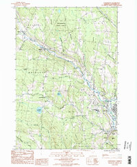 1986 Lyndonville1987 Print · USGSCaledonia County, Vermont, enters the late twentieth century as a landscape of highland forests and tight river-valley villages. Genealogists and local historians can trace the roads connecting Lyndonville and Wheelock past Lyndon State College and rural Cem sites.2 unique versions available
 - 1988 Map of Burke Mountain
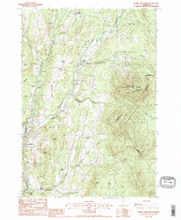 1988 Burke Mountain1988 Print · USGSThe Vermont highlands of the late eighties are defined here by the steep slopes of Burke Mtn and the working landscapes of the Caledonia and Essex county lines. Genealogists and hikers can trace old routes like Calendar Brook or locate historic hamlets including Burke Hollow and Red Village.2 unique versions available
 - 1988 Map of Montpelier
 1988 Montpelier1988 Print · USGSThe area surrounding Vermont’s capital city appears here during the early 1940s, showing the vital rail-and-river network. Genealogists can trace family names across a dozen district schools and rural sites like Middlesex Center and the Talc Mine.2 unique versions available
 - 1988 Map of Mount Washington, 1989 Print
 1988 Mount Washington1989 Print · USGSThe New Hampshire high country in the late 1980s is defined by its iconic peaks and the legacy of mountain tourism. Trace the routes of the historic Mount Washington Cog Railway and the Maine Central RR through the gaps of Crawford Notch State Park.
 - 1989 Map of Mount Mansfield
 1989 Mount Mansfield1989 Print · USGSNorthern Vermont in the late eighties remains a landscape of deep forests and isolated mountain villages. Genealogists and hikers can trace the old rail lines of the Canadian Pacific RR or locate family sites near Lake Willoughby and Brownington Village.
End of results
Showing maps 1-8 of 8
Top cities near Lyndon
- Saint Johnsbury historical maps
- Littleton historical maps
- Barton historical maps
- Danville historical maps
- Cabot historical maps
- Lunenburg historical maps
See more
Top neighborhoods of Lyndon
- Egypt historical maps
- Folsom historical maps
- Lyndon Center historical maps
- East Lyndon historical maps
- Lyndonville historical maps
Frequently asked questions
- What are the different types of historical maps available for Lyndon?
- What is the oldest map of Lyndon?
- Where can I purchase historical maps of Lyndon for my home or office?
- Where can I download high-res historical maps of Lyndon?
- Are there historical topographic maps available for Lyndon?
- Is there historical aerial imagery available for Lyndon?
- Where are historical maps of Lyndon sourced from?