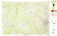
1983 Map of St. Johnsbury
USGS Topo · Published 1983About this map
The Passumpsic River and Sleeper River converge at the industrial and educational heart of the Northeast Kingdom, where the Canadian Pacific railroad tracks trace the valley floor. This 1983 topographic study captures the transition from the densely settled streets of St Johnsbury, featuring the St Johnsbury Academy and St Johnsbury Hospital, to the surrounding agricultural uplands and dairy country of Danville and Walden. The map reveals a landscape defined by its water power and elevation, from the remote Steam Mill Brook Wildlife Management Area in the northwest to the recreational cluster around Joes Pond.
Find a feature on this map
68 named features on this map. Tap any name to fly to it.
Don’t see what you’re looking for? This feature index may not catch every label — zoom into the map to look around manually.
Map Details
Editions of this 1983 St. Johnsbury Map
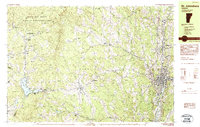
2 editions found
Other maps of this area

1928 · Hardwick
USGS Topo · 1:62,500

1931 · Littleton
USGS Topo · 1:62,500

1932 · Littleton
USGS Topo · 1:48,000

1934 · Hardwick
USGS Topo · 1:48,000

1935 · Littleton
USGS Topo · 1:62,500

1935 · Lyndonville
USGS Topo · 1:48,000

1938 · Hardwick
USGS Topo · 1:62,500

1938 · St. Johnsbury
USGS Topo · 1:48,000

1939 · Lyndonville
USGS Topo · 1:62,500

1939 · Plainfield
USGS Topo · 1:48,000