2000s (21st Century) Maps of Underhill, Vermont
Explore 5 historic maps of Underhill from the 2000s (21st Century). These maps offer a rare glimpse into what life looked like during the 2000s — showing old roads, neighborhoods, homes, and landmarks that have changed or disappeared over time.
Whether you're researching your family's past, planning a metal detecting trip, or studying how Underhill's landscape evolved across the 2000s, these high-resolution maps are a powerful tool for exploring the history of this region.
- Focus on a specific era: All maps on this page are from the 2000s, giving you a focused view of this time period.
- See what’s changed: Compare century-old streets, trails, and buildings to today's modern landscape using overlays and satellite layers.
- Research with precision: Use these maps for genealogy, historical research, land use analysis, or educational projects.
- View, download, or print: Maps are fully viewable online in high resolution, and can be downloaded or printed for your own records.
Start exploring Underhill's history through authentic maps from the 2000s. This is your window into the past.
Underhill, VT maps
(5)- 2024 Map of Bolton Mountain, 2024 Print
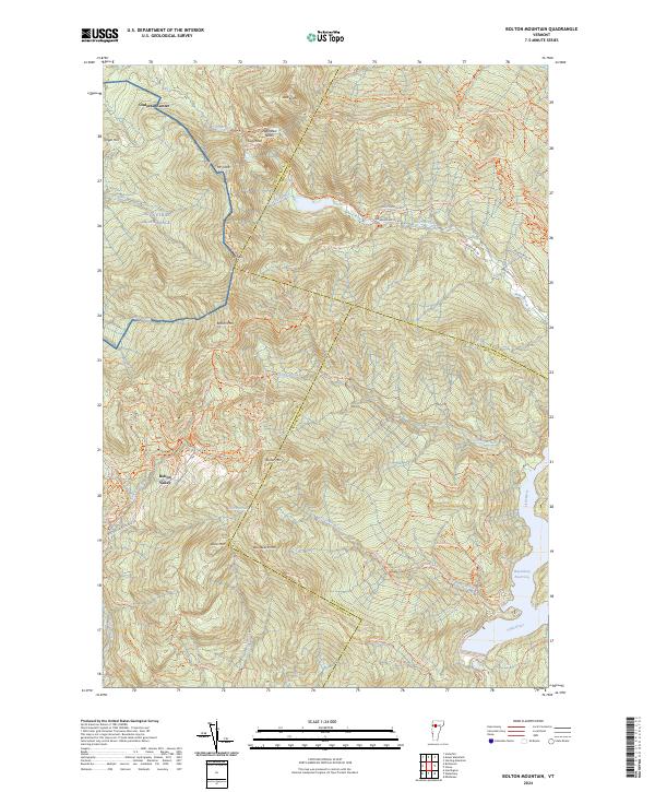 2024 Bolton Mountain2024 Print · USGSThe high peaks of the Green Mountains are captured in this 2024 survey, showing the development of Bolton Valley and the vast trail networks around Bolton Mtn. Trace the paths of the Long Trl and Catamount Trl through Nebraska Notch.
 - 2024 Map of Mount Mansfield, 2024 Print
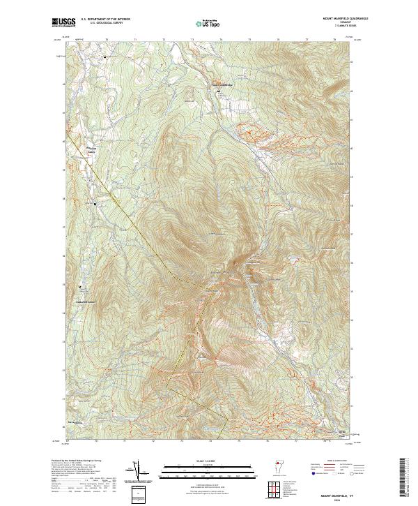 2024 Mount Mansfield2024 Print · USGSThe Green Mountains in the early twenty-first century are defined here by high peaks and valley hamlets. Researchers can trace historic burial sites like Hopkins Cem and navigate the high passes of Smugglers Notch and Chilcoot Pass.
 - 2024 Map of Richmond, 2024 Print
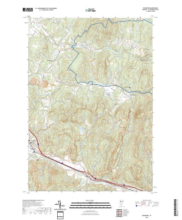 2024 Richmond2024 Print · USGSChittenden County’s river valleys and mountain ridges are captured here in the early twenty-first century, showing the enduring village footprints of Richmond and Jonesville. Researchers can trace local lineage through River View Cem and Saint Marys Cem or locate old farms along Lee River Rd.
 - 2024 Map of Gilson Mountain, 2024 Print
 2024 Gilson Mountain2024 Print · USGSNorthern Vermont's rural character is preserved in this modern survey of the hills and valleys at the edge of the Green Mountains. Researchers can trace generations of families through numerous burial sites like Mudgett Cem and Spafford Cem near Binghamville.
 - 2024 Map of Underhill, 2024 Print
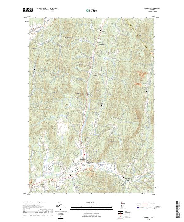 2024 Underhill2024 Print · USGSChittenden County’s foothill villages and mountain gaps are captured in this modern survey of the Green Mountains area. Researchers can locate many local landmarks like the Irish Settlement Cem, Underhill Flats, and the rural Davis Airport.
End of results
Showing maps 1-5 of 5
Top cities near Underhill
- Colchester historical maps
- Essex historical maps
- Essex Junction historical maps
- Williston historical maps
- Waterbury historical maps
- Stowe historical maps
See more
Top neighborhoods of Underhill
Frequently asked questions
- What are the different types of historical maps available for Underhill?
- What is the oldest map of Underhill?
- Where can I purchase historical maps of Underhill for my home or office?
- Where can I download high-res historical maps of Underhill?
- Are there historical topographic maps available for Underhill?
- Is there historical aerial imagery available for Underhill?
- Where are historical maps of Underhill sourced from?