Old Maps of Grand Isle, Vermont for Hiking & Exploration
Hike through history with 49 historic maps of Grand Isle. Explore old trails, ghost towns, and forgotten backroads — perfect for outdoor adventurers and local explorers.
- Rediscover forgotten places: Map out old mining camps, roads, and footpaths that no longer exist on modern maps.
- Layer with modern tools: Combine with LiDAR or satellite views to plan hikes through historical terrain.
- Made for exploration: Popular among hikers, overlanders, and local history lovers.
Use these maps to find adventure and explore the hidden past of Grand Isle.
Grand Isle, VT maps
(49)- 1894 Map of Plattsburg
 1894 Plattsburg1894 Print · USGSLake Champlain was a bustling corridor of steamer routes and rail lines in the 1890s. Researchers can trace the layout of Plattsburg Barracks, find the Hotel Champlain at Bluff Point, and explore the islands of GRAND ISLE and South Hero.3 unique versions available
 - 1895 Map of Rouse Point
 1895 Rouse Point1895 Print · USGSUpper Lake Champlain and the Canadian border served as a critical late 19th-century transit corridor where major rail lines met the water. Researchers can trace historic family lands near Beekmantown, the strategic position of Fort Montgomery, and the lighthouses at Isle La Motte and Point au Roche.3 unique versions available
 - 1906 Map of Plattsburg
 1906 Plattsburg1906 Print · USGSLake Champlain's northern waters are captured here in the early 1900s, showing the vital maritime and rail corridors of Clinton County and the islands of Vermont. Genealogists and historians can trace the Plattsburg Barracks, find old stops like Grand Isle Sta., and locate lighthouses such as Valcour L.H..6 unique versions available
 - 1907 Map of Rouse Point
 1907 Rouse Point1907 Print · USGSThe Lake Champlain shoreline at the turn of the century reveals a busy borderland of rail junctions and island settlements. Researchers can trace the early waterfront at Rouse Point, find the Fisk church on Isle La Motte, and locate Fort Montgomery near the Canadian boundary.5 unique versions available
 - 1913 Map of Milton
 1913 Milton1913 Print · USGSVermont's northwestern lakefront settlements are captured here just before the Great War, showing a landscape of small school districts and lakeside camps. Trace early transport routes like the CENTRAL VERMONT railroad or locate historic homesites near Miltonborough, Georgia Plains, and Checkerberry Village.
 - 1914 Map of St. Albans
 1914 St. Albans1914 Print · USGSFranklin County at the dawn of the Great War shows a landscape defined by the iron rails of the Central Vermont and a bustling lakefront. Genealogists can locate old family schoolhouses like Tuller School and historic landing points including Melville Landing.2 unique versions available
 - 1915 Map of Milton
 1915 Milton1915 Print · USGSNorthwest Vermont's shoreline and interior towns come alive in the decade before the Great War, showing a network of rural schools and lakeside camps. Trace the early layout of Colchester, Westford, and Fort Ethan Allen, or locate family-named sites like Brigham Hill and Bowman Corners.5 unique versions available
 - 1916 Map of St. Albans
 1916 St. Albans1916 Print · USGSNorthwestern Vermont at the start of the Great War was a busy junction of international rail lines and lakeside resorts. Genealogists and historians can trace the early 20th-century footprints of St Albans and Swanton, or locate specific rural sites like Fonda Quarry and the Tuller School.6 unique versions available
 - 1939 Map of Rouses Point
 1939 Rouses Point1939 Print · USGSThe northern reaches of Lake Champlain and the Canadian border come alive in this pre-war survey of the New York-Vermont frontier. Genealogists and historians can trace rail-and-water connections through Rouses Point, locate family landmarks like Doane Cem, and explore the grounds of Fort Montgomery.4 unique versions available
 - 1939 Map of Plattsburg
 1939 Plattsburg1939 Print · USGSLake Champlain was a vital corridor for rail and military activity just before the second World War. Genealogists and historians can trace the Plattsburg Barracks, the Rutland Railroad on Grand Isle, and landmarks like Hotel Champlain.
 - 1941 Map of Plattsburg
 1941 Plattsburg1941 Print · USGSLake Champlain was a critical corridor of military and transport activity in the years leading into the war. Researchers can trace the legacy of the Plattsburg Barracks, the winding Rutland rail line, and the geological site at Ausable Chasm.
 - 1943 Map of Rouses Point
 1943 Rouses Point1943 Print · USGSThe Lake Champlain borderlands in the early 1940s served as a critical international junction for rail and river transit between New York, Vermont, and Quebec. Researchers can trace historic family landmarks from Fort Montgomery to local schoolhouses like Rogers Sch and Barnes Sch.2 unique versions available
 - 1943 Map of St. Albans
 1943 St. Albans1943 Print · USGSFranklin County's shoreline and rail corridors are captured here during the early years of the war, showing the vital connection between Lake Champlain and the Canadian border. Researchers can trace the paths of the Central Vermont railroad through Swanton and St Albans, or locate rural landmarks like the Rock River Sch and Fonda Quarry.
 - 1943 Map of Plattsburg
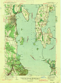 1943 Plattsburg1943 Print · USGSLake Champlain was a bustling corridor of rail and water traffic in the early 1940s, connecting the Adirondack foothills to the Vermont islands. Genealogists and researchers can trace the old schoolhouses of Beekmantown, the Rutland railroad stops, and historic sites like Hotel Champlain.4 unique versions available
 - 1944 Map of Milton
 1944 Milton1944 Print · USGSThe Lake Champlain shoreline and the Lamoille River valley are captured here just before the mid-forties. Genealogists and local historians can trace rural schoolhouse districts, the grounds of Fort Ethan Allen, and early lakeside retreats like Camp Winisquam.
 - 1948 Map of Georgia Plains, 1953 Print
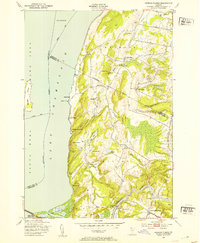 1948 Georgia Plains1953 Print · USGSCoastal Chittenden County is shown here in the late forties, where the eastern shore of Lake Champlain meets a landscape of quiet farms and summer camps. Genealogists and local historians can locate early schoolhouses like School No 8 and find the exact footprints of West Milton and Checkerberry Village.5 unique versions available
 - 1948 Map of Milton, 1954 Print
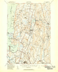 1948 Milton1954 Print · USGSMid-century Chittenden County shows a landscape of lakeside camps and interior dairy farms connected by the Central Vermont rail. Genealogists can trace family roots at St Anns Ch, Hope Cem, and vanished school districts like Silvertown Sch.4 unique versions available
 - 1950 Map of Lake Champlain
 1950 Lake Champlain1950 Print · USGSThe Lake Champlain valley and its surrounding peaks are captured in detail during the late 1940s, showing the vital rail and road connections between New York and Vermont. Researchers can trace the routes of the Central Vermont Railway or locate old industrial centers like Mineville and Witherbee.2 unique versions available
 - 1956 Map of Plattsburgh
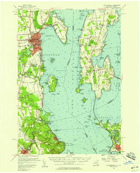 1956 Plattsburgh1956 Print · USGSLake Champlain and its island communities are captured here in the mid-fifties, just as the region's rail and water networks faced the rise of the jet age. Genealogists and historians can trace the foundations of Plattsburgh Air Force Base, old Vermont stations like Grand Isle Sta, and landmarks like Ausable Chasm.3 unique versions available
 - 1956 Map of Rouses Point, 1958 Print
 1956 Rouses Point1958 Print · USGSLake Champlain's northern islands and shoreline are captured here in the mid-1950s, where the New York and Vermont borders meet Quebec. Researchers can locate family landmarks like the Miner Institute, St Marys Cem, and the ruins of Fort Montgomery.2 unique versions available
 - 1958 Map of Lake Champlain
 1958 Lake Champlain1958 Print · USGSThe Champlain Valley and surrounding high peaks are captured here in the late fifties, showcasing the cross-border region from the Adirondacks to the Green Mountains. Researchers can trace historic rail routes like the Rutland Railway or locate old valley settlements such as Keeseville and Vergennes.2 unique versions available
 - 1962 Map of Lake Champlain, 1975 Print
 1962 Lake Champlain1975 Print · USGSLake Champlain and the high peaks of the Adirondacks and Green Mountains are captured here during the mid-twentieth century. Researchers can trace the industrial legacy of the Lyon Mountain Mine and the rail corridors of the Central Vermont RR and Delaware & Hudson RR.3 unique versions available
 - 1964 Map of St. Albans Bay, 1965 Print
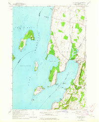 1964 St. Albans Bay1965 Print · USGSLake Champlain's eastern shoreline in the 1960s reveals a blend of island life and coastal Vermont settlements. Researchers can trace historic family burial sites at Waller Cem, explore the early footprint of Burton Island State Park, or locate the State Boat Dock at St Albans Bay.2 unique versions available
 - 1966 Map of North Hero, 1968 Print
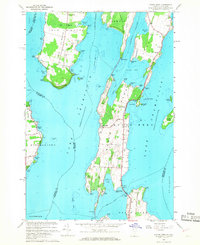 1966 North Hero1968 Print · USGSLake Champlain's islands in the mid-1960s reveal a landscape of seasonal camps, quarries, and historic crossings. Genealogists and local historians can trace family-named sites like Fisk Point and Hyde Cem or follow the path of the Old Railroad Grade.3 unique versions available
 - 1966 Map of South Hero, 1968 Print
 1966 South Hero1968 Print · USGSThe island towns of South Hero and Grand Isle are captured here in the mid-sixties, showing a landscape shaped by Lake Champlain and old transit lines. Genealogists and local historians can trace family-named sites like Hoag Cem, Adams Landing, and the Folsom Sch.
Showing maps 1-25 of 49
Top cities near Grand Isle
- Burlington historical maps
- South Burlington historical maps
- Plattsburgh historical maps
- Colchester historical maps
- Plattsburgh historical maps
- Essex historical maps
See more
Top neighborhoods of Grand Isle
- Adams Landing historical maps
- Gordon Landing historical maps
- Grand Isle Station historical maps
- Pearl historical maps
Frequently asked questions
- What are the different types of historical maps available for Grand Isle?
- What is the oldest map of Grand Isle?
- Where can I purchase historical maps of Grand Isle for my home or office?
- Where can I download high-res historical maps of Grand Isle?
- Are there historical topographic maps available for Grand Isle?
- Is there historical aerial imagery available for Grand Isle?
- Where are historical maps of Grand Isle sourced from?