Old Maps of Vershire, Vermont for Academic Research
Study the evolution of Vershire with 46 high-resolution historic maps. Whether you're teaching, researching, or modeling changes in land use, these maps provide essential visual documentation of urban, environmental, and geographic change.
- Analyze long-term change: Track patterns in development, transportation, and natural features.
- Ideal for environmental or urban studies: Support academic projects with primary historical map data.
- Use in the classroom or lab: Educators and researchers rely on these maps to bring historical context to life.
These maps are a powerful tool for teaching, research, and visualizing how Vershire has changed over the decades.
Vershire, VT maps
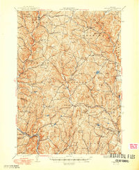
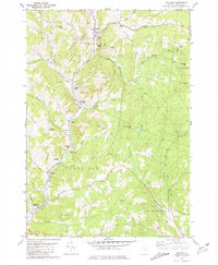
(46)- 1896 Map of Strafford
 1896 Strafford1896 Print · USGSOrange County and the upper White River valley are seen here during the height of the Vermont copper mining era. Local historians can locate specific operations like Copper Flat and Copperfield, or trace the rural landscape near South Strafford and Rices Mills.6 unique versions available
 - 1931 Map of Mt. Cube
 1931 Mt. Cube1931 Print · USGSThe Connecticut River valley and the foothills of the White Mountains are shown here as they appeared in the early 1930s. Genealogists and hikers can trace the Appalachian Trail, locate rural schools like Blood Brook Sch, or find family sites near Quinttown.3 unique versions available
 - 1933 Map of Mt. Cube
 1933 Mt. Cube1933 Print · USGSThe Upper Connecticut River valley is shown in the early thirties, where rail and river networks linked New Hampshire and Vermont. Genealogists and local historians can trace schoolhouses like Stetson Sch, the remote Quinttown settlement, and the historic Mt Cube House.6 unique versions available
 - 1944 Map of Strafford, 1949 Print
 1944 Strafford1949 Print · USGSVermont's mining and rural heritage are frozen in time on this mid-century survey of the hills between the White and Ompompanoosuc Rivers. Genealogists and historians can trace the foundations of Strafford, locate the Joseph Smith Monument, or find industrial sites like the Elizabeth Mine.5 unique versions available
 - 1947 Map of Corinth
 1947 Corinth1947 Print · USGSThe granite quarrying region of Vermont is captured here just after the war, showing the industrial density of the hills. Genealogists can trace family roots through numerous local landmarks like Wilson Cem, Miles Sch, and settlements such as Goose Green and Websterville.
 - 1948 Map of East Barre
 1948 East Barre1948 Print · USGSCentral Vermont's quarrying and timber lands are captured here just after the war, showing the industrial centers of the Knox Mountains area. Genealogists can trace family roots through numerous remote burial grounds like Hutchinson Cem and schoolhouses such as Quarry Sch.2 unique versions available
 - 1950 Map of Glens Falls
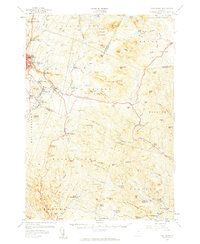
 1950 Glens Falls1950 Print · USGSThe Adirondacks and the Green Mountains meet in this mid-century survey of the New York and Vermont borderlands. Researchers can trace the industrial rail corridors of the Rutland RR and Delaware & Hudson RR connecting Glens Falls, Rutland, and the shores of Lake George.
 - 1950 Map of Lake Champlain
 1950 Lake Champlain1950 Print · USGSThe Lake Champlain valley and its surrounding peaks are captured in detail during the late 1940s, showing the vital rail and road connections between New York and Vermont. Researchers can trace the routes of the Central Vermont Railway or locate old industrial centers like Mineville and Witherbee.2 unique versions available
 - 1956 Map of Glens Falls, 1968 Print
 1956 Glens Falls1968 Print · USGSUpper New York and the Vermont mountains are captured here in the mid-fifties, showing the rugged rail-and-river network of the Northeast. Researchers can trace the paths of the Delaware and Hudson RR and Rutland RR as they wind through valley towns like Poultney and Whitehall.3 unique versions available
 - 1957 Map of East Barre, 1959 Print
 1957 East Barre1959 Print · USGSThe granite industry and deep woodland of central Vermont are on display in the mid-fifties. Genealogists can trace family lines through Wilson Cem or locate the Quarry Sch near Upper Graniteville.4 unique versions available
 - 1958 Map of Lake Champlain
 1958 Lake Champlain1958 Print · USGSThe Champlain Valley and surrounding high peaks are captured here in the late fifties, showcasing the cross-border region from the Adirondacks to the Green Mountains. Researchers can trace historic rail routes like the Rutland Railway or locate old valley settlements such as Keeseville and Vergennes.2 unique versions available
 - 1959 Map of Glens Falls
 1959 Glens Falls1959 Print · USGSUpper New York and Vermont are captured here during the late 1950s, a period of transition for these mountain communities. Researchers can trace the legacy of the region's river-and-rail economy through landmarks like Lake George, Saratoga Springs, and Killington Peak.2 unique versions available
 - 1962 Map of Lake Champlain, 1975 Print
 1962 Lake Champlain1975 Print · USGSLake Champlain and the high peaks of the Adirondacks and Green Mountains are captured here during the mid-twentieth century. Researchers can trace the industrial legacy of the Lyon Mountain Mine and the rail corridors of the Central Vermont RR and Delaware & Hudson RR.3 unique versions available
 - 1964 Map of Glens Falls
 1964 Glens Falls1964 Print · USGSThe tri-state borderlands of New York, Vermont, and New Hampshire appear here in the mid-1960s. Researchers can trace the rail routes of the Rutland RR and find historic sites like Ticonderoga and Saratoga National Historical Park.
 - 1981 Map of West Topsham
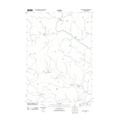
 1981 West Topsham1981 Print · USGSThe hill country of Orange and Topsham in the early 1980s reveals a landscape of isolated valley settlements and high ridges. Genealogists can trace family names at Hutchinson Cem or locate old sites like Union No 36 Sch and the mines on Pike Hill.
 - 1981 Map of Washington
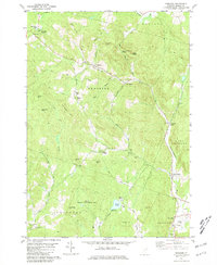
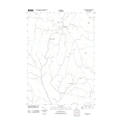
 1981 Washington1981 Print · USGSCentral Vermont's rural landscape is captured here in the early eighties, showcasing the intersection of small upland hamlets and managed timberlands. Genealogists and local historians can locate several family cemeteries such as Fish Cem and Clough Cem, or trace the winding roads connecting Washington to Kennedy Corners.2 unique versions available
 - 1981 Map of Vershire
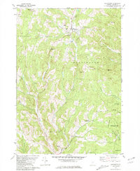
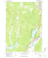
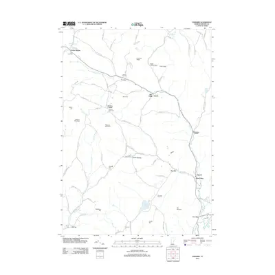
 1981 Vershire1981 Print · USGSOrange County's hill country is captured in the early 1980s, showcasing a landscape of dispersed hamlets and mountain farmsteads. Genealogists and historians can trace old property access via Old City Road and locate rural landmarks such as Vershire Center and the Mountain Sch.4 unique versions available
 - 1981 Map of Fairlee
 1981 Fairlee1981 Print · USGSThe Connecticut River valley in the early eighties shows a landscape of lakeside leisure and transit corridors. Researchers can trace the Boston and Maine rail line, locate St Martins Chapel, and find local landmarks like the Drive-in Theater and Bear Ridge Raceway.3 unique versions available
 - 1981 Map of Chelsea
 1981 Chelsea1981 Print · USGSOrange County, Vermont, maintains its traditional river-valley character in this early 1980s survey of the White River highlands. Researchers can trace historic timber spans like the Larkin Covered Bridge and locate numerous family burial grounds, including Lincoln Cem and Durkee Cem.3 unique versions available
 - 1985 Map of Rutland, 1988 Print
 1985 Rutland1988 Print · USGSThe Upper Valley of the mid-1980s comes to life along the winding Connecticut River as it divides the Green Mountain and Granite states. Historians can trace the industrial rail hubs of White River Junction and the paths of the Appalachian Trail and Long Trail.
 - 1988 Map of Montpelier
 1988 Montpelier1988 Print · USGSThe area surrounding Vermont’s capital city appears here during the early 1940s, showing the vital rail-and-river network. Genealogists can trace family names across a dozen district schools and rural sites like Middlesex Center and the Talc Mine.2 unique versions available
 - 2012 Map of West Topsham, 2012 Print
 2012 West Topsham2012 Print · USGSCovers Vershire, including Orange, Washington, and other nearby areas
 - 2012 Map of Washington, 2012 Print
 2012 Washington2012 Print · USGSCovers Vershire, including Williamstown, Orange, and other nearby areas
 - 2012 Map of Vershire, 2012 Print
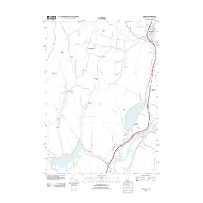
 2012 Vershire2012 Print · USGSCovers Vershire, including Strafford, West Fairlee, and other nearby areas
 - 2012 Map of Fairlee, 2012 Print
 2012 Fairlee2012 Print · USGSCovers Vershire, including Orford, Bradford, and other nearby areas
Showing maps 1-25 of 46
Top cities near Vershire
- Hanover historical maps
- Barre historical maps
- Randolph historical maps
- Williamstown historical maps
- Norwich historical maps
- Berlin historical maps
See more
Top neighborhoods of Vershire
- Beanville historical maps
- Brimstone Corner historical maps
- Mill Village historical maps
- South Vershire historical maps
- Vershire Heights historical maps
- Vershire Center historical maps
Frequently asked questions
- What are the different types of historical maps available for Vershire?
- What is the oldest map of Vershire?
- Where can I purchase historical maps of Vershire for my home or office?
- Where can I download high-res historical maps of Vershire?
- Are there historical topographic maps available for Vershire?
- Is there historical aerial imagery available for Vershire?
- Where are historical maps of Vershire sourced from?