1950s Maps of Orleans County, Vermont
Explore 11 historic maps of Orleans County from the 1950s. These maps offer a rare glimpse into what life looked like during the 1950s — showing old roads, neighborhoods, homes, and landmarks that have changed or disappeared over time.
Whether you're researching your family's past, planning a metal detecting trip, or studying how Orleans County's landscape evolved across the 1950s, these high-resolution maps are a powerful tool for exploring the history of this region.
- Focus on a specific era: All maps on this page are from the 1950s, giving you a focused view of this time period.
- See what’s changed: Compare century-old streets, trails, and buildings to today's modern landscape using overlays and satellite layers.
- Research with precision: Use these maps for genealogy, historical research, land use analysis, or educational projects.
- View, download, or print: Maps are fully viewable online in high resolution, and can be downloaded or printed for your own records.
Start exploring Orleans County's history through authentic maps from the 1950s. This is your window into the past.
Orleans County, VT maps
(11)- 1950 Map of Lake Champlain
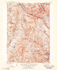
 1950 Lake Champlain1950 Print · USGSThe Lake Champlain valley and its surrounding peaks are captured in detail during the late 1940s, showing the vital rail and road connections between New York and Vermont. Researchers can trace the routes of the Central Vermont Railway or locate old industrial centers like Mineville and Witherbee.2 unique versions available
 - 1950 Map of Lewiston
 1950 Lewiston1950 Print · USGSThe Maine and New Hampshire borderlands come alive in this post-war survey of the White Mountains and Androscoggin valley. Genealogists and historians can trace rail lines like the Maine Central Railroad and find high-altitude landmarks from Mount Washington to Bretton Woods.2 unique versions available
 - 1951 Map of Lyndonville
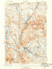
 1951 Lyndonville1951 Print · USGSCaledonia and Orleans counties are shown here in the mid-twentieth century, featuring the deep glacial waters of the Northeast Kingdom. Genealogists and historians can trace local landmarks like Lyndon Teachers College, the Canadian Pacific line through Sutton Sta, and the West Look Cem.5 unique versions available
 - 1951 Map of Hardwick, 1952 Print
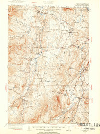
 1951 Hardwick1952 Print · USGSThe Northeast Kingdom's rugged highlands and river valleys are captured here in the early fifties, centering on the granite and rail hub of Hardwick. Researchers can trace old family schoolhouses like Wright Sch and Stan Sch or follow the route of the St Johnsbury and Lake Champlain Railroad.4 unique versions available
 - 1951 Map of Burke, 1953 Print
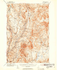 1951 Burke1953 Print · USGSNortheastern Vermont in the early 1950s is a landscape of high peaks and isolated logging hamlets. Genealogists and local historians can trace rural schools like White Sch, family burial grounds such as Pownal Cem, and the timber history of Gallup Mills.6 unique versions available
 - 1953 Map of Jay Peak, 1954 Print
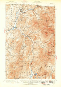 1953 Jay Peak1954 Print · USGSNorthern Vermont's Green Mountains meet the Canadian border in this mid-century survey of the high peaks and river valleys. Researchers can trace the legacy of timber and mining at Tillotson Mill and the ASBESTOS MINE, or locate rural schools like Woodward School.4 unique versions available
 - 1953 Map of Island Pond, 1954 Print
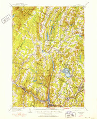
 1953 Island Pond1954 Print · USGSNortheast Vermont at the mid-century shows a landscape of rail-linked settlements and timberlands. Genealogists and historians can trace Island Pond and Norton Mills, or locate landmarks like Cargill Cem and Buck School.5 unique versions available
 - 1953 Map of Irasburg, 1954 Print
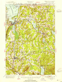
 1953 Irasburg1954 Print · USGSOrleans County, Vermont, sits at the international border in the early fifties, where the Canadian Pacific rail line meets the frontier at North Troy. Researchers can trace old family lands near Summit Siding or locate local landmarks like Brighton School and Center Cemetery.4 unique versions available
 - 1953 Map of Memphremagog, 1955 Print
 1953 Memphremagog1955 Print · USGSThe Vermont-Quebec borderlands come alive in this mid-century survey of the Northeast Kingdom, showing the region's rail-and-water commerce. Researchers can trace family roots at Brownington Village, find the Willey Granite Quarry, or locate the St Theresa Ch in Barton.5 unique versions available
 - 1956 Map of Lewiston, 1975 Print
 1956 Lewiston1975 Print · USGSThe Northern New England interior is documented here in the mid-fifties, from the industrial Androscoggin River to the high peaks of the White Mountains. Trace the Grand Trunk Railway through mountain passes or locate family landmarks near Sabbathday Lake and Bretton Woods.
 - 1958 Map of Lake Champlain
 1958 Lake Champlain1958 Print · USGSThe Champlain Valley and surrounding high peaks are captured here in the late fifties, showcasing the cross-border region from the Adirondacks to the Green Mountains. Researchers can trace historic rail routes like the Rutland Railway or locate old valley settlements such as Keeseville and Vergennes.2 unique versions available
End of results
Showing maps 1-11 of 11
Top cities of Orleans County
- Newport City historical maps
- Barton historical maps
- Craftsbury historical maps
- Irasburg historical maps
- Glover historical maps
- Coventry historical maps
See more
Frequently asked questions
- What are the different types of historical maps available for Orleans County?
- What is the oldest map of Orleans County?
- Where can I purchase historical maps of Orleans County for my home or office?
- Where can I download high-res historical maps of Orleans County?
- Are there historical topographic maps available for Orleans County?
- Is there historical aerial imagery available for Orleans County?
- Where are historical maps of Orleans County sourced from?