2020s Maps of Orleans County, Vermont
Explore 26 historic maps of Orleans County from the 2020s. These maps offer a rare glimpse into what life looked like during the 2020s — showing old roads, neighborhoods, homes, and landmarks that have changed or disappeared over time.
Whether you're researching your family's past, planning a metal detecting trip, or studying how Orleans County's landscape evolved across the 2020s, these high-resolution maps are a powerful tool for exploring the history of this region.
- Focus on a specific era: All maps on this page are from the 2020s, giving you a focused view of this time period.
- See what’s changed: Compare century-old streets, trails, and buildings to today's modern landscape using overlays and satellite layers.
- Research with precision: Use these maps for genealogy, historical research, land use analysis, or educational projects.
- View, download, or print: Maps are fully viewable online in high resolution, and can be downloaded or printed for your own records.
Start exploring Orleans County's history through authentic maps from the 2020s. This is your window into the past.
Orleans County, VT maps
(26)- 2024 Map of Westmore, 2024 Print
 2024 Westmore2024 Print · USGSVermont’s Northeast Kingdom appears in contemporary detail, showing the rural landscape around the deep waters of Lake Willoughby. Researchers can locate family landmarks such as Blyhill Cem and East Brownington Cem or follow the route of the Northern Forest Canoe Trl.
 - 2024 Map of Stannard, 2024 Print
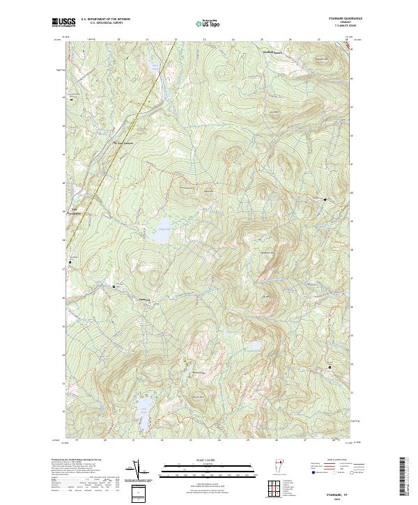 2024 Stannard2024 Print · USGSCaledonia and Orleans counties meet in this highland region during the early twenty-first century, showing a landscape of mountain peaks and scattered homesteads. Genealogists can locate family sites and burial grounds such as Stannard Cem, Ramsey Cem, and the Green Mountain Monastery.
 - 2024 Map of Orleans, 2024 Print
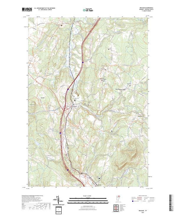 2024 Orleans2024 Print · USGSOrleans County is captured in the modern era, showing the enduring village structures and river valley corridors of Vermont's Northeast Kingdom. Researchers can locate family sites at the Brownington Center Cem and trace the paths of Alder Brook and the Barton River.
 - 2024 Map of Newport Center, 2024 Print
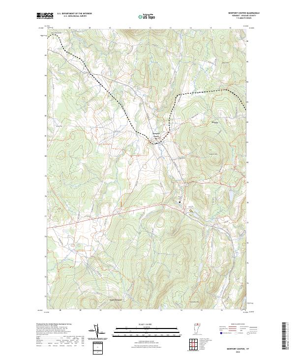 2024 Newport Center2024 Print · USGSOrleans County, Vermont, maintains its rural character in this contemporary survey of the hills and hollows near Newport Center. Researchers can trace old family routes like Drouin Mill Rd or locate the Newport Center Cem and Smith Pond.
 - 2024 Map of Irasburg, 2024 Print
 2024 Irasburg2024 Print · USGSOrleans County, Vermont, maintains its rural character in this contemporary survey of the Black River valley. Researchers can trace family history through several burial sites like Saint John Vianny Cem or explore landmarks in Irasburg and Coventry.
 - 2024 Map of Wolcott, 2024 Print
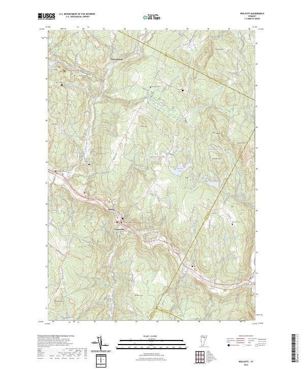 2024 Wolcott2024 Print · USGSThe Lamoille River valley serves as the heart of this Vermont township, documented here in its contemporary landscape. Researchers can trace ancestral locations through numerous burial grounds like Hubbell Cemetery or locate the village of Pottersville.
 - 2024 Map of Caspian Lake, 2024 Print
 2024 Caspian Lake2024 Print · USGSThe Greensboro and Hardwick area comes into focus through this modern survey of Vermont's lakeside and rail corridors. Genealogists can locate several family burial sites including Lincoln Noyes Cem and Sanborn Cem, or trace the path of the Lamoille Valley Rail Trl.
 - 2024 Map of Jay Peak, 2024 Print
 2024 Jay Peak2024 Print · USGSThe high ridgelines of the Green Mountains define this Vermont borderland in the early twenty-first century. Genealogists and local historians can trace family roots through Saint Isidore Cem and Montgomery Center Cem or follow the path of The Long Trl past Big Jay.
 - 2024 Map of Hazens Notch, 2024 Print
 2024 Hazens Notch2024 Print · USGSVermont's Green Mountains reveal a landscape of high peaks and historic crossings during the twenty-first century. Genealogists and hikers can trace the paths around Hazens Notch, locating Roegan Road Cem and the site of Tillotson Mill.
 - 2024 Map of Sutton, 2024 Print
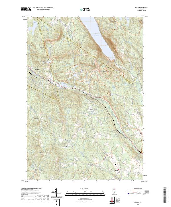 2024 Sutton2024 Print · USGSThe mountain gaps of northern Vermont are captured here in the 2020s, showcasing the high terrain around the village of Sutton. Local historians can trace family burial sites at Sutton Village Cem and North Ridge Cem or explore the steep paths up Mt Pisgah and Mt Hor.
 - 2024 Map of West Charleston, 2024 Print
 2024 West Charleston2024 Print · USGSVermont's Northeast Kingdom remains a landscape of quiet lakeside hamlets and upland farms in this recent survey. Genealogists can locate several small burial grounds, including West Charleston Cem and Crawford Hill Cem, while tracing the shores of Lake Salem.
 - 2024 Map of West Charleston OE N, 2024 Print
 2024 West Charleston OE N2024 Print · USGSThe international boundary between Vermont and Canada defines this northern frontier village at the edge of Orleans County. Genealogists can trace family plots at Saint Edwards Cem or Derby Line Cem, while outdoorsmen can follow the path of Rivière Tomifobia.
 - 2024 Map of North Troy OE N, 2024 Print
 2024 North Troy OE N2024 Print · USGSThe international border near the Green Mountains comes into focus in this contemporary survey. Trace the northern reaches of The Long Trl and Journey's End Trl as they approach North Troy and the Canada-U.S. border.
 - 2024 Map of Newport OE N, 2024 Print
 2024 Newport OE N2024 Print · USGSThe international border between Vermont and Quebec defines this landscape, showing where North Derby and Beebe Plain sit right on the line. You can trace the Beebe Spur Rail Trl, family-named brooks like Ruisseau Dustin, and the island-dotted waters of Lake Memphremagog.
 - 2024 Map of Island Pond, 2024 Print
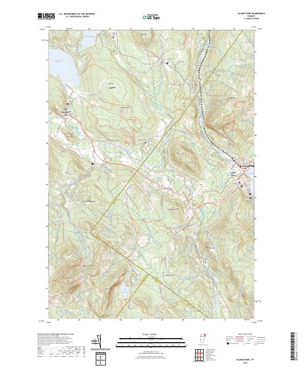 2024 Island Pond2024 Print · USGSIsland Pond at the modern day remains a critical intersection of rail history and upland wilderness. Genealogists can trace family lines through the Old Protestant Cem and Lakeside Cem, while researchers can follow the path of the St Lawrence and Atlantic RR past Bluff Mtn.
 - 2024 Map of Morgan Center, 2024 Print
 2024 Morgan Center2024 Print · USGSUpper Orleans County is shown here in its modern rural character, centered on the settlement at Morgan Center and the shores of Seymour Lake. Researchers can trace old family lands near Morgan Center Cem or explore the drainage of Holland Brook and The Hurricane.
 - 2024 Map of Morgan Center OE N, 2024 Print
 2024 Morgan Center OE N2024 Print · USGSThe international border between Vermont and Quebec takes center stage in this 2024 survey of the northern frontier. Researchers can trace historical water routes like Rivière Tomifobia or find family-named landmarks along Line Farm Rd and Holland Pond Rd.
 - 2024 Map of Jay Peak OE N, 2024 Print
 2024 Jay Peak OE N2024 Print · USGSThe northern borderlands of Vermont and Quebec meet at the settlement of East Richford in this contemporary topographic survey. Researchers can locate family landmarks at the East Richford Cem or trace the winding course of the Missisquoi River through the Green Mountains.
 - 2024 Map of Craftsbury, 2024 Print
 2024 Craftsbury2024 Print · USGSThe rural heart of Orleans County, Vermont, comes into focus in this recent survey of the hill country between the Black River and Big Hosmer Lake. Genealogists and local historians can trace family roots through numerous burial sites like Rowell Cem and the quiet settlements of Mill Village and East Craftsbury.
 - 2024 Map of Lowell, 2024 Print
 2024 Lowell2024 Print · USGSOrleans County is shown in detail during the twenty-first century, centered on the mountain-ringed village of Lowell. Researchers can trace local genealogy through several burial grounds like Old Catholic Cem and locate landmarks such as Leland Hill and McAllister Pond.
 - 2024 Map of Albany, 2024 Print
 2024 Albany2024 Print · USGSIn the highlands of north-central Vermont, this modern survey captures the rural landscape at the edge of the Lowell Mountains. Genealogists and historians can locate family burial sites at Albany Village Cem or trace the early path of the Bailey Hazen RD through Eden Notch.
 - 2024 Map of Newport, 2024 Print
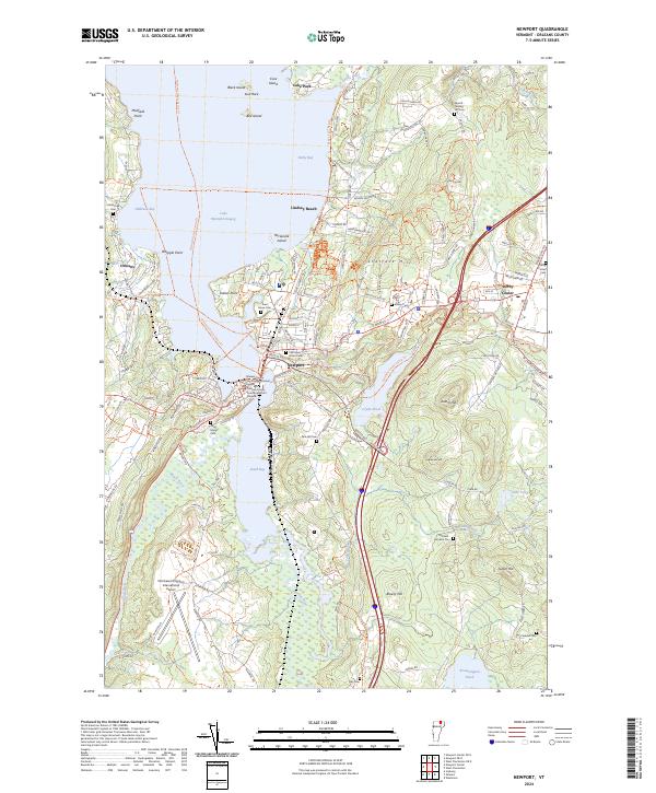 2024 Newport2024 Print · USGSThe shorelines of Lake Memphremagog and the city of Newport are presented here in the twenty-first century, showing a landscape shaped by water and recreation. Researchers can trace numerous family burial grounds like Morrill - Darling Hill Cem or locate civic landmarks such as the Orleans County Courthouse.
 - 2024 Map of North Troy, 2024 Print
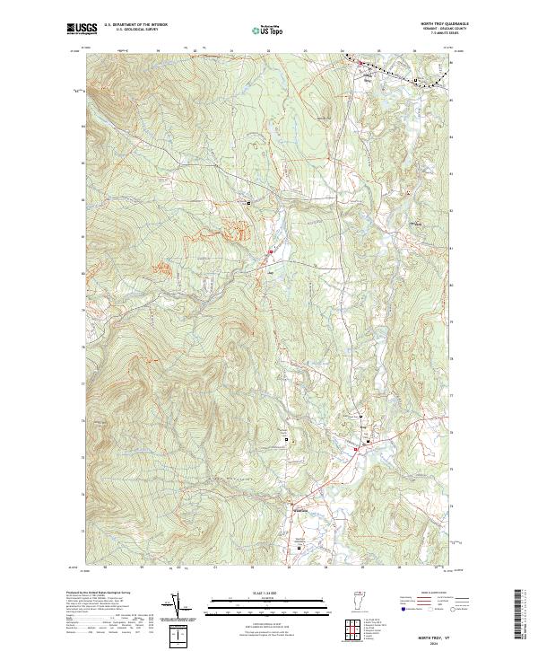 2024 North Troy2024 Print · USGSOrleans County, Vermont, maintains its character as a river-centric mountain region in this recent survey. Researchers can trace family history through several local burial grounds like West Road Cem and find landmarks such as Phillips Pond and Warner Hill.
 - 2024 Map of West Burke, 2024 Print
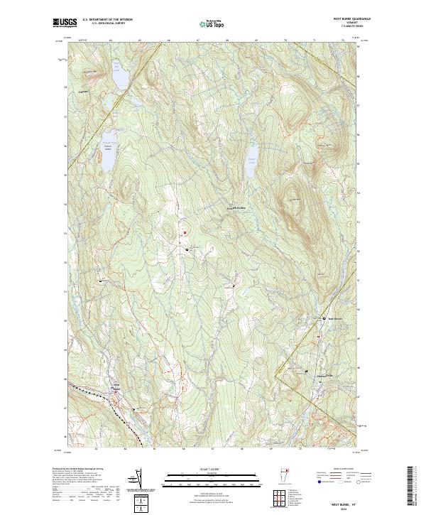 2024 West Burke2024 Print · USGSUpper Caledonia and Essex counties are captured here in the early twenty-first century, showing the rural communities along the Passumpsic forks. Genealogists can locate several historic burying grounds like Hillside Cem and Pleasant View Cem near West Burke.
 - 2024 Map of Crystal Lake, 2024 Print
 2024 Crystal Lake2024 Print · USGSThe Northeast Kingdom hills of Orleans County appear here in a recent survey, showing the enduring village layouts of Barton and Glover. Genealogists can trace family sites at Welcome O Brown Cem and the remote Sheffield Heights - Cass Cem.
Showing maps 1-25 of 26
Top cities of Orleans County
- Newport City historical maps
- Barton historical maps
- Craftsbury historical maps
- Irasburg historical maps
- Glover historical maps
- Coventry historical maps
See more
Frequently asked questions
- What are the different types of historical maps available for Orleans County?
- What is the oldest map of Orleans County?
- Where can I purchase historical maps of Orleans County for my home or office?
- Where can I download high-res historical maps of Orleans County?
- Are there historical topographic maps available for Orleans County?
- Is there historical aerial imagery available for Orleans County?
- Where are historical maps of Orleans County sourced from?