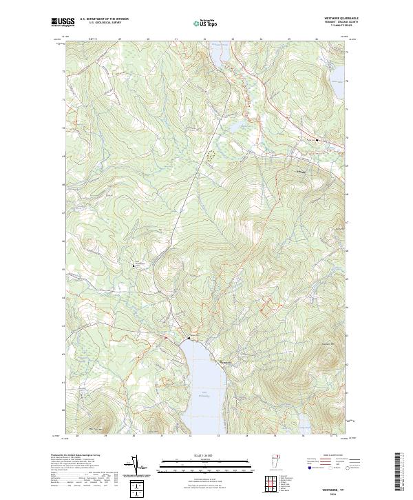
2024 Map of Westmore
USGS Topo · Published 2024About this map
Glacial carved waters and upland pastures define this portion of Orleans County, anchored by the striking profile of Lake Willoughby and the surrounding peaks. The landscape transitions from the open waters of Echo Lake in the northeast down toward the Willoughby River drainage, where the settlement of Orleans sits along the Clyde River. This modern survey traces a network of rural roads and recreation corridors, including the Northern Forest Canoe Trl and Sentinel Rock Trl, which navigate the elevation changes between May Pond Mtn and Goodwin Mtn.
Find a feature on this map
83 named features on this map. Tap any name to fly to it.
Don’t see what you’re looking for? This feature index may not catch every label — zoom into the map to look around manually.
Map Details
Editions of this 2024 Westmore Map
This is the sole edition of this map. No revisions or reprints were ever made.
Other maps of this area

1919 · Lake Memphremagog
USGS Topo · 1:62,500

1920 · Derby
USGS Topo · 1:62,500

1923 · Lake Memphremagog
USGS Topo · 1:48,000

1924 · Island Pond
USGS Topo · 1:48,000

1925 · Memphremagog
USGS Topo · 1:62,500

1926 · Island Pond
USGS Topo · 1:62,500

1935 · Lyndonville
USGS Topo · 1:48,000

1939 · Lyndonville
USGS Topo · 1:62,500

1950 · Lake Champlain
USGS Topo · 1:250,000

1950 · Lewiston
USGS Topo · 1:250,000