Old Maps of Washington County, Vermont for Genealogy
Trace your family roots with 183 historic maps of Washington County. These high-res maps reveal old neighborhoods, homesites, landmarks, and streets — helping you uncover where your ancestors lived and how the area evolved over time.
- Explore historic neighborhoods: Identify where your relatives may have lived in the 1800s or 1900s.
- Compare maps over time: Trace the changes in streets, buildings, and landmarks for multi-generational research.
- Perfect for genealogy & ancestry research: Used by family historians and researchers to map out lineage and migration.
These maps are an incredible resource for exploring your personal connection to Washington County's past.
Washington County, VT maps
(183)- 1919 Map of Lincoln Mountain, 1953 Print
 1919 Lincoln Mountain1953 Print · USGSThe Mad River valley and the high Green Mountain ridges are captured here during the first decades of the twentieth century. Genealogists and historians can locate numerous district schoolhouses like Robinson School and trace the timber-and-rail economy near the Central Vermont line.2 unique versions available
 - 1919 Map of Montpelier, 1958 Print
 1919 Montpelier1958 Print · USGSMontpelier and the Winooski River valley are shown here just after the Great War, when rail lines and early highways connected a landscape of small hill farms and mines. Genealogists can locate dozens of rural landmarks, including the Talc Mine, the Sodom PO, and the Green Mountain Cemetery.2 unique versions available
 - 1920 Map of Lincoln Mountain
 1920 Lincoln Mountain1920 Print · USGSThe Green Mountain summits and surrounding hill towns of central Vermont are captured here just after the Great War. Genealogists and local historians can trace old homesteads, early district schools like Gore School, and mountain landmarks such as Battell Lodge.
 - 1921 Map of Richmond
 1921 Richmond1921 Print · USGSThe Green Mountains in the early twenties were defined by the deep valleys of the Winooski River and the high peaks of the northern range. Genealogists and hikers can trace the original footprints of Underhill Center, the Duxbury School, and the Central Vermont rail line.
 - 1921 Map of Lincoln Mountain
 1921 Lincoln Mountain1921 Print · USGSThe Green Mountains in the early twentieth century are seen here in a detailed survey of high-elevation peaks and rural townships. Trace the early Green Mountain Trail past Battell Lodge or locate vanished hillside schoolhouses like Jerusalem School and Alder Hill School.5 unique versions available
 - 1921 Map of Montpelier
 1921 Montpelier1921 Print · USGSMontpelier and the Winooski valley are seen here in the early twenties, framed by the peaks of the Worcester Mountains. Genealogists and local historians can locate dozens of district schools and unique landmarks like the Talc Mine, Sodom PO, and the Central Vermont Ry.6 unique versions available
 - 1922 Map of Barre
 1922 Barre1922 Print · USGSCentral Vermont in the early 1920s is revealed as a bustling landscape of granite quarries, hillside farms, and the historic Norwich University campus. Genealogists and historians can trace district schoolhouses, remote cemeteries like West Hill Cemetery, and industrial landmarks including the Talc Mine and numerous quarries.
 - 1924 Map of Barre
 1924 Barre1924 Print · USGSVermont's granite country and the Dog River valley are captured here in the mid-1920s, showing the early industrial roots of the region. Researchers can locate dozens of district schools, the Norwich University campus, and local industry sites like the Washington Granite Co and the Talc Mine.5 unique versions available
 - 1924 Map of Camels Hump
 1924 Camels Hump1924 Print · USGSThe Green Mountains in the early 1920s are centered on the iconic peak of Camels Hump and the busy Winooski River corridor. Genealogists and historians can trace the foundations of local life through the State Hospital for the Insane in Waterbury, small mountain schools like Piddock School, and the path of the Central Vermont railroad.5 unique versions available
 - 1928 Map of Hardwick, 1938 Print
 1928 Hardwick1938 Print · USGSUpper Vermont at the end of the 1920s is seen here through its network of district schools and valley rail lines. Genealogists can trace family landmarks like Jackson Bridge or locate vanished schoolhouses such as Beeler Sch and Speir Sch.
 - 1934 Map of Hardwick
 1934 Hardwick1934 Print · USGSUpper Vermont's hill towns and river valleys are captured here in the mid-1930s, showing a landscape tied to the Lamoille River and small-town industry. Researchers can trace dozens of rural schoolhouses like Collinsville Sch and landmarks such as Jackson Bridge.
 - 1938 Map of Hardwick
 1938 Hardwick1938 Print · USGSVermont’s northern hills and the Lamoille River valley are shown in the late 1930s, documenting a time when rural schools and the railroad connected the highlands. Trace family roots through sites like Hazen Road Sch, Greensboro Bend, and the ST JOHNSBURY AND LAKE CHAMPLAIN RR.2 unique versions available
 - 1938 Map of St. Johnsbury
 1938 St. Johnsbury1938 Print · USGSNorthern Vermont in the late thirties reveals a landscape of rail-connected valley towns and upland farming districts. Locate old schoolhouses like Stark Sch, trace the St Johnsbury and Lake Champlain RR, and find family landmarks near Harvey Lake.
 - 1939 Map of Plainfield
 1939 Plainfield1939 Print · USGSVermont's granite-and-timber country is captured here on the eve of the 1940s, when remote rail lines still connected upland villages. Genealogists can trace family names at the Old West Ch, Hollister Hill Sch, and the isolated Lanesboro rail stop.
 - 1940 Map of Plainfield, 1953 Print
 1940 Plainfield1953 Print · USGSVermont's hill country is captured here just before the war, showing a landscape defined by small farms and upland schools. Genealogists can locate family landmarks at Maple Cors Calais PO, Old West Ch, and the St Johnsbury and Lake Champlain RR.2 unique versions available
 - 1943 Map of Plainfield
 1943 Plainfield1943 Print · USGSVermont's highland farming and rail communities are captured here in the 1940s as the state's rural landscape remained densely settled. Genealogists can locate family-named landmarks like Hollister Hill Sch, trace the Montpelier and Wells River RR, or find the Old West Ch near Kent Cors.2 unique versions available
 - 1943 Map of St. Johnsbury
 1943 St. Johnsbury1943 Print · USGSUpper Vermont and New Hampshire communities thrive along the Connecticut and Passumpsic rivers during the early war years. Genealogists can trace family names at Walden Four Corners, find rural schoolhouses like Stanton Sch, or locate the Goslants Mill site.3 unique versions available
 - 1944 Map of Montpelier
 1944 Montpelier1944 Print · USGSCentral Vermont in the mid-1940s is mapped here with a focus on its mountain settlements and river valley corridors. Genealogists can trace family roots through numerous district schools like Loomis Hill Sch and the location of the Talc Mine.
 - 1944 Map of Camels Hump
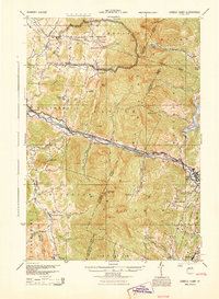 1944 Camels Hump1944 Print · USGSThe Green Mountains at the height of the war era show a landscape defined by valley settlements and military expansion. You can trace the Central Vermont rail line through Bolton or find vanished rural schoolhouses like Ricker Sch and Phillips Sch.
 - 1947 Map of Corinth
 1947 Corinth1947 Print · USGSThe granite quarrying region of Vermont is captured here just after the war, showing the industrial density of the hills. Genealogists can trace family roots through numerous local landmarks like Wilson Cem, Miles Sch, and settlements such as Goose Green and Websterville.
 - 1948 Map of East Barre
 1948 East Barre1948 Print · USGSCentral Vermont's quarrying and timber lands are captured here just after the war, showing the industrial centers of the Knox Mountains area. Genealogists can trace family roots through numerous remote burial grounds like Hutchinson Cem and schoolhouses such as Quarry Sch.2 unique versions available
 - 1948 Map of Huntington, 1953 Print
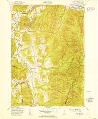 1948 Huntington1953 Print · USGSThe Huntington River valley and the heights of the Green Mountains are shown in the late 1940s before modern development. Hikers and historians can trace The Long Trail to remote camps like Gorham Lodge or find rural landmarks like Fiddock Sch.4 unique versions available
 - 1948 Map of Bolton Mountain, 1953 Print
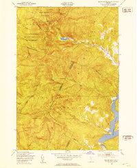 1948 Bolton Mountain1953 Print · USGSThe Green Mountains in the late 1940s served as both a recreational escape and a training ground for the military. You can trace the trails to high-altitude shelters like Taylor Lodge or locate the extensive Artillery Target Range within the Fort Ethan Allen Military Reservation.5 unique versions available
 - 1948 Map of Waterbury, 1953 Print
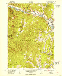 1948 Waterbury1953 Print · USGSWashington County enters the post-war era as a landscape of deep river valleys and high forest ridges. Genealogists can trace family footprints near Waterbury, find the State Hospital, or locate remote mountain schools like Phillips Sch and Durkee Sch.4 unique versions available
 - 1948 Map of Camels Hump, 1954 Print
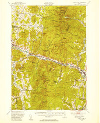 1948 Camels Hump1954 Print · USGSThe Green Mountains of the late 1940s are defined by the Winooski River corridor and the high peaks of the range. Genealogists and local historians can trace the foundations of mountain life through Old Round Ch, the Machine Gun Sch, and the rail stops of the Central Vermont line.5 unique versions available
Showing maps 1-25 of 183
Top cities of Washington County
- Barre historical maps
- Montpelier historical maps
- Northfield historical maps
- Waterbury historical maps
- Berlin historical maps
- East Montpelier historical maps
See more
Frequently asked questions
- What are the different types of historical maps available for Washington County?
- What is the oldest map of Washington County?
- Where can I purchase historical maps of Washington County for my home or office?
- Where can I download high-res historical maps of Washington County?
- Are there historical topographic maps available for Washington County?
- Is there historical aerial imagery available for Washington County?
- Where are historical maps of Washington County sourced from?