Old Maps of Blueridge Forest, Virginia for Metal Detecting
Plan your next treasure hunt with 13 historic maps of Blueridge Forest. Find old homesites, ghost towns, trails, and gathering spots that may be lost to time — perfect for identifying promising metal detecting locations.
- Locate forgotten sites: Uncover places like long-lost settlements, abandoned rail lines, or gathering spots.
- Plan better hunts: Use map overlays combined with LiDAR or satellite views to narrow in on historically rich areas.
- Made for detectorists: Thousands of hobbyists use these maps to discover relics, coins, and hidden history.
Use these historic maps to boost your research and find new opportunities beneath the surface of Blueridge Forest.
Blueridge Forest, VA maps
(13)- 1892 Map of Harrisonburg, 1901 Print
 1892 Harrisonburg1901 Print · USGSThe Shenandoah Valley during the 1890s reveals a landscape of thriving springs, mills, and emerging industry across Rockingham and Albemarle counties. Genealogists can trace family locations through sites like Meyerhoffer's Store, the Crimora Mine, and the University of Virginia Observatory.6 unique versions available
 - 1931 Map of University
 1931 University1931 Print · USGSAlbemarle County is shown here during the late Prohibition era, when the university and the railroad defined the local economy. Genealogists can trace family names through landmarks like the Miller School, Whitehall, and Mt Plains Ch.2 unique versions available
 - 1935 Map of University, 1962 Print
 1935 University1962 Print · USGSAlbemarle County is captured here in the mid-thirties as the new national park and Skyline Drive begin to reshape the Blue Ridge peaks. Genealogists can trace family names across dozens of rural institutions, from the Miller School to Meriwether Lewis Sch and Hillsboro.
 - 1949 Map of Charlottesville
 1949 Charlottesville1949 Print · USGSThe Shenandoah Valley and Blue Ridge appear in the late 1940s as a thriving corridor of rail and river commerce. Researchers can trace the mid-century footprints of Harrisonburg, Staunton, and Culpeper alongside the historic routes of the Southern Railway.2 unique versions available
 - 1956 Map of Charlottesville, 1966 Print
 1956 Charlottesville1966 Print · USGSThe Shenandoah Valley and Blue Ridge are captured in detail during the mid-1960s as the modern interstate system began to emerge. Genealogists and historians can trace rail-connected hubs like Waynesboro or follow the river paths of the Rapidan River and Rivanna River.4 unique versions available
 - 1965 Map of Free Union, 1976 Print
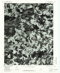
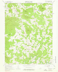 1965 Free Union1976 Print · USGSAlbemarle and Greene Counties are captured here in the mid-1960s, showing a rural landscape defined by community churches and river confluences. Researchers can locate local landmarks like Prize Hill Ch, the Thompson Cem, and the winding paths of the Mechums River.2 unique versions available
 - 1977 Map of Free Union, 1982 Print
 1977 Free Union1982 Print · USGSAlbemarle County's rolling Piedmont and rising foothills are seen in the late seventies as a landscape of rural farmsteads and ancient watercourses. Genealogists can locate family lands near Free Union, Boonesville, and the banks of the Lynch River.
 - 1986 Map of Charlottesville
 1986 Charlottesville1986 Print · USGSCentral Virginia in the mid-eighties shows a landscape balanced between the growing city centers of the Piedmont and the protected ridges of the Blue Ridge. Trace the historic rail lines of the Chesapeake and Ohio Railway or locate local landmarks like Monticello Mountain and Bridgewater College.3 unique versions available
 - 2011 Map of Free Union, 2011 Print
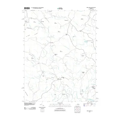 2011 Free Union2011 Print · USGSCovers Blueridge Forest, including Free Union, Fairgrove, and other nearby areas
 - 2013 Map of Free Union, 2013 Print
 2013 Free Union2013 Print · USGSCovers Blueridge Forest, including Free Union, Fairgrove, and other nearby areas
 - 2016 Map of Free Union, 2016 Print
 2016 Free Union2016 Print · USGSCovers Blueridge Forest, including Free Union, Fairgrove, and other nearby areas
 - 2019 Map of Free Union, 2019 Print
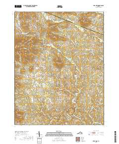 2019 Free Union2019 Print · USGSCovers Blueridge Forest, including Free Union, Fairgrove, and other nearby areas
 - 2022 Map of Free Union, 2022 Print
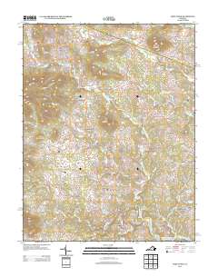
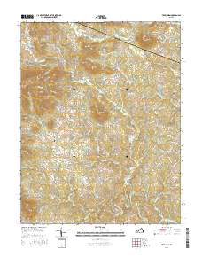
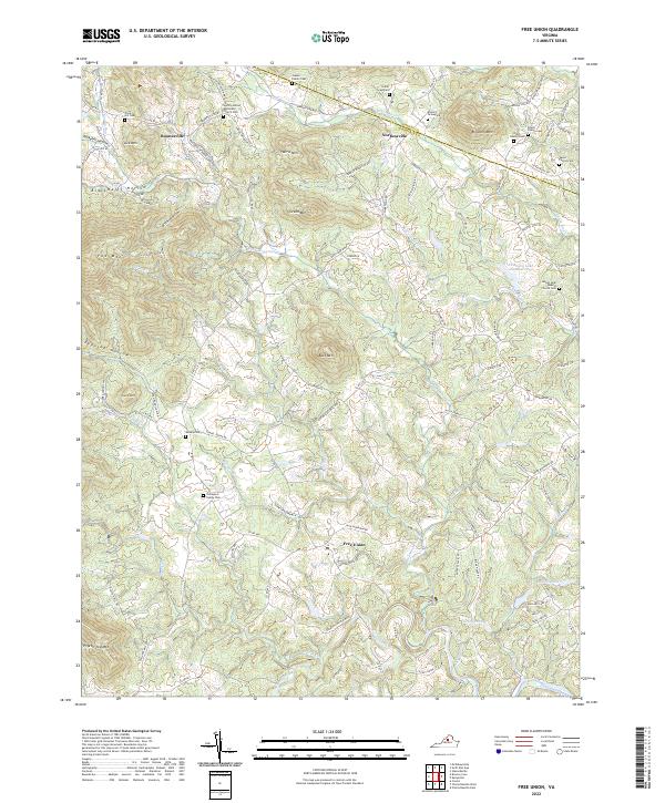 2022 Free Union2022 Print · USGSThe foothills of Albemarle and Greene Counties are mapped here in the early twenty-first century, showing a rural landscape shaped by narrow hollows and river forks. Genealogists can trace family heritage through sites like the Gentry-United Methodist Church Cem or the Gibson Family Cem.
End of results
Showing maps 1-13 of 13
Top cities near Blueridge Forest
- Charlottesville historical maps
- Lake Monticello historical maps
- Hollymead historical maps
- University of Virginia historical maps
- Crozet historical maps
- Pantops historical maps
See more
Frequently asked questions
- What are the different types of historical maps available for Blueridge Forest?
- What is the oldest map of Blueridge Forest?
- Where can I purchase historical maps of Blueridge Forest for my home or office?
- Where can I download high-res historical maps of Blueridge Forest?
- Are there historical topographic maps available for Blueridge Forest?
- Is there historical aerial imagery available for Blueridge Forest?
- Where are historical maps of Blueridge Forest sourced from?