Old Maps of Hollymead, Virginia for Hiking & Exploration
Hike through history with 24 historic maps of Hollymead. Explore old trails, ghost towns, and forgotten backroads — perfect for outdoor adventurers and local explorers.
- Rediscover forgotten places: Map out old mining camps, roads, and footpaths that no longer exist on modern maps.
- Layer with modern tools: Combine with LiDAR or satellite views to plan hikes through historical terrain.
- Made for exploration: Popular among hikers, overlanders, and local history lovers.
Use these maps to find adventure and explore the hidden past of Hollymead.
Hollymead, VA maps
(24)- 1892 Map of Gordonsville, 1899 Print
 1892 Gordonsville1899 Print · USGSCentral Virginia’s railway hubs and mountain gaps come alive in this late nineteenth-century survey. Genealogists and historians can trace the foundations of Charlottesville and the bustling rail junctions at Gordonsville and Orange.6 unique versions available
 - 1935 Map of Charlottesville
 1935 Charlottesville1935 Print · USGSAlbemarle County's landscape is meticulously detailed in the mid-1930s, centered on the historic crossroads and river forks surrounding the city. Genealogists and local historians can trace family-named landmarks and essential community sites like Monticello, the Rosenwald Sch, and the rail junction at Barboursville.2 unique versions available
 - 1939 Map of Charlottesville
 1939 Charlottesville1939 Print · USGSAlbemarle and Orange Counties come alive in the late 1930s, showing a Piedmont landscape defined by the Southwest Mountains and historic river valleys. Genealogists can locate family landmarks from Monticello to the Rosenwald Sch, alongside dozens of rural churches like Bethany Ch.3 unique versions available
 - 1949 Map of Charlottesville
 1949 Charlottesville1949 Print · USGSThe Shenandoah Valley and Blue Ridge appear in the late 1940s as a thriving corridor of rail and river commerce. Researchers can trace the mid-century footprints of Harrisonburg, Staunton, and Culpeper alongside the historic routes of the Southern Railway.2 unique versions available
 - 1949 Map of Charlottesville, 1962 Print
 1949 Charlottesville1962 Print · USGSMid-century Albemarle County is captured here during a period of steady growth, anchored by the expansion of the Charlottesville area and its surrounding ridges. Researchers can locate rural landmarks like Advance Mills, the Albemarle Training Sch, and the historic Spotswood Trail.
 - 1956 Map of Charlottesville, 1966 Print
 1956 Charlottesville1966 Print · USGSThe Shenandoah Valley and Blue Ridge are captured in detail during the mid-1960s as the modern interstate system began to emerge. Genealogists and historians can trace rail-connected hubs like Waynesboro or follow the river paths of the Rapidan River and Rivanna River.4 unique versions available
 - 1964 Map of Charlottesville East, 1965 Print
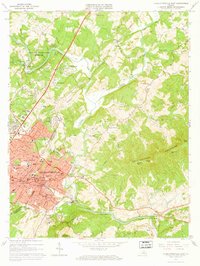 1964 Charlottesville East1965 Print · USGSCharlottesville and the surrounding Albemarle hills are captured here in the mid-sixties, just as the local landscape was being reshaped by new infrastructure. Genealogists and historians can locate Monticello, trace the vanished streets of Vinegar Hill, or find family names at Michie Tavern Cem and Griffin Cem.2 unique versions available
 - 1965 Map of Earlysville, 1966 Print
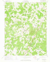 1965 Earlysville1966 Print · USGSThe Virginia Piedmont comes into sharp focus during the mid-sixties, showing the rural communities of Earlysville and Advance Mills at a moment of transition. Genealogists and local historians can trace family roots through numerous landmarks like Buck Mountain Ch, Broadus Wood Sch, and the scattered Cem markers across the hills.4 unique versions available
 - 1972 Map of Charlottesville East, 1974 Print
 1972 Charlottesville East1974 Print · USGSAlbemarle County comes into sharp focus during the early 1970s as the suburbs and road networks expand toward the Piedmont slopes. Researchers can trace the watercourses of the Rivanna River and the elevations of Southwestern Mountain.
 - 1973 Map of Charlottesville East, 1974 Print
 1973 Charlottesville East1974 Print · USGSThe Charlottesville area in the early seventies shows a balance of historical preservation and suburban growth. Trace the grounds of Monticello and the Jefferson Tomb, or locate family sites like Moon Cem and Chapman Grove Ch.3 unique versions available
 - 1977 Map of Earlysville, 1982 Print
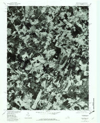 1977 Earlysville1982 Print · USGSThe rural landscapes of Albemarle County are captured during the late 1970s, showing the agricultural heart of the Virginia Piedmont. Researchers can trace historic property boundaries and river crossings near Earlysville, Advance Mills, and the slopes of Piney Mountain.
 - 1977 Map of Charlottesville East, 1982 Print
 1977 Charlottesville East1982 Print · USGSAlbemarle County in the late seventies is captured here just as the suburban footprint of the city was expanding into the surrounding hills. Genealogists and local historians can trace the rural tracts around Shadwell or follow the riverbanks at Eastham.
 - 1986 Map of Charlottesville
 1986 Charlottesville1986 Print · USGSCentral Virginia in the mid-eighties shows a landscape balanced between the growing city centers of the Piedmont and the protected ridges of the Blue Ridge. Trace the historic rail lines of the Chesapeake and Ohio Railway or locate local landmarks like Monticello Mountain and Bridgewater College.3 unique versions available
 - 1997 Map of Charlottesville East, 1999 Print
 1997 Charlottesville East1999 Print · USGSCharlottesville and Albemarle County are captured here in the late twentieth century as suburban growth reached toward the Southwest Mountains. Genealogists and historians can locate the Jefferson Tomb, find historic congregations like Chapman Grove Ch, or trace the old Three Chopt Road.
 - 2011 Map of Earlysville, 2011 Print
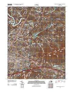
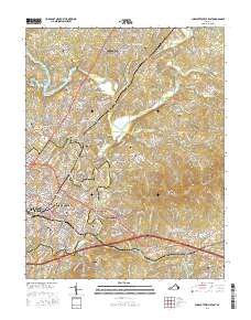
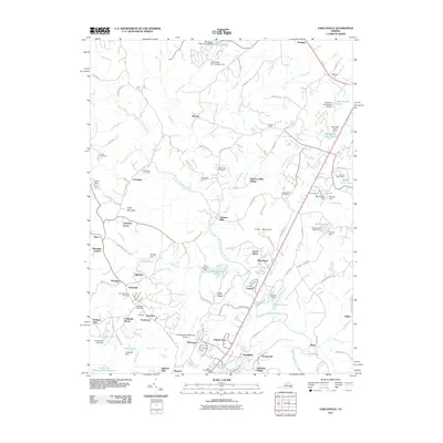 2011 Earlysville2011 Print · USGSCovers Hollymead, including Piney Mountain, Twin Lakes, and other nearby areas
 - 2011 Map of Charlottesville East, 2011 Print
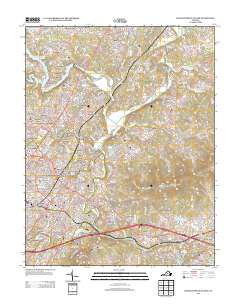
 2011 Charlottesville East2011 Print · USGSCovers Hollymead, including Charlottesville, Pantops, and other nearby areas
 - 2013 Map of Earlysville, 2013 Print
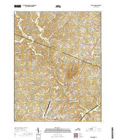
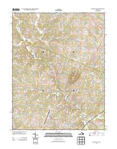 2013 Earlysville2013 Print · USGSCovers Hollymead, including Piney Mountain, Twin Lakes, and other nearby areas
 - 2013 Map of Charlottesville East, 2013 Print
 2013 Charlottesville East2013 Print · USGSCovers Hollymead, including Charlottesville, Pantops, and other nearby areas
 - 2016 Map of Earlysville, 2016 Print
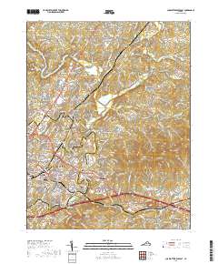
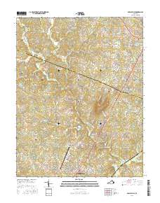 2016 Earlysville2016 Print · USGSCovers Hollymead, including Piney Mountain, Twin Lakes, and other nearby areas
 - 2016 Map of Charlottesville East, 2016 Print
 2016 Charlottesville East2016 Print · USGSCovers Hollymead, including Charlottesville, Pantops, and other nearby areas
 - 2019 Map of Earlysville, 2019 Print
 2019 Earlysville2019 Print · USGSCovers Hollymead, including Piney Mountain, Twin Lakes, and other nearby areas
 - 2019 Map of Charlottesville East, 2019 Print
 2019 Charlottesville East2019 Print · USGSCovers Hollymead, including Charlottesville, Pantops, and other nearby areas
 - 2022 Map of Charlottesville East, 2022 Print
 2022 Charlottesville East2022 Print · USGSAlbemarle County's storied landscape comes into focus in this modern era, centered on the historic streets of Charlottesville and the Rivanna River valley. Genealogists and historians can trace significant family and memorial sites, from the Jefferson Tomb to the Hebrew Cem Charlottesville.
 - 2022 Map of Earlysville, 2022 Print
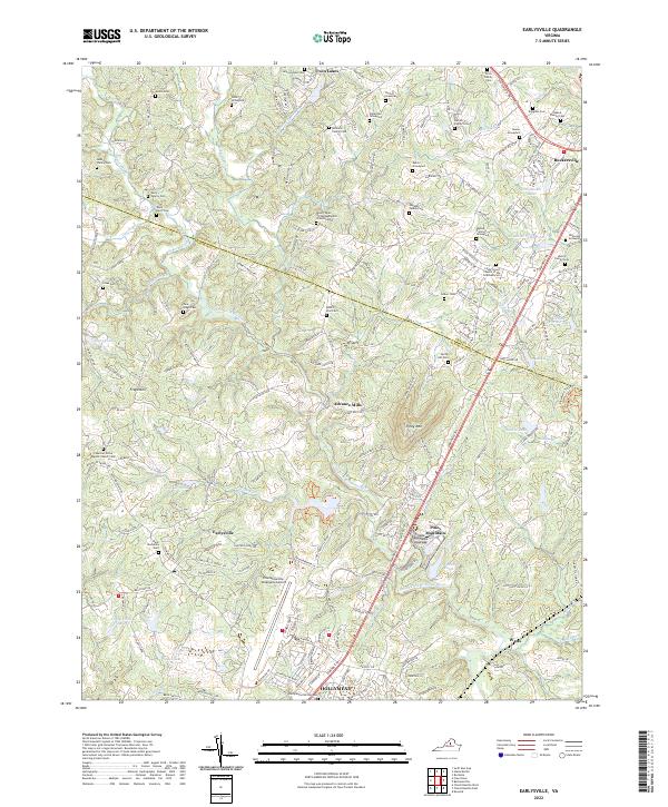 2022 Earlysville2022 Print · USGSAlbemarle County's Piedmont landscape is captured here in the early twenty-first century, showing a mix of traditional family farms and modern infrastructure. Genealogists can trace family burial grounds like the Early Family Cem or Deane Family Cem, while researchers can locate historic centers like Advance Mills.
End of results
Showing maps 1-24 of 24
Top cities near Hollymead
- Charlottesville historical maps
- Lake Monticello historical maps
- University of Virginia historical maps
- Pantops historical maps
- Rivanna historical maps
- Rio historical maps
See more
Top neighborhoods of Hollymead
- Deerwood historical maps
- Jefferson Village historical maps
- Springfield historical maps
- Templeton Acres historical maps
- Airport Acres historical maps
- Ridgewood Mobile Home Park historical maps
See more
Frequently asked questions
- What are the different types of historical maps available for Hollymead?
- What is the oldest map of Hollymead?
- Where can I purchase historical maps of Hollymead for my home or office?
- Where can I download high-res historical maps of Hollymead?
- Are there historical topographic maps available for Hollymead?
- Is there historical aerial imagery available for Hollymead?
- Where are historical maps of Hollymead sourced from?