1960s Maps of Amelia County, Virginia
Explore 14 historic maps of Amelia County from the 1960s. These maps offer a rare glimpse into what life looked like during the 1960s — showing old roads, neighborhoods, homes, and landmarks that have changed or disappeared over time.
Whether you're researching your family's past, planning a metal detecting trip, or studying how Amelia County's landscape evolved across the 1960s, these high-resolution maps are a powerful tool for exploring the history of this region.
- Focus on a specific era: All maps on this page are from the 1960s, giving you a focused view of this time period.
- See what’s changed: Compare century-old streets, trails, and buildings to today's modern landscape using overlays and satellite layers.
- Research with precision: Use these maps for genealogy, historical research, land use analysis, or educational projects.
- View, download, or print: Maps are fully viewable online in high resolution, and can be downloaded or printed for your own records.
Start exploring Amelia County's history through authentic maps from the 1960s. This is your window into the past.
Amelia County, VA maps
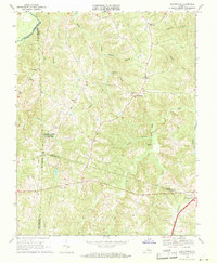
(14)- 1963 Map of Roanoke
 1963 Roanoke1963 Print · USGSCentral Virginia and the Blue Ridge front appear here in the early sixties, caught between their deep railroad roots and new postwar developments. Genealogists and historians can trace the rail lines of the Norfolk and Western through towns like Bedford and Altavista, or locate family landmarks near Smith Mountain Lake.
 - 1963 Map of Winterpock, 1965 Print
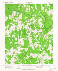
 1963 Winterpock1965 Print · USGSChesterfield and Amelia counties are divided by the winding Appomattox River in this mid-century survey. Genealogists can trace family connections through local landmarks like Winterpock School, the Second Branch Church and Cemetery, and Whites Store.4 unique versions available
 - 1963 Map of Church Road, 1965 Print
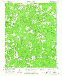
 1963 Church Road1965 Print · USGSDinwiddie and Amelia counties appear as a landscape of rural crossroads and family parishes in the early sixties. Genealogists can trace property lines and church sites like St Peters Ch, Zion Ch, and the rail stop at Poole Siding.3 unique versions available
 - 1964 Map of Richmond
 1964 Richmond1964 Print · USGSCoastal and central Virginia are mapped during the mid-twentieth century, showing the critical intersection of rail, river, and military life. Genealogists can trace family roots through rural county seats like Amelia or find vanished coastal neighborhoods near Phoebus and Hilton Village.
 - 1964 Map of Clayville, 1966 Print
 1964 Clayville1966 Print · USGSChesterfield and Powhatan counties are shown in the mid-1960s as the Appomattox River defined the rural landscape. Genealogists and historians can trace rail-side communities like Moseley and Mattoax or locate landmarks like Grange Hall Sch and Skinquarter Ch.3 unique versions available
 - 1964 Map of Hebron, 1966 Print
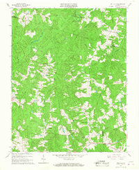
 1964 Hebron1966 Print · USGSThe rural borderlands of Dinwiddie, Amelia, and Nottoway counties are shown here in the mid-1960s, centered on the railroad corridor and scattered farming hamlets. Family researchers can locate numerous burial sites and landmarks like Hebron, Hobbs Mill, and the King David Lodge Hall.4 unique versions available
 - 1964 Map of Mannboro, 1966 Print
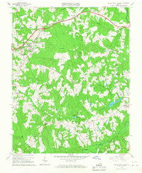
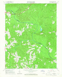 1964 Mannboro1966 Print · USGSAmelia and Chesterfield Counties meet along the river in the mid-sixties, a landscape of family-named creeks and rural crossroads. Local historians can trace the Goode Civil War Trench and find community landmarks like Amelia Academy and Mannboro.5 unique versions available
 - 1966 Map of Chula, 1967 Print
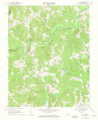
 1966 Chula1967 Print · USGSAmelia and Powhatan counties appear in the mid-sixties as a landscape of rural crossroads and riverfront farms. Genealogists and historians can trace family locations near Chula, Fieldstown, and numerous country churches including Grub Hill Ch and Mattoax Ch.3 unique versions available
 - 1966 Map of Wellville, 1967 Print
 1966 Wellville1967 Print · USGSNottoway County in the mid-sixties remained a landscape of rural commerce and deep-rooted congregations. Researchers can find traditional family-named crossroads like Simonsons Store and trace the Norfolk and Western line through Wellville.3 unique versions available
 - 1966 Map of Amelia Court House, 1968 Print
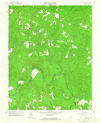
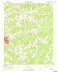
 1966 Amelia Court House1968 Print · USGSAmelia County and its historic seat come alive in the mid-sixties, showcasing a landscape of rural crossroads and community landmarks. Researchers can trace the roots of local families and institutions through sites like Pointons Store, Russell Grove High Sch, and Big Oak Cem.3 unique versions available
 - 1968 Map of Ballsville, 1971 Print
 1968 Ballsville1971 Print · USGSAmelia and Powhatan counties appear in the late sixties as a landscape of rural crossroads and river-bound farmsteads. Researchers can trace family-named landmarks and community centers such as Clementown Mills, Flower Hill Ch, and the settlement of Tobaccoville.2 unique versions available
 - 1968 Map of Deatonville, 1971 Print
 1968 Deatonville1971 Print · USGSAmelia and Prince Edward counties are captured here in the late sixties, showing a landscape defined by the Appomattox River. You can trace the grounds of Saylers Creek Battlefield State Park and locate historic community centers like Deatonville and Gravel Hill Ch.2 unique versions available
 - 1968 Map of Crewe East, 1972 Print
 1968 Crewe East1972 Print · USGSNottoway County and the Amelia border are captured here in the late sixties, centered on the railroad town of Crewe. Local historians can trace family roots at Old Poplar Mtn Cem or locate community hubs like Fergusonville and St Johns Ch.4 unique versions available
 - 1968 Map of Jetersville, 1972 Print
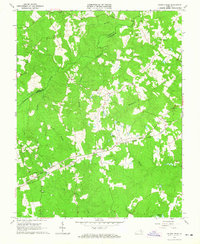
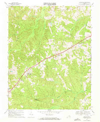 1968 Jetersville1972 Print · USGSAmelia County at the end of the sixties remained a landscape of rural villages and creekside farms connected by the Southern railroad. Local researchers can trace old family sites and rural landmarks like Truxillo, Zion Hill Ch, and Good Hope Ch.
End of results
Showing maps 1-14 of 14
Top cities of Amelia County
Frequently asked questions
- What are the different types of historical maps available for Amelia County?
- What is the oldest map of Amelia County?
- Where can I purchase historical maps of Amelia County for my home or office?
- Where can I download high-res historical maps of Amelia County?
- Are there historical topographic maps available for Amelia County?
- Is there historical aerial imagery available for Amelia County?
- Where are historical maps of Amelia County sourced from?