Old Maps of Amelia County, Virginia for Academic Research
Study the evolution of Amelia County with 56 high-resolution historic maps. Whether you're teaching, researching, or modeling changes in land use, these maps provide essential visual documentation of urban, environmental, and geographic change.
- Analyze long-term change: Track patterns in development, transportation, and natural features.
- Ideal for environmental or urban studies: Support academic projects with primary historical map data.
- Use in the classroom or lab: Educators and researchers rely on these maps to bring historical context to life.
These maps are a powerful tool for teaching, research, and visualizing how Amelia County has changed over the decades.
Amelia County, VA maps
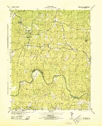
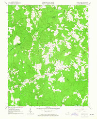
(56)- 1891 Map of Farmville
 1891 Farmville1891 Print · USGSSouth-central Virginia's rail and river networks come alive in the 1890s, centered on the bustling hub of Farmville. Genealogists can trace family roots through old courthouse seats like Cumberland C.H. and vanished stops like Jennings Ordinary or Rice Depot.
 - 1893 Map of Farmville
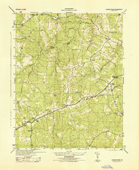
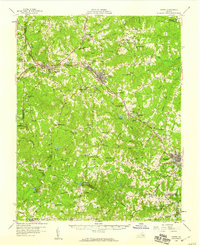
 1893 Farmville1893 Print · USGSThe Virginia Piedmont at the end of the nineteenth century centers on the rail junction at Farmville and the winding Appomattox River. Genealogists can trace family lands near Hampden Sidney, Guinea Mills, and the old tavern site at Joppings Ordinary.8 unique versions available
 - 1897 Map of Amelia
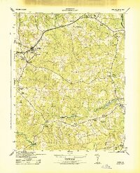
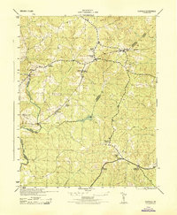
 1897 Amelia1897 Print · USGSThe rural interior of central Virginia comes into focus in the late nineteenth century, as the Appomattox River corridor transitions from a river-based economy to a rail-centered one. Researchers can trace ancestral property lines near Giles Mill, locate the rail hub at Mosley Junction, or find old river crossings like Goode Bridge.5 unique versions available
 - 1943 Map of Amelia
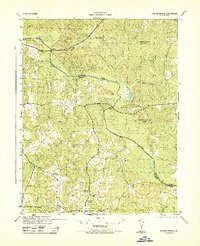
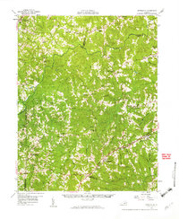
 1943 Amelia1943 Print · USGSAmelia County was a network of railroad stops and milling sites in the early 1940s. Genealogists and historians can locate family-named landmarks and rural hubs like Whites Mill, Scotts Fork, and the Russell Grove High School during this period.2 unique versions available
 - 1943 Map of Goodes Bridge
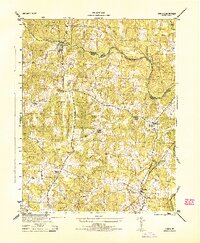
 1943 Goodes Bridge1943 Print · USGSAmelia and Chesterfield counties are divided by the winding Appomattox River during the early years of the war. Genealogists and local historians can trace rural life through the locations of Mannboro, Branchs Run Church, and the river crossing at Bevils Bridge.2 unique versions available
 - 1943 Map of Clayville, 1961 Print
 1943 Clayville1961 Print · USGSIn the early 1940s, this pocket of Central Virginia was a landscape of river-bend settlements and timberlands along the Appomattox River. Researchers can trace old family locations and community hubs like Grange Hall High Sch, Mattoax, and the rural Beulah Ch.
 - 1943 Map of Church Road, 1961 Print
 1943 Church Road1961 Print · USGSDinwiddie and Amelia counties during the early years of the Second World War were characterized by timbered creek bottoms and small railroad hamlets. Genealogists can trace family footprints near Ford, Alonia, and numerous country churches like Marmora Ch.
 - 1943 Map of Winterpock, 1961 Print
 1943 Winterpock1961 Print · USGSVirginia's rural interior during the 1940s is shown in detail here as the coal-mining community of Winterpock and its surrounding countryside are mapped. Researchers can locate local landmarks like Bethia Ch, the Winterpock School, and the winding Appomattox River.
 - 1943 Map of Chula, 1961 Print
 1943 Chula1961 Print · USGSAmelia County and the banks of the Appomattox River are captured here during the Second World War. Genealogists and local historians can trace family-named sites like Masons Corner or locate rural landmarks such as Grub Hill Ch and the settlement of Chula.
 - 1943 Map of Richmond, 1972 Print
 1943 Richmond1972 Print · USGSCoastal Virginia and the state capital are shown in detail during the mid-century era of infrastructure expansion. Genealogists and historians can trace the grounds of Richmond Nat Battlefield Park, locate the Yorktown Nat Cem, or follow the many rural routes through Amelia Court House and Tappahannock.
 - 1944 Map of Chula
 1944 Chula1944 Print · USGSAmelia County and the southern banks of the Appomattox River appear here during the mid-1940s, showing a landscape of traditional farming and local milling. Genealogists can trace family landmarks and rural life through locations like Giles Mill, Grub Hill Church, and the depot at Chula.
 - 1944 Map of Winterpock
 1944 Winterpock1944 Print · USGSMid-century Chesterfield County is shown here as a rural landscape of creek-fed timberland and quiet crossroads just before the post-war boom. Genealogists can trace family footprints at Winterpock School, Whites Store, and Centenary Church.
 - 1944 Map of Church Road
 1944 Church Road1944 Print · USGSDinwiddie and Amelia counties are shown here during the mid-forties, capturing a landscape of rural churches and railway sidings. Researchers can trace family roots at Marmora Church or Corinth Church and locate vanished landmarks like Jones Store and Poole Siding.
 - 1944 Map of Clayville
 1944 Clayville1944 Print · USGSMid-century Chesterfield and Powhatan counties show a landscape of railroad hamlets and river crossings during the 1940s. Genealogists can locate family landmarks like Grange Hall High School, Skinquarter Church, and the river site of Genito Mill.
 - 1947 Map of Roanoke, 1948 Print
 1947 Roanoke1948 Print · USGSCentral Virginia in the late 1940s reveals a region defined by its great mountain ridges and the powerful river-and-rail economy connecting Roanoke to Lynchburg. Researchers can trace the path of the Virginian RR and locate historic county seats like Charlotte Court House.2 unique versions available
 - 1949 Map of Richmond, 1951 Print
 1949 Richmond1951 Print · USGSCoastal Virginia in the years following World War II remained a landscape of historic river towns and expanding military bases. Genealogists and historians can trace the rail lines of the Southern Ry and locate established landmarks from Camp Lee to the remote reaches of Dragon Swamp.
 - 1950 Map of Wellville
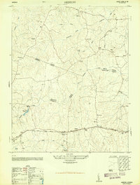
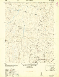 1950 Wellville1950 Print · USGSThe rural intersection of Nottoway, Amelia, and Dinwiddie Counties comes alive in this post-war survey. Genealogists can trace family connections through a network of country stores and churches like Simpsons Store, Rocky Hill Church, and Jerusalem School.2 unique versions available
 - 1950 Map of Hebron
 1950 Hebron1950 Print · USGSDinwiddie and Nottoway counties are shown here at mid-century, where rural life revolved around the railroad and community schools. Genealogists can trace family roots at Salem Cemetery or locate landmarks like King David Lodge Hall and the Mission Light School.2 unique versions available
 - 1958 Map of Jetersville, 1959 Print
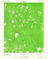
 1958 Jetersville1959 Print · USGSAmelia and Cumberland counties in the late 1950s show a landscape of traditional mills and rail-side settlements along the Appomattox River. Genealogists can trace family connections at Clarke Cem or study community hubs like Paineveille Sch and Hobsons Chapel.2 unique versions available
 - 1958 Map of Crewe, 1959 Print
 1958 Crewe1959 Print · USGSNottoway County thrived as a railroad crossroads in the late fifties, centered on the busy rail hubs of Crewe and Burkeville. Researchers can trace old family sites and rural landmarks like the Piedmont Sanatorium, Jennings Ordinary, and Wards Chapel.2 unique versions available
 - 1959 Map of Roanoke
 1959 Roanoke1959 Print · USGSCentral Virginia and the Blue Ridge appear in great detail during the late fifties, showcasing the transition from mountain industry to Piedmont farmland. Trace the path of the Norfolk and Western railroad or find old river towns like Appomattox and Amelia Court House.
 - 1959 Map of Richmond
 1959 Richmond1959 Print · USGSMid-century Virginia is captured here at its most vital rail and river junctions, from the capital city to the Chesapeake Bay. Genealogists and historians can trace the development of colonial settlements like Williamsburg and military landmarks including Fort Monroe and Camp Lee.
 - 1963 Map of Roanoke
 1963 Roanoke1963 Print · USGSCentral Virginia and the Blue Ridge front appear here in the early sixties, caught between their deep railroad roots and new postwar developments. Genealogists and historians can trace the rail lines of the Norfolk and Western through towns like Bedford and Altavista, or locate family landmarks near Smith Mountain Lake.
 - 1963 Map of Winterpock, 1965 Print
 1963 Winterpock1965 Print · USGSChesterfield and Amelia counties are divided by the winding Appomattox River in this mid-century survey. Genealogists can trace family connections through local landmarks like Winterpock School, the Second Branch Church and Cemetery, and Whites Store.4 unique versions available
 - 1963 Map of Church Road, 1965 Print
 1963 Church Road1965 Print · USGSDinwiddie and Amelia counties appear as a landscape of rural crossroads and family parishes in the early sixties. Genealogists can trace property lines and church sites like St Peters Ch, Zion Ch, and the rail stop at Poole Siding.3 unique versions available
Showing maps 1-25 of 56
Top cities of Amelia County
Frequently asked questions
- What are the different types of historical maps available for Amelia County?
- What is the oldest map of Amelia County?
- Where can I purchase historical maps of Amelia County for my home or office?
- Where can I download high-res historical maps of Amelia County?
- Are there historical topographic maps available for Amelia County?
- Is there historical aerial imagery available for Amelia County?
- Where are historical maps of Amelia County sourced from?