Old Maps of Lake Land'Or, Virginia for Academic Research
Study the evolution of Lake Land'Or with 21 high-resolution historic maps. Whether you're teaching, researching, or modeling changes in land use, these maps provide essential visual documentation of urban, environmental, and geographic change.
- Analyze long-term change: Track patterns in development, transportation, and natural features.
- Ideal for environmental or urban studies: Support academic projects with primary historical map data.
- Use in the classroom or lab: Educators and researchers rely on these maps to bring historical context to life.
These maps are a powerful tool for teaching, research, and visualizing how Lake Land'Or has changed over the decades.
Lake Land'Or, VA maps
(21)- 1887 Map of Spottsylvania
 1887 Spottsylvania1887 Print · USGSCentral Virginia in the late 1880s remains a landscape of river fords and crossroads shops before modern development. Genealogists and historians can trace the locations of the Vaucluse Gold Mine, Wilderness Tavern, and the path of the Narrow Gauge Railroad.
 - 1890 Map of Goochland
 1890 Goochland1890 Print · USGSGoochland and the surrounding Virginia Piedmont are captured here in the late nineteenth century as the river-and-rail economy thrived. Researchers can trace the paths of the Chesapeake and Ohio Railroad and find landmarks like Hopeful Church or the Coal Pits.
 - 1892 Map of Spottsylvania
 1892 Spottsylvania1892 Print · USGSCentral Virginia’s post-war landscape is captured here in the late nineteenth century, showing a rural economy defined by gold mining and river crossings. Genealogists can trace family footprints at Todds Tavern, the Vaucluse Gold Mine, and along the Narrow Gauge Railroad.6 unique versions available
 - 1892 Map of Goochland
 1892 Goochland1892 Print · USGSThe rural heart of central Virginia is captured here in the decade before the turn of the century, showing a landscape shaped by major rivers and early rail lines. Genealogists can trace family names and early settlements like Negro Foot, Mabelton, and the historic Hanover Academy.8 unique versions available
 - 1942 Map of Ladysmith
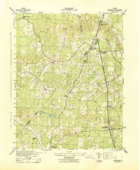 1942 Ladysmith1942 Print · USGSCaroline County and its borders during the early war years reveal a rural landscape of crossroads hamlets and family-run mills. Researchers can trace historic family landmarks and community centers like Colemans Mill, Ann Wrights Corner, and Beulah Church.2 unique versions available
 - 1943 Map of Hewlett
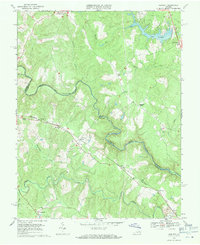
 1943 Hewlett1943 Print · USGSCaroline and Hanover counties are captured here in the early 1940s, showing a rural landscape organized around the Chesapeake and Ohio rail line. Researchers can trace the heritage of local crossroads like Chilesburg or find specific landmarks such as Ottley Mill and the Mt Hewlett School.2 unique versions available
 - 1943 Map of Richmond, 1972 Print
 1943 Richmond1972 Print · USGSCoastal Virginia and the state capital are shown in detail during the mid-century era of infrastructure expansion. Genealogists and historians can trace the grounds of Richmond Nat Battlefield Park, locate the Yorktown Nat Cem, or follow the many rural routes through Amelia Court House and Tappahannock.
 - 1948 Map of Washington
 1948 Washington1948 Print · USGSThe Potomac and Chesapeake regions in the late 1940s reveal a landscape of expanding military reach and deep-rooted Tidewater settlements. Trace old rail corridors like the Richmond Fredericksburg & Potomac RR or locate landmarks like the Wakefield Washington Monument and St. Marys College.2 unique versions available
 - 1949 Map of Richmond, 1951 Print
 1949 Richmond1951 Print · USGSCoastal Virginia in the years following World War II remained a landscape of historic river towns and expanding military bases. Genealogists and historians can trace the rail lines of the Southern Ry and locate established landmarks from Camp Lee to the remote reaches of Dragon Swamp.
 - 1957 Map of Washington, 1966 Print
 1957 Washington1966 Print · USGSThe mid-Atlantic region during the mid-fifties and early sixties reveals a landscape of growing suburbs and vital military outposts. Researchers can trace historic river towns and shorelines from Alexandria to the Hooper Islands and St Clements Island.5 unique versions available
 - 1959 Map of Richmond
 1959 Richmond1959 Print · USGSMid-century Virginia is captured here at its most vital rail and river junctions, from the capital city to the Chesapeake Bay. Genealogists and historians can trace the development of colonial settlements like Williamsburg and military landmarks including Fort Monroe and Camp Lee.
 - 1961 Map of Washington
 1961 Washington1961 Print · USGSThe mid-Atlantic region in the late fifties is presented in remarkable detail, from the Blue Ridge foothills to the Chesapeake Eastern Shore. Researchers can trace historic river landings and military sites like Mount Vernon, Fort Belvoir, and Point Lookout.2 unique versions available
 - 1964 Map of Richmond
 1964 Richmond1964 Print · USGSCoastal and central Virginia are mapped during the mid-twentieth century, showing the critical intersection of rail, river, and military life. Genealogists can trace family roots through rural county seats like Amelia or find vanished coastal neighborhoods near Phoebus and Hilton Village.
 - 1966 Map of Ladysmith, 1968 Print
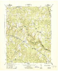
 1966 Ladysmith1968 Print · USGSThe rural Virginia interior comes into focus during the mid-sixties as the county lines of Caroline and Spotsylvania meet among tangled river forks. Genealogists can trace family footprints at Nancy Wrights Corner, Blades Corner, and historic congregations like Wrights Chapel.4 unique versions available
 - 1969 Map of Hewlett, 1971 Print
 1969 Hewlett1971 Print · USGSCaroline and Hanover counties are captured here in the late sixties as the river-and-rail landscape began to see new development. Genealogists can locate family landmarks like Mt Salem Ch, trace the Chesapeake and Ohio rail line, and find small communities like Hewlett and Chilesburg.4 unique versions available
 - 1973 Map of Richmond, 1974 Print
 1973 Richmond1974 Print · USGSThe Virginia Tidewater and Piedmont come alive in the early seventies, showcasing a region defined by its great rivers and massive military installations. Researchers can trace the mid-century growth of Richmond or locate family sites near Amelia Court House and Highland Springs.2 unique versions available
 - 1983 Map of Fredericksburg, 1984 Print
 1983 Fredericksburg1984 Print · USGSThe Virginia and Maryland tidewater region comes into sharp focus during the early 1980s, centered on the historic Rappahannock and Potomac river valleys. Researchers can trace the boundaries of the Fredericksburg-Spotsylvania National Military Park alongside growing residential areas and military sites like Fort A.P. Hill Military Reservation.2 unique versions available
 - 1984 Map of Richmond, 1986 Print
 1984 Richmond1986 Print · USGSCentral Virginia during the mid-eighties shows a landscape of rapid suburban expansion centered on the state capital and its historic riverfront. Genealogists and historians can trace institutional sites like Randolph-Macon College, the grounds of Fort Lee, and small community landmarks like Hebron Ch.3 unique versions available
 - 1989 Map of Washington
 1989 Washington1989 Print · USGSThe Potomac River valley and Chesapeake Bay are shown in comprehensive detail during the late 1980s. Genealogists and historians can trace the transition from urban Alexandria to the rural Northern Neck, locating landmarks like Mount Vernon and Stratford Hall.
 - 2022 Map of Hewlett, 2022 Print
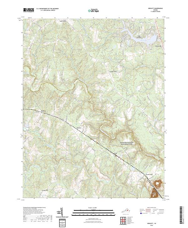 2022 Hewlett2022 Print · USGSCaroline and Hanover counties are mapped here in the modern day, showing the rural landscapes along the North Anna River. Researchers can trace the layout of the Richmond National Battlefield Park and old rail-stop settlements like Hewlett and Noel.
 - 2022 Map of Ladysmith, 2022 Print
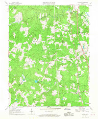
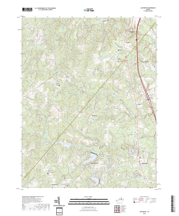 2022 Ladysmith2022 Print · USGSCaroline County and the surrounding rural corridor are shown in the twenty-first century as modern growth meets deep-rooted history. Researchers can trace family heritage at the Beulah Baptist Church Cem or find old landmarks like Colemans Mill and Hams Ford.
End of results
Showing maps 1-21 of 21
Top cities near Lake Land'Or
Frequently asked questions
- What are the different types of historical maps available for Lake Land'Or?
- What is the oldest map of Lake Land'Or?
- Where can I purchase historical maps of Lake Land'Or for my home or office?
- Where can I download high-res historical maps of Lake Land'Or?
- Are there historical topographic maps available for Lake Land'Or?
- Is there historical aerial imagery available for Lake Land'Or?
- Where are historical maps of Lake Land'Or sourced from?