Old Maps of Charles City County, Virginia for Hiking & Exploration
Hike through history with 53 historic maps of Charles City County. Explore old trails, ghost towns, and forgotten backroads — perfect for outdoor adventurers and local explorers.
- Rediscover forgotten places: Map out old mining camps, roads, and footpaths that no longer exist on modern maps.
- Layer with modern tools: Combine with LiDAR or satellite views to plan hikes through historical terrain.
- Made for exploration: Popular among hikers, overlanders, and local history lovers.
Use these maps to find adventure and explore the hidden past of Charles City County.
Charles City County, VA maps
(53)- 1894 Map of Bermuda Hundred
 1894 Bermuda Hundred1894 Print · USGSCovers Charles City County, including Chester, Hopewell, and other nearby areas5 unique versions available
 - 1917 Map of Toano, 1959 Print
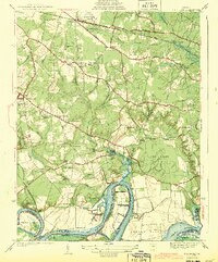
 1917 Toano1959 Print · USGSCovers Charles City County, including Lanexa, Brandon, and other nearby areas
 - 1918 Map of Charles City
 1918 Charles City1918 Print · USGSCovers Charles City County, including Charles City, New Hope, and other nearby areas4 unique versions available
 - 1918 Map of Toano
 1918 Toano1918 Print · USGSCovers Charles City County, including Lanexa, Brandon, and other nearby areas3 unique versions available
 - 1919 Map of Surry
 1919 Surry1919 Print · USGSCovers Charles City County, including Claremont, Dendron, and other nearby areas3 unique versions available
 - 1938 Map of Dutch Gap
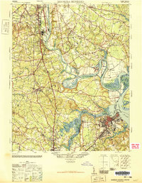
 1938 Dutch Gap1938 Print · USGSCovers Charles City County, including Varina, Chesterfield County, and other nearby areas
 - 1943 Map of Dutch Gap
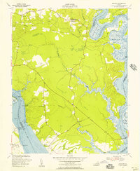
 1943 Dutch Gap1943 Print · USGSCovers Charles City County, including Varina, Chesterfield County, and other nearby areas2 unique versions available
 - 1943 Map of Hopewell
 1943 Hopewell1943 Print · USGSCovers Charles City County, including Hopewell, Enon, and other nearby areas3 unique versions available
 - 1943 Map of Richmond, 1972 Print
 1943 Richmond1972 Print · USGSCovers Charles City County, including Richmond, Hampton, and other nearby areas
 - 1946 Map of Bermuda Hundred
 1946 Bermuda Hundred1946 Print · USGSCovers Charles City County, including Chester, Hopewell, and other nearby areas2 unique versions available
 - 1949 Map of Richmond, 1951 Print
 1949 Richmond1951 Print · USGSCovers Charles City County, including Richmond, Hampton, and other nearby areas
 - 1952 Map of Brandon, 1957 Print
 1952 Brandon1957 Print · USGSCovers Charles City County, including Brandon, Kennon, and other nearby areas
 - 1952 Map of Norge, 1958 Print
 1952 Norge1958 Print · USGSCovers Charles City County, including Centerville, Warren Mill, and other nearby areas
 - 1952 Map of Hopewell, 1959 Print
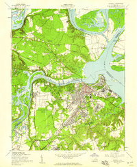 1952 Hopewell1959 Print · USGSCovers Charles City County, including Hopewell, Enon, and other nearby areas
 - 1952 Map of Dutch Gap, 1959 Print
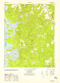
 1952 Dutch Gap1959 Print · USGSCovers Charles City County, including Varina, Chesterfield County, and other nearby areas
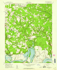
 - 1953 Map of Norge
 1953 Norge1953 Print · USGSCovers Charles City County, including Centerville, Warren Mill, and other nearby areas
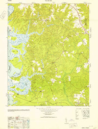
 - 1953 Map of Providence Forge, 1957 Print
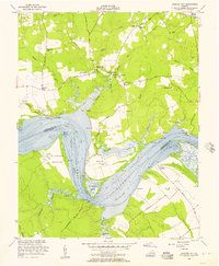
 1953 Providence Forge1957 Print · USGSCovers Charles City County, including Providence Forge, Roaches Corner, and other nearby areas
 - 1953 Map of Walkers, 1957 Print
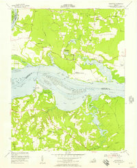
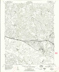 1953 Walkers1957 Print · USGSCovers Charles City County, including Lanexa, Osborn Landing, and other nearby areas
 - 1953 Map of Westover, 1957 Print
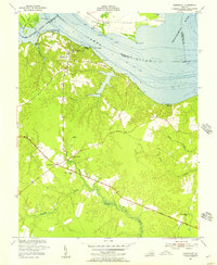
 1953 Westover1957 Print · USGSCovers Charles City County, including Barnetts, Blairs, and other nearby areas
 - 1953 Map of Charles City, 1957 Print
 1953 Charles City1957 Print · USGSCovers Charles City County, including Charles City, New Hope, and other nearby areas
 - 1953 Map of Roxbury, 1957 Print
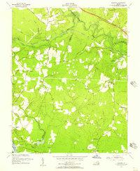 1953 Roxbury1957 Print · USGSCovers Charles City County, including Glendale, Roxbury, and other nearby areas
 - 1953 Map of Charles City, 1960 Print
 1953 Charles City1960 Print · USGSCovers Charles City County, including Charles City, New Hope, and other nearby areas2 unique versions available
 - 1954 Map of Claremont, 1957 Print
 1954 Claremont1957 Print · USGSCovers Charles City County, including Claremont, Guilford Heights, and other nearby areas
 - 1959 Map of Richmond
 1959 Richmond1959 Print · USGSCovers Charles City County, including Richmond, Hampton, and other nearby areas
 - 1964 Map of Richmond
 1964 Richmond1964 Print · USGSCovers Charles City County, including Richmond, Hampton, and other nearby areas
Showing maps 1-25 of 53
Top cities of Charles City County
Frequently asked questions
- What are the different types of historical maps available for Charles City County?
- What is the oldest map of Charles City County?
- Where can I purchase historical maps of Charles City County for my home or office?
- Where can I download high-res historical maps of Charles City County?
- Are there historical topographic maps available for Charles City County?
- Is there historical aerial imagery available for Charles City County?
- Where are historical maps of Charles City County sourced from?