1900s (20th Century) Maps of Dinwiddie County, Virginia
Explore 62 historic maps of Dinwiddie County from the 1900s (20th Century). These maps offer a rare glimpse into what life looked like during the 1900s — showing old roads, neighborhoods, homes, and landmarks that have changed or disappeared over time.
Whether you're researching your family's past, planning a metal detecting trip, or studying how Dinwiddie County's landscape evolved across the 1900s, these high-resolution maps are a powerful tool for exploring the history of this region.
- Focus on a specific era: All maps on this page are from the 1900s, giving you a focused view of this time period.
- See what’s changed: Compare century-old streets, trails, and buildings to today's modern landscape using overlays and satellite layers.
- Research with precision: Use these maps for genealogy, historical research, land use analysis, or educational projects.
- View, download, or print: Maps are fully viewable online in high resolution, and can be downloaded or printed for your own records.
Start exploring Dinwiddie County's history through authentic maps from the 1900s. This is your window into the past.
Dinwiddie County, VA maps
(62)- 1918 Map of Lawrenceville, 1963 Print
 1918 Lawrenceville1963 Print · USGSBrunswick and Dinwiddie Counties are shown here during the late days of the First World War, as the region's rail-and-river economy reached its peak. Genealogists can trace family roots through numerous rural landmarks like Sunnyside High School, Wheeler Mill, and Johnston Grove Church.
 - 1919 Map of Jarratt
 1919 Jarratt1919 Print · USGSSoutheastern Virginia at the close of the Great War was a busy crossroads of the Atlantic Coast Line and Virginian railroads. Genealogists and local historians can trace family locations near the Russian Church, identify the site of Harrells Mill, or locate old post offices like Comans Well.3 unique versions available
 - 1919 Map of Mc Kenney
 1919 Mc Kenney1919 Print · USGSSouthside Virginia at the close of the Great War was a region defined by its river crossings and small-town commerce. Genealogists can trace family roots through numerous local landmarks like Smoky Ordinary, Big Bethel Church, and the Drumgoole School.
 - 1920 Map of Lawrenceville
 1920 Lawrenceville1920 Print · USGSBrunswick County at the height of the steam-rail era shows a landscape crisscrossed by three major rail lines and dozens of small rural communities. Genealogists can trace family connections to many churches and schools, such as Little Mount Church (Colored), Masons Mill School, and the County Poor Farm.
 - 1921 Map of Mc Kenney
 1921 Mc Kenney1921 Print · USGSSouthern Virginia at the turn of the decade reveals a landscape of tobacco-country schools, churches, and river crossings. Trace the old rail lines of the Virginian and find local landmarks like Smoky Ordinary, Barnes and Parsons Store, and Laxottes Ford.2 unique versions available
 - 1921 Map of Lawrenceville
 1921 Lawrenceville1921 Print · USGSBrunswick County in the years following the Great War shows a landscape defined by its bustling rail junctions and riverside mills. Genealogists and local historians can trace family-named sites like Meredithville P.O., Barrows Store, and the County Poor Farm.2 unique versions available
 - 1942 Map of Lawrenceville
 1942 Lawrenceville1942 Print · USGSBrunswick County at the start of the 1940s is defined by its busy rail junctions and a landscape of small rural schoolhouses. Trace the origins of local families near Lawrenceville or find old community centers like Charlie Hope and Price Mill.
 - 1943 Map of Mc Kenney
 1943 Mc Kenney1943 Print · USGSSouthside Virginia's rural landscape is captured here during the mid-forties, showing the vital rail-and-river network of Dinwiddie and Brunswick counties. Genealogists can trace family footprints at dozens of sites like Big Bethel Church, Drumgoole School, and the Barnes and Parsons Store.
 - 1943 Map of De Witt, 1961 Print
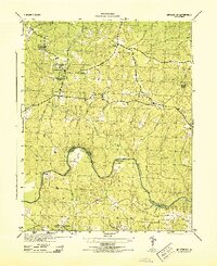
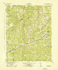
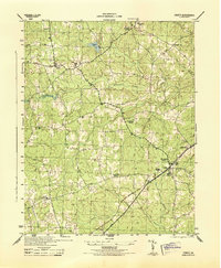
 1943 De Witt1961 Print · USGSDinwiddie County remained a landscape of quiet crossroads and rail sidings during the early years of the war. Genealogists can trace family footprints near DeWitt or locate historic congregations like Bott Memorial Ch and Rocky Run Ch.
 - 1943 Map of Dinwiddie, 1961 Print
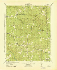
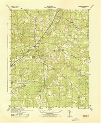
 1943 Dinwiddie1961 Print · USGSDinwiddie County during the early 1940s is captured here in detail, centered on the community of Dinwiddie and its rail connections. Genealogists can trace family roots through landmarks like Hawkins Memorial Sch, Olive Branch Ch, and the Seaboard line.
 - 1943 Map of Beach, 1961 Print
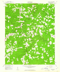
 1943 Beach1961 Print · USGSChesterfield County during the early 1940s remains a heavily wooded landscape of rural crossroads and stream-fed valleys. Genealogists and local historians can locate several namesake institutions including Lees Chapel, Union Branch Sch, and Gill Grove Ch.
 - 1943 Map of Church Road, 1961 Print
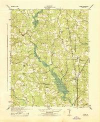
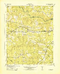
 1943 Church Road1961 Print · USGSDinwiddie and Amelia counties during the early years of the Second World War were characterized by timbered creek bottoms and small railroad hamlets. Genealogists can trace family footprints near Ford, Alonia, and numerous country churches like Marmora Ch.
 - 1943 Map of Winterpock, 1961 Print
 1943 Winterpock1961 Print · USGSVirginia's rural interior during the 1940s is shown in detail here as the coal-mining community of Winterpock and its surrounding countryside are mapped. Researchers can locate local landmarks like Bethia Ch, the Winterpock School, and the winding Appomattox River.
 - 1943 Map of Sutherland, 1961 Print
 1943 Sutherland1961 Print · USGSDinwiddie County during the mid-forties remains a landscape of rail-connected rural communities and creek-fed bottomlands. Genealogists and historians can trace the foundations of Sutherland and Five Forks, along with country landmarks like Wesley Chapel and Midway Sch.
 - 1943 Map of Richmond, 1972 Print
 1943 Richmond1972 Print · USGSCoastal Virginia and the state capital are shown in detail during the mid-century era of infrastructure expansion. Genealogists and historians can trace the grounds of Richmond Nat Battlefield Park, locate the Yorktown Nat Cem, or follow the many rural routes through Amelia Court House and Tappahannock.
 - 1944 Map of Winterpock
 1944 Winterpock1944 Print · USGSMid-century Chesterfield County is shown here as a rural landscape of creek-fed timberland and quiet crossroads just before the post-war boom. Genealogists can trace family footprints at Winterpock School, Whites Store, and Centenary Church.
 - 1944 Map of Beach
 1944 Beach1944 Print · USGSChesterfield County during the mid-forties shows a mix of rural community roots and new federal conservation projects. Genealogists and local historians can locate several rural landmarks including Union Branch Church, Union Grove School, and the village of Beach.
 - 1944 Map of Reams
 1944 Reams1944 Print · USGSMid-century Dinwiddie County comes into focus in this wartime survey of the rural communities south of Petersburg. Genealogists and historians can trace family roots through several local landmarks like Oak Grove Church, Zion School, and the village of Rowanta.
 - 1944 Map of Dinwiddie
 1944 Dinwiddie1944 Print · USGSDinwiddie County during the mid-1940s shows a landscape of rural crossroads and segregated social institutions organized around the Seaboard rail line. Researchers can trace ancestral locations through sites like Jessup Store, Hamilton, and the Mt Level Church & School.
 - 1944 Map of Church Road
 1944 Church Road1944 Print · USGSDinwiddie and Amelia counties are shown here during the mid-forties, capturing a landscape of rural churches and railway sidings. Researchers can trace family roots at Marmora Church or Corinth Church and locate vanished landmarks like Jones Store and Poole Siding.
 - 1944 Map of Sutherland
 1944 Sutherland1944 Print · USGSDinwiddie and Chesterfield Counties are shown during the mid-1940s, centered on the strategic rail corridor west of Petersburg. Researchers can trace the community life of the era through sites like Sutherland, Ocran Church, and the rural Midway School.
 - 1944 Map of Petersburg
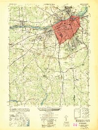
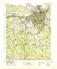 1944 Petersburg1944 Print · USGSPetersburg and the surrounding Dinwiddie County countryside are shown here during the 1940s, revealing a landscape deeply intertwined with its Civil War history and rail industry. Researchers can locate family landmarks like Sharon Church, trace the lines of the Atlantic Coast Line, or study the grounds of Poplar Grove National Cemetery.2 unique versions available
 - 1944 Map of DeWitt
 1944 DeWitt1944 Print · USGSDinwiddie County's rural crossroads and rail-side hamlets are documented here at the height of the Second World War. Genealogists and local historians can trace family locations near landmarks like Bott Memorial Church, Wilkinsons Store, and the industrial site at Hills Mill.
 - 1946 Map of Petersburg
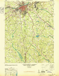 1946 Petersburg1946 Print · USGSPetersburg and the surrounding tobacco and rail country of the mid-1940s are documented here just as the post-war era began. Genealogists and historians can trace family locations near Blandford Cemetery, search for rural schoolhouses like Bives School, or locate the historic river crossing at Pocahontas Island.3 unique versions available
 - 1949 Map of Petersburg
 1949 Petersburg1949 Print · USGSPetersburg and its industrial riverfront are captured here in the late Forties, showing a city deeply tied to its rail lines and Civil War heritage. Genealogists can locate family landmarks like Sharon Church and Smith Grove Church or trace the grounds of Blandford Cemetery.
Showing maps 1-25 of 62
Top cities of Dinwiddie County
Frequently asked questions
- What are the different types of historical maps available for Dinwiddie County?
- What is the oldest map of Dinwiddie County?
- Where can I purchase historical maps of Dinwiddie County for my home or office?
- Where can I download high-res historical maps of Dinwiddie County?
- Are there historical topographic maps available for Dinwiddie County?
- Is there historical aerial imagery available for Dinwiddie County?
- Where are historical maps of Dinwiddie County sourced from?