1960s Maps of Dinwiddie County, Virginia
Explore 17 historic maps of Dinwiddie County from the 1960s. These maps offer a rare glimpse into what life looked like during the 1960s — showing old roads, neighborhoods, homes, and landmarks that have changed or disappeared over time.
Whether you're researching your family's past, planning a metal detecting trip, or studying how Dinwiddie County's landscape evolved across the 1960s, these high-resolution maps are a powerful tool for exploring the history of this region.
- Focus on a specific era: All maps on this page are from the 1960s, giving you a focused view of this time period.
- See what’s changed: Compare century-old streets, trails, and buildings to today's modern landscape using overlays and satellite layers.
- Research with precision: Use these maps for genealogy, historical research, land use analysis, or educational projects.
- View, download, or print: Maps are fully viewable online in high resolution, and can be downloaded or printed for your own records.
Start exploring Dinwiddie County's history through authentic maps from the 1960s. This is your window into the past.
Dinwiddie County, VA maps
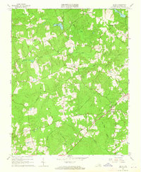
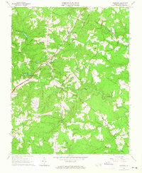
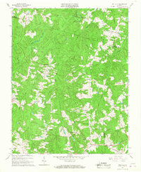
(17)- 1963 Map of Mc Kenney, 1964 Print
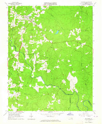 1963 Mc Kenney1964 Print · USGSDinwiddie County's rural landscape is centered on the railroad town of McKenney in the early 1960s, a time when family-named cemeteries and country churches defined the community. Local history researchers can trace family roots at Asbury Cem, Abernathy Cem, or near the Nottoway River and Cutbank Bridge.2 unique versions available
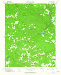
 - 1963 Map of Cherry Hill, 1964 Print
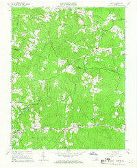
 1963 Cherry Hill1964 Print · USGSDinwiddie and Sussex counties come alive in the early 1960s, showing a traditional landscape of crossroads stores and family holdings. Genealogists can locate numerous family burial sites like Boisseau Cem and Bain Cem or centers of community life at Wharf's Store and Masontown Sch.3 unique versions available
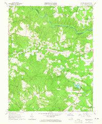
 - 1963 Map of Smoky Ordinary, 1964 Print
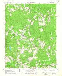
 1963 Smoky Ordinary1964 Print · USGSSouthern Brunswick County appears in the early sixties as a region of small rail stops and country parishes. Genealogists and historians can trace family locations near Smoky Ordinary, Mallory Sch, or the several churches like Emmanuel Ch along the NORFOLK AND WESTERN line.3 unique versions available
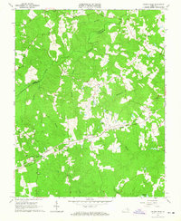
 - 1963 Map of Winterpock, 1965 Print
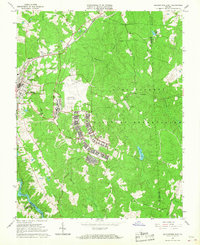
 1963 Winterpock1965 Print · USGSChesterfield and Amelia counties are divided by the winding Appomattox River in this mid-century survey. Genealogists can trace family connections through local landmarks like Winterpock School, the Second Branch Church and Cemetery, and Whites Store.4 unique versions available
 - 1963 Map of De Witt, 1965 Print
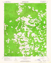
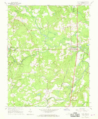
 1963 De Witt1965 Print · USGSDinwiddie County in the early sixties was a landscape of crossroads settlements and small country churches. Genealogists and local historians can trace family roots at Wilkinsons Store or locate the historic Eleven Oaks Ch and its Cem.3 unique versions available
 - 1963 Map of Beach, 1965 Print
 1963 Beach1965 Print · USGSChesterfield County during the early sixties is captured here as a landscape of dense state forests and scattered rural communities. Genealogists and historians can trace family locations near Mt Gilead Ch, Leon Chapel, and the historic Crosstick Millpond.5 unique versions available
 - 1963 Map of Sutherland, 1965 Print
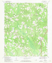
 1963 Sutherland1965 Print · USGSDinwiddie County's rail-and-river landscape is captured in the early sixties as small settlements expanded alongside major transit corridors. Genealogists and local historians can locate family landmarks like Wesley Chapel, Olgers Cem, and the old Midway Sch near the Norfolk and Western RR.4 unique versions available
 - 1963 Map of Church Road, 1965 Print
 1963 Church Road1965 Print · USGSDinwiddie and Amelia counties appear as a landscape of rural crossroads and family parishes in the early sixties. Genealogists can trace property lines and church sites like St Peters Ch, Zion Ch, and the rail stop at Poole Siding.3 unique versions available
 - 1963 Map of Dinwiddie, 1965 Print
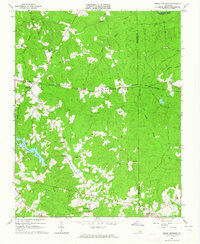
 1963 Dinwiddie1965 Print · USGSDinwiddie and the surrounding Piedmont landscape are captured in the early sixties as the railroad still anchored the local economy. Researchers can locate specific family and community sites like Wittbush Cem, Butterworth Dep, and the Seaboard Air Line rail corridor.3 unique versions available
 - 1964 Map of Richmond
 1964 Richmond1964 Print · USGSCoastal and central Virginia are mapped during the mid-twentieth century, showing the critical intersection of rail, river, and military life. Genealogists can trace family roots through rural county seats like Amelia or find vanished coastal neighborhoods near Phoebus and Hilton Village.
 - 1964 Map of Hebron, 1966 Print
 1964 Hebron1966 Print · USGSThe rural borderlands of Dinwiddie, Amelia, and Nottoway counties are shown here in the mid-1960s, centered on the railroad corridor and scattered farming hamlets. Family researchers can locate numerous burial sites and landmarks like Hebron, Hobbs Mill, and the King David Lodge Hall.4 unique versions available
 - 1964 Map of Darvills, 1967 Print
 1964 Darvills1967 Print · USGSDinwiddie County’s rural crossroads and military borders are detailed here during the mid-sixties. Researchers can trace the legacy of small congregations at Hawkins Memorial Ch and Shiloh Ch, or explore the eastern edge of the Camp Pickett Military Reservation.3 unique versions available
 - 1966 Map of Blackstone East, 1967 Print
 1966 Blackstone East1967 Print · USGSNottoway County during the mid-sixties is captured here, showing the expansion of military training facilities alongside traditional rural life. Genealogists and historians can trace the foundations of Blackstone Army Air Base and locate local landmarks like Spring Hill Ch and the Nottoway Reservoir.5 unique versions available
 - 1966 Map of Wellville, 1967 Print
 1966 Wellville1967 Print · USGSNottoway County in the mid-sixties remained a landscape of rural commerce and deep-rooted congregations. Researchers can find traditional family-named crossroads like Simonsons Store and trace the Norfolk and Western line through Wellville.3 unique versions available
 - 1967 Map of Stony Creek, 1968 Print
 1967 Stony Creek1968 Print · USGSCoastal Plain wetlands and river crossings define the landscape of central Sussex County in the late sixties. Researchers can trace the Seaboard Coast Line corridor through Stony Creek and locate landmarks like Winfields Mill and Sappony Ch.3 unique versions available
 - 1969 Map of Carson, 1971 Print
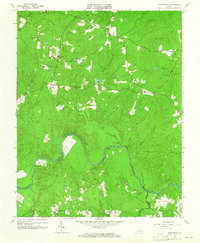
 1969 Carson1971 Print · USGSThe rural landscape near the Dinwiddie and Prince George county line comes to life in this late-sixties study. Genealogists can trace family roots through several landmarks, including the Confederate Cem, Rowanty Ch, and the village of Carson.5 unique versions available
 - 1969 Map of Petersburg, 1971 Print
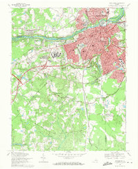 1969 Petersburg1971 Print · USGSPetersburg and Colonial Heights are shown in the late sixties as the urban core expands alongside a landscape defined by Civil War history. Researchers can trace numerous fortifications like Fort Wadsworth and locate family sites at Blandford Cemetery or Smith Grove Ch.3 unique versions available
End of results
Showing maps 1-17 of 17
Top cities of Dinwiddie County
Frequently asked questions
- What are the different types of historical maps available for Dinwiddie County?
- What is the oldest map of Dinwiddie County?
- Where can I purchase historical maps of Dinwiddie County for my home or office?
- Where can I download high-res historical maps of Dinwiddie County?
- Are there historical topographic maps available for Dinwiddie County?
- Is there historical aerial imagery available for Dinwiddie County?
- Where are historical maps of Dinwiddie County sourced from?