Old Maps of Essex County, Virginia for Metal Detecting
Plan your next treasure hunt with 128 historic maps of Essex County. Find old homesites, ghost towns, trails, and gathering spots that may be lost to time — perfect for identifying promising metal detecting locations.
- Locate forgotten sites: Uncover places like long-lost settlements, abandoned rail lines, or gathering spots.
- Plan better hunts: Use map overlays combined with LiDAR or satellite views to narrow in on historically rich areas.
- Made for detectorists: Thousands of hobbyists use these maps to discover relics, coins, and hidden history.
Use these historic maps to boost your research and find new opportunities beneath the surface of Essex County.
Essex County, VA maps
(128)- 1889 Map of Fredericksburg
 1889 Fredericksburg1889 Print · USGSThe Tidewater region of Virginia and Maryland comes into focus in the late 1880s, centered on the river-and-rail hub of Fredericksburg. Genealogists can trace early landmarks like Rappahannock Academy, Bull Church, and Saunders Wharf.
 - 1892 Map of Fredericksburg
 1892 Fredericksburg1892 Print · USGSCoastal Virginia and Maryland are captured here in the late nineteenth century, showing a landscape of river-port towns and historic crossroads. Researchers can locate vanished landmarks and family sites like Rappahannock Academy, Whites Mill, and the riverside Port Royal.
 - 1892 Map of Montross
 1892 Montross1892 Print · USGSThe Northern Neck of Virginia is shown here in the 1890s, when life revolved around the deep waters of the Potomac and Rappahannock. Genealogists can trace old family landing sites and settlements such as Montross, Stratford, and Potomac Mills.5 unique versions available
 - 1894 Map of Fredericksburg
 1894 Fredericksburg1894 Print · USGSThe Tidewater and Piedmont regions of Virginia meet in the late nineteenth century at the head of the Rappahannock River. Local historians can trace early inland commerce through rural centers like Nindes Store, the Rappahannock Academy, and Stafford.10 unique versions available
 - 1895 Map of Nomini
 1895 Nomini1895 Print · USGSSouthern Maryland and the Virginia tidewater shores meet along the Potomac in this late nineteenth-century survey. Genealogists can trace family holdings and river landings from Charlotte Hall down to Sotterly and the Nomini Ferry.
 - 1895 Map of Montross
 1895 Montross1895 Print · USGSWestmoreland and Richmond counties are shown in the 1890s as a thriving river-based economy on the Northern Neck peninsula. Genealogists and historians can trace family-named landings and settlements like Wirt Wharf, Montross, and Potomac Mills.2 unique versions available
 - 1898 Map of Nomini
 1898 Nomini1898 Print · USGSMaryland and Virginia's Tidewater region comes alive in the late nineteenth century as a world of river landings, rail terminals, and rural crossroads. Researchers can trace the maritime economy through Nomini Ferry and Stone Wharf, or locate ancestral homesteads near Charlotte Hall and Potomac Mills.5 unique versions available
 - 1917 Map of Urbanna
 1917 Urbanna1917 Print · USGSMiddlesex and Lancaster Counties come alive in this survey of the Virginia Tidewater during the Great War era. Researchers can trace ancestral roots through dozens of local landmarks like Christ Church, Healys Mill, and Royal Oak School.3 unique versions available
 - 1917 Map of Morattico
 1917 Morattico1917 Print · USGSThe Northern Neck of Virginia is shown here in the years before the Great War, when the Rappahannock River was a busy Steamboat Route. Genealogists can locate family landmarks like Gordys Millpond, Lively, and the Marvin Grove Camp in this detailed look at early rural life.
 - 1918 Map of Tappahannock
 1918 Tappahannock1918 Print · USGSThe Tidewater region during the first World War comes alive on this sheet, centered on the historic river crossing at Tappahannock. Researchers can trace the active Steamboat Route, old river landings like Bowlers Wharf, and rural landmarks including St Pauls Church.2 unique versions available
 - 1918 Map of Aylett
 1918 Aylett1918 Print · USGSThe rural landscapes of King and Queen and King William counties are captured here at the end of the Great War. Researchers can trace ancestral connections through old mill sites and churches like Aylett Mill, St Stephens Church, and Shiloh Church.
 - 1918 Map of Morattico
 1918 Morattico1918 Print · USGSThe Northern Neck region relied heavily on the Rappahannock waterfront during the early twentieth century, when steamboats were still the primary connection to the outside world. Researchers can trace ancestral home sites and community centers from Lodge and Nuttsville to historic landmarks like Gibeon Church and Downings Mill.3 unique versions available
 - 1919 Map of New Kent
 1919 New Kent1919 Print · USGSThe Virginia tidewater comes to life in the years following the Great War, showing the convergence of the Mattaponi and Pamunkey rivers. Genealogists can trace family roots through the Pamunkey Indian Reservation, West Point, and rural landmarks like Mattaponi Church or Frazier Ferry.3 unique versions available
 - 1919 Map of Tappahannock, 1938 Print
 1919 Tappahannock1938 Print · USGSCoastal life along the Rappahannock River is meticulously charted here in the years following the Great War. Genealogists and historians can trace the foundations of Essex and Richmond counties through landmarks like Millers Tavern, the Rappahannock Industrial Academy, and Mt Airy Millpond.
 - 1926 Map of Morattico, 1943 Print
 1926 Morattico1943 Print · USGSThe Rappahannock River and Northern Neck are captured in the mid-1920s, showing a landscape defined by tidewater commerce and rural tradition. Genealogists can trace family roots through numerous churches and schools like Totuskey Church, Folly School, and Sharps.
 - 1930 Map of Wakefield
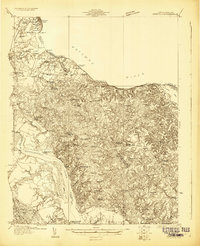 1930 Wakefield1930 Print · USGSWestmoreland County and the Northern Neck appear here in the early thirties, defined by a historic riverfront landscape and rural hamlets. Researchers can locate the Birthplace of Washington and Monroe Birthplace alongside old river ports like Leedstown and Steve Landing.
 - 1932 Map of Wakefield
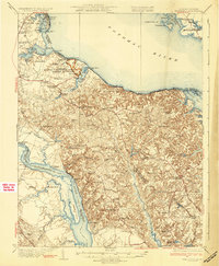 1932 Wakefield1932 Print · USGSWestmoreland County at the start of the 1930s shows a landscape defined by the great bends of the Potomac and Rappahannock Rivers. Researchers can trace ancestral locations near the George Washington Birthplace or find local landmarks like Potomac Mills and Monroe Hall.2 unique versions available
 - 1933 Map of Aylett
 1933 Aylett1933 Print · USGSCoastal Plain Virginia during the 1930s shows a landscape of river-based commerce and tight-knit farming communities. Genealogists and historians can trace family locations near Aylett, locate the Millfork School, or find old mills like Dublin Mill.2 unique versions available
 - 1942 Map of Upper Zion
 1942 Upper Zion1942 Print · USGSCaroline and Essex counties appear here during the early forties as the military footprint expanded. Genealogists can trace family landmarks and rural crossroads like Naulakla, Upper Zion, and the quiet Enon Church.
 - 1942 Map of Occupacia
 1942 Occupacia1942 Print · USGSEssex County's riverfront and rural interior are documented here during the early 1940s, showing a landscape of crossroads settlements and timber resources. Genealogists and historians can trace family locations near Vauters Church, Bethlehem Fork, and the Lumber Mill near Iraville.
 - 1942 Map of Rollins Fork
 1942 Rollins Fork1942 Print · USGSThe Northern Neck region during the early 1940s reveals a landscape defined by the river economy and established rural crossroads. Genealogists and local historians can trace family land and community hubs from Wilmont Wharf on the river to inland points like Rollins Fork and Kings Mill.
 - 1943 Map of Champlain
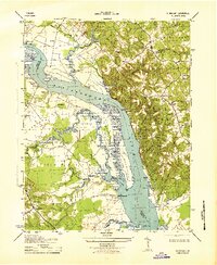 1943 Champlain1943 Print · USGSThe Rappahannock River defines this mid-century survey of the Essex and Westmoreland county border during the early 1940s. Genealogists and historians can trace family-named estates and landings like Malvale Farm, Farmers Hall, and Carters Whf.2 unique versions available
 - 1943 Map of Richmond, 1972 Print
 1943 Richmond1972 Print · USGSCoastal Virginia and the state capital are shown in detail during the mid-century era of infrastructure expansion. Genealogists and historians can trace the grounds of Richmond Nat Battlefield Park, locate the Yorktown Nat Cem, or follow the many rural routes through Amelia Court House and Tappahannock.
 - 1944 Map of Mount Landing
 1944 Mount Landing1944 Print · USGSEssex County during the mid-forties reveals a rural landscape defined by marshy riverbanks and numerous creek-side mills. Genealogists can trace family footprints at Kino P O, Rexburg, and First Union Church near the Tidewater Trail.2 unique versions available
 - 1944 Map of Tappahannock
 1944 Tappahannock1944 Print · USGSThe Rappahannock River valley in the mid-1940s is shown here at the height of its river-landing era. Researchers can trace family estates and rural infrastructure like St Johns Ch, Mt Airy Millpond, and the historic waterfront at Wares Wharf.2 unique versions available
Showing maps 1-25 of 128
Top cities of Essex County
Frequently asked questions
- What are the different types of historical maps available for Essex County?
- What is the oldest map of Essex County?
- Where can I purchase historical maps of Essex County for my home or office?
- Where can I download high-res historical maps of Essex County?
- Are there historical topographic maps available for Essex County?
- Is there historical aerial imagery available for Essex County?
- Where are historical maps of Essex County sourced from?