Old Maps of Mount Vernon, Virginia for Metal Detecting
Plan your next treasure hunt with 34 historic maps of Mount Vernon. Find old homesites, ghost towns, trails, and gathering spots that may be lost to time — perfect for identifying promising metal detecting locations.
- Locate forgotten sites: Uncover places like long-lost settlements, abandoned rail lines, or gathering spots.
- Plan better hunts: Use map overlays combined with LiDAR or satellite views to narrow in on historically rich areas.
- Made for detectorists: Thousands of hobbyists use these maps to discover relics, coins, and hidden history.
Use these historic maps to boost your research and find new opportunities beneath the surface of Mount Vernon.
Mount Vernon, VA maps
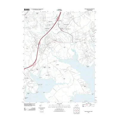
(34)- 1890 Map of Mt. Vernon
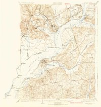
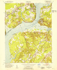
 1890 Mt. Vernon1890 Print · USGSNorthern Virginia and the capital region appear here in the decade before the turn of the century, showing a landscape of river estates and rail-connected villages. Researchers can trace early property sites and historic river landings from Mt. Vernon to Occoquan and Falls Church.
 - 1891 Map of Mt. Vernon
 1891 Mt. Vernon1891 Print · USGSNorthern Virginia and the D.C. area appear here in the late nineteenth century, as the rail-and-river economy connected rural counties to the capital. Researchers can trace ancestral roots through dozens of local landmarks, including Arlington National Cemetery, the Fox Ferry, and historic towns like Occoquan and Vienna.
 - 1894 Map of Mt. Vernon, 1904 Print
 1894 Mt. Vernon1904 Print · USGSThe Potomac River valley south of the capital was still largely a landscape of crossroads and rail depots in the late nineteenth century. Genealogists can trace the rural reaches of Fairfax through landmarks like Arlington National Cemetery, Mt. Vernon, and Tyson Cross Roads.6 unique versions available
 - 1897 Map of Mt. Vernon
 1897 Mt. Vernon1897 Print · USGSNorthern Virginia and the Potomac River appear in the late nineteenth century as a landscape of rural crossroads and strategic fortifications. Trace the early footprints of Vienna, Herndon, and Manassas along the path of the Southern R. R.2 unique versions available
 - 1913 Map of Indian Head
 1913 Indian Head1913 Print · USGSThe Potomac River tidewater south of the capital was a region of defensive forts and busy river landings before the First World War. Researchers can trace the early layout of the Naval Proving Grounds and locate family landmarks like Mattinglys Wharf or the Granny Thompson School.2 unique versions available
 - 1923 Map of Indian Head
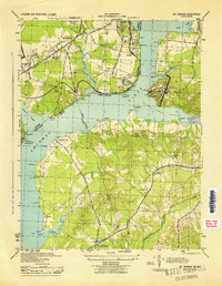
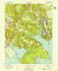
 1923 Indian Head1923 Print · USGSMaryland and Virginia meet along the Potomac in the 1920s, a period when steamboats and early highways still defined regional travel. Genealogists can trace family footprints through sites like Marshall Hall PO, Pohick Church, and the Woodlawn School (Colored).2 unique versions available
 - 1925 Map of Indian Head
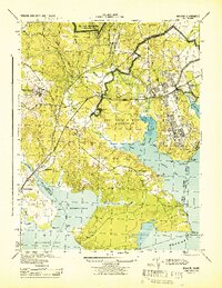
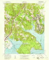
 1925 Indian Head1925 Print · USGSThe Potomac River corridor in the mid-1920s reveals a landscape of strategic military installations and historic river landings. Genealogists and local historians can trace the foundations of Indian Head, find local landmarks like Pohick Church, or locate defunct river hubs such as Budds Ferry.6 unique versions available
 - 1944 Map of Belvoir
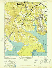
 1944 Belvoir1944 Print · USGSFairfax County is shown at a pivotal moment in the 1940s, balancing its historic riverfront estates with wartime military expansion. Genealogists can trace old family sites and stations near Woodbridge, Colchester, and the landmark Gunston Hall.
 - 1944 Map of Mount Vernon
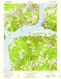
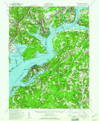
 1944 Mount Vernon1944 Print · USGSThe Potomac River shoreline during the Second World War reveals a landscape of coastal fortifications and early aviation. Genealogists and historians can trace old community hubs like Gum Springs, Accokeek, and the historic Marshall Hall estate.
 - 1948 Map of Washington
 1948 Washington1948 Print · USGSThe Potomac and Chesapeake regions in the late 1940s reveal a landscape of expanding military reach and deep-rooted Tidewater settlements. Trace old rail corridors like the Richmond Fredericksburg & Potomac RR or locate landmarks like the Wakefield Washington Monument and St. Marys College.2 unique versions available
 - 1948 Map of Belvoir
 1948 Belvoir1948 Print · USGSFairfax County and the Potomac River shoreline appear in the late 1940s as military expansion meets historic Virginia estates. Trace the footprint of Fort Belvoir and search for family roots near Gunston Hall, Pohick Ch, and the old settlement at Colchester.
 - 1951 Map of Mt Vernon, 1953 Print
 1951 Mt Vernon1953 Print · USGSThe Potomac River shoreline near Mount Vernon and Accokeek is captured here just as the suburban corridor began to take shape in the early fifties. Researchers can trace historic sites like Fort Washington, the riverside Marshall Hall Park, and family-named churches like Macedonia Ch.2 unique versions available
 - 1951 Map of Belvoir, 1953 Print
 1951 Belvoir1953 Print · USGSThe Potomac shoreline in the early fifties shows a transition from historic estates to expanding military facilities. Genealogists can trace family landmarks like Woodlawn Mansion, Laceys Hill Cem, and the settlement at Accotink.2 unique versions available
 - 1956 Map of Belvoir, 1959 Print
 1956 Belvoir1959 Print · USGSFairfax County in the mid-fifties is captured here as a landscape of military expansion, riverfront estates, and early highway development. Researchers can trace family roots through Pohick Ch, Gunston Sch, and the historical grounds of Gunston Hall.
 - 1956 Map of Mount Vernon, 1959 Print
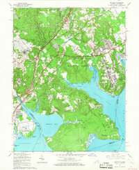
 1956 Mount Vernon1959 Print · USGSThe Potomac riverfront near Mount Vernon appears in the mid-fifties as suburban growth begins to touch both the Virginia and Maryland shores. Trace the development of communities like Gum Springs and Marshall Hall alongside historic sites like Harmony Hall.2 unique versions available
 - 1956 Map of Indian Head, 1961 Print
 1956 Indian Head1961 Print · USGSThe Potomac shoreline in the mid-fifties is a landscape of federal reservations and tobacco-country heritage. Researchers can trace historic river landings like Proctors Wharf and significant sites such as the Indian Head Powder Factory or the Habre de Venture estate.2 unique versions available
 - 1957 Map of Washington, 1966 Print
 1957 Washington1966 Print · USGSThe mid-Atlantic region during the mid-fifties and early sixties reveals a landscape of growing suburbs and vital military outposts. Researchers can trace historic river towns and shorelines from Alexandria to the Hooper Islands and St Clements Island.5 unique versions available
 - 1961 Map of Washington
 1961 Washington1961 Print · USGSThe mid-Atlantic region in the late fifties is presented in remarkable detail, from the Blue Ridge foothills to the Chesapeake Eastern Shore. Researchers can trace historic river landings and military sites like Mount Vernon, Fort Belvoir, and Point Lookout.2 unique versions available
 - 1965 Map of Belvoir, 1967 Print
 1965 Belvoir1967 Print · USGSFairfax County in the mid-sixties reveals a dense intersection of Cold War military operations and preserved colonial history along the Potomac shoreline. Researchers can trace ancestral sites at Pohick Ch and Gunston Hall, or locate family homes in Newington and Harbor View.4 unique versions available
 - 1966 Map of Mount Vernon, 1968 Print
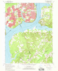 1966 Mount Vernon1968 Print · USGSThe Potomac shoreline was transforming in the mid-sixties as suburban developments grew around historic estates. Local historians can trace the grounds of Mount Vernon, locate the Amusement Park at Marshall Hall, and find numerous neighborhood schools like Hollin Hall School.4 unique versions available
 - 1977 Map of Fort Belvoir, 1982 Print
 1977 Fort Belvoir1982 Print · USGSNorthern Virginia's riverfront and developing suburbs are shown in detail during the late seventies. Researchers can trace the layout of Newington and Lorton or examine the shoreline near Gunston Cove and Occoquan Bay.
 - 1982 Map of Washington West, 1983 Print
 1982 Washington West1983 Print · USGSThe Virginia and Maryland suburbs were undergoing intense development in the early eighties as the capital region expanded outward. Researchers can trace the footprint of Cold War-era defense sites like Fort Belvoir and Vint Hill Farms Station alongside growing academic centers like George Mason University.
 - 1986 Map of Washington West
 1986 Washington West1986 Print · USGSNorthern Virginia and the D.C. metro area are captured here in the mid-eighties as suburban growth began to meet rural Fauquier County. Trace the development of the corridor from Alexandria out to Dulles and the preserved lands of Prince William Forest Park.2 unique versions available
 - 1989 Map of Washington
 1989 Washington1989 Print · USGSThe Potomac River valley and Chesapeake Bay are shown in comprehensive detail during the late 1980s. Genealogists and historians can trace the transition from urban Alexandria to the rural Northern Neck, locating landmarks like Mount Vernon and Stratford Hall.
 - 2011 Map of Fort Belvoir, 2011 Print
 2011 Fort Belvoir2011 Print · USGSCovers Mount Vernon, including Lorton, Newington, and other nearby areas
Showing maps 1-25 of 34
Top cities near Mount Vernon
- Washington historical maps
- Arlington historical maps
- Alexandria historical maps
- Waldorf historical maps
- Bethesda historical maps
- McLean historical maps
See more
Top neighborhoods of Mount Vernon
- Woodlawn historical maps
- Woodley Hills historical maps
- Engleside historical maps
- Waldon Woods historical maps
- Sequoyah historical maps
- Southwood historical maps
See more
Frequently asked questions
- What are the different types of historical maps available for Mount Vernon?
- What is the oldest map of Mount Vernon?
- Where can I purchase historical maps of Mount Vernon for my home or office?
- Where can I download high-res historical maps of Mount Vernon?
- Are there historical topographic maps available for Mount Vernon?
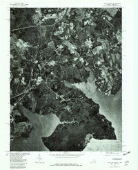
- Is there historical aerial imagery available for Mount Vernon?
- Where are historical maps of Mount Vernon sourced from?