2020s Maps of Tysons, Virginia
Explore 2 historic maps of Tysons from the 2020s. These maps offer a rare glimpse into what life looked like during the 2020s — showing old roads, neighborhoods, homes, and landmarks that have changed or disappeared over time.
Whether you're researching your family's past, planning a metal detecting trip, or studying how Tysons's landscape evolved across the 2020s, these high-resolution maps are a powerful tool for exploring the history of this region.
- Focus on a specific era: All maps on this page are from the 2020s, giving you a focused view of this time period.
- See what’s changed: Compare century-old streets, trails, and buildings to today's modern landscape using overlays and satellite layers.
- Research with precision: Use these maps for genealogy, historical research, land use analysis, or educational projects.
- View, download, or print: Maps are fully viewable online in high resolution, and can be downloaded or printed for your own records.
Start exploring Tysons's history through authentic maps from the 2020s. This is your window into the past.
Tysons, VA maps
(2)- 2022 Map of Falls Church, 2022 Print
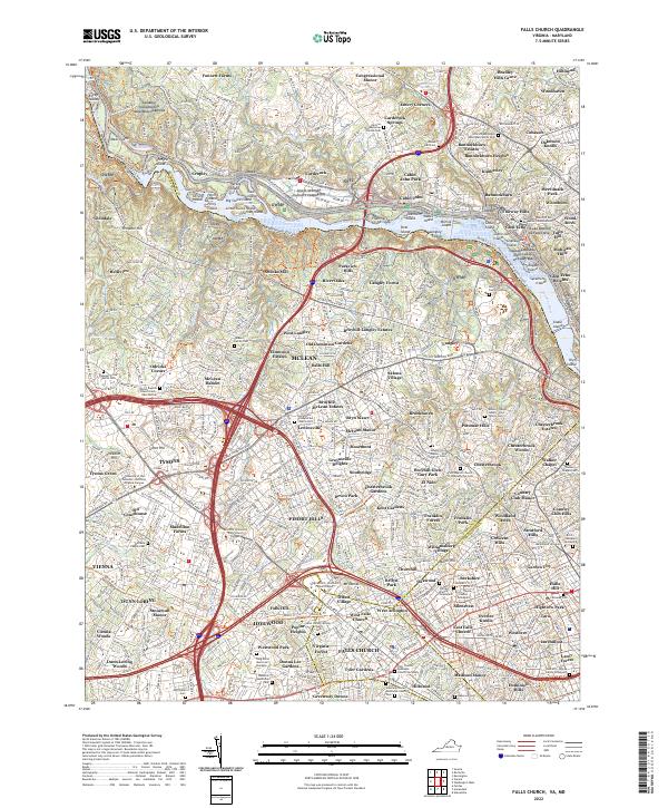 2022 Falls Church2022 Print · USGSThis late-period survey of the Northern Virginia and Maryland borderlands captures the dense development surrounding Falls Church and McLean. Genealogists can trace numerous family burial sites, including the Phillips Family Graveyard and Jackson Family Cem.
 - 2023 Map of Vienna, 2023 Print
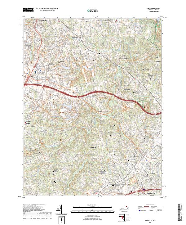 2023 Vienna2023 Print · USGSFairfax County's contemporary suburban landscape and historic family plots are captured here in the early 2020s. Genealogists can locate small family markers like the Iden Family Cem and Thompson Kidwell Family Cem among the reaches of Difficult Run.
End of results
Showing maps 1-2 of 2
Top cities near Tysons
- Washington historical maps
- Arlington historical maps
- Alexandria historical maps
- Silver Spring historical maps
- Centreville historical maps
- Gaithersburg historical maps
See more
Top neighborhoods of Tysons
- Old Courthouse historical maps
- Tysons Green historical maps
- Ash Grove historical maps
- Madrillon Farms historical maps
Frequently asked questions
- What are the different types of historical maps available for Tysons?
- What is the oldest map of Tysons?
- Where can I purchase historical maps of Tysons for my home or office?
- Where can I download high-res historical maps of Tysons?
- Are there historical topographic maps available for Tysons?
- Is there historical aerial imagery available for Tysons?
- Where are historical maps of Tysons sourced from?