1960s Maps of Ruckersville, Virginia
Explore 2 historic maps of Ruckersville from the 1960s. These maps offer a rare glimpse into what life looked like during the 1960s — showing old roads, neighborhoods, homes, and landmarks that have changed or disappeared over time.
Whether you're researching your family's past, planning a metal detecting trip, or studying how Ruckersville's landscape evolved across the 1960s, these high-resolution maps are a powerful tool for exploring the history of this region.
- Focus on a specific era: All maps on this page are from the 1960s, giving you a focused view of this time period.
- See what’s changed: Compare century-old streets, trails, and buildings to today's modern landscape using overlays and satellite layers.
- Research with precision: Use these maps for genealogy, historical research, land use analysis, or educational projects.
- View, download, or print: Maps are fully viewable online in high resolution, and can be downloaded or printed for your own records.
Start exploring Ruckersville's history through authentic maps from the 1960s. This is your window into the past.
Ruckersville, VA maps
(2)- 1964 Map of Barboursville, 1965 Print
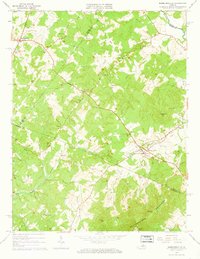 1964 Barboursville1965 Print · USGSThe Virginia Piedmont near Barboursville comes alive in the mid-1960s, showing a landscape of railroad hamlets and rural mountain ridges. Genealogists can trace family landmarks like Thomas Cem and Knights Chapel or explore the Barbour Ruins near the Southern rail line.4 unique versions available
 - 1965 Map of Earlysville, 1966 Print
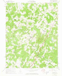 1965 Earlysville1966 Print · USGSThe Virginia Piedmont comes into sharp focus during the mid-sixties, showing the rural communities of Earlysville and Advance Mills at a moment of transition. Genealogists and local historians can trace family roots through numerous landmarks like Buck Mountain Ch, Broadus Wood Sch, and the scattered Cem markers across the hills.4 unique versions available
End of results
Showing maps 1-2 of 2
Top cities near Ruckersville
- Charlottesville historical maps
- Hollymead historical maps
- University of Virginia historical maps
- Pantops historical maps
- Elkton historical maps
- Rivanna historical maps
See more
Frequently asked questions
- What are the different types of historical maps available for Ruckersville?
- What is the oldest map of Ruckersville?
- Where can I purchase historical maps of Ruckersville for my home or office?
- Where can I download high-res historical maps of Ruckersville?
- Are there historical topographic maps available for Ruckersville?
- Is there historical aerial imagery available for Ruckersville?
- Where are historical maps of Ruckersville sourced from?