Old Maps of Ashland, Virginia for Academic Research
Study the evolution of Ashland with 22 high-resolution historic maps. Whether you're teaching, researching, or modeling changes in land use, these maps provide essential visual documentation of urban, environmental, and geographic change.
- Analyze long-term change: Track patterns in development, transportation, and natural features.
- Ideal for environmental or urban studies: Support academic projects with primary historical map data.
- Use in the classroom or lab: Educators and researchers rely on these maps to bring historical context to life.
These maps are a powerful tool for teaching, research, and visualizing how Ashland has changed over the decades.
Ashland, VA maps
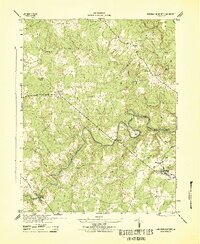
(22)- 1890 Map of Goochland
 1890 Goochland1890 Print · USGSGoochland and the surrounding Virginia Piedmont are captured here in the late nineteenth century as the river-and-rail economy thrived. Researchers can trace the paths of the Chesapeake and Ohio Railroad and find landmarks like Hopeful Church or the Coal Pits.
 - 1892 Map of Goochland
 1892 Goochland1892 Print · USGSThe rural heart of central Virginia is captured here in the decade before the turn of the century, showing a landscape shaped by major rivers and early rail lines. Genealogists can trace family names and early settlements like Negro Foot, Mabelton, and the historic Hanover Academy.8 unique versions available
 - 1894 Map of Richmond
 1894 Richmond1894 Print · USGSThe Richmond area at the close of the nineteenth century reveals a city expanding into its rural surroundings via a complex network of turnpikes and railroads. Genealogists and historians can trace family-named sites like Hawes Shop, Hazelgrove's Store, and Gilman's Mill alongside civil war landmarks at Seven Pines and Old Cold Harbor.
 - 1895 Map of Richmond
 1895 Richmond1895 Print · USGSRichmond and Manchester thrive as bustling riverfront hubs in the 1890s, where rail lines and historic turnpikes converge on the James River. Genealogists and historians can trace family locations near Merry Oaks Church or follow the road to Old Cold Harbor and Seven Pines.5 unique versions available
 - 1918 Map of Doswell
 1918 Doswell1918 Print · USGSCentral Virginia during the first World War features a landscape of river-fed mills and vital rail junctions. Genealogists can locate family names at Hanover Courthouse or trace the early paths of segregated schools like Ruther Glen School (Colored) and Penola School (Colored).4 unique versions available
 - 1938 Map of Yellow Tavern
 1938 Yellow Tavern1938 Print · USGSHanover and Henrico counties appear in the 1930s as a landscape of rural crossroads and river bottomlands. Genealogists can trace family-named landmarks and institutions like the Henry Clay Birthplace, St Josephs Villa, and the Jeb Stuart Monument.3 unique versions available
 - 1943 Map of Hanover Academy
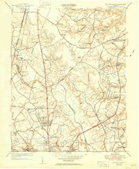
 1943 Hanover Academy1943 Print · USGSMid-century Hanover County is shown here during the war years, when the rural economy still revolved around river fords and crossroads mills. Researchers can locate family landmarks like SNEEDS MILL, Hanover Academy, and the curiously named Negro Foot.2 unique versions available
 - 1943 Map of Richmond, 1972 Print
 1943 Richmond1972 Print · USGSCoastal Virginia and the state capital are shown in detail during the mid-century era of infrastructure expansion. Genealogists and historians can trace the grounds of Richmond Nat Battlefield Park, locate the Yorktown Nat Cem, or follow the many rural routes through Amelia Court House and Tappahannock.
 - 1949 Map of Richmond, 1951 Print
 1949 Richmond1951 Print · USGSCoastal Virginia in the years following World War II remained a landscape of historic river towns and expanding military bases. Genealogists and historians can trace the rail lines of the Southern Ry and locate established landmarks from Camp Lee to the remote reaches of Dragon Swamp.
 - 1951 Map of Ashland
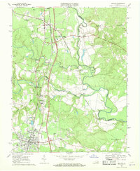
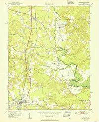 1951 Ashland1951 Print · USGSMid-century Hanover County centers on the rail hub of Ashland and the collegiate grounds of Randolph-Macon College. Genealogists and historians can trace river crossings and local landmarks like Ashland Mill, Doswell Sch, and Jerusalem Ch.
 - 1951 Map of Yellow Tavern
 1951 Yellow Tavern1951 Print · USGSNorth of Richmond in the early fifties, this area reveals a landscape of rural stores and historic memorials along the Chickahominy. Trace the sites of the Henry Clay Birthplace, the Jeb Stuart Monument, and the rail junction at Atlee Sta.
 - 1959 Map of Richmond
 1959 Richmond1959 Print · USGSMid-century Virginia is captured here at its most vital rail and river junctions, from the capital city to the Chesapeake Bay. Genealogists and historians can trace the development of colonial settlements like Williamsburg and military landmarks including Fort Monroe and Camp Lee.
 - 1963 Map of Yellow Tavern, 1965 Print
 1963 Yellow Tavern1965 Print · USGSNorth of Richmond in the early sixties, the Hanover and Henrico borderlands remained a landscape of historic landmarks and growing suburbs. Genealogists and historians can locate family-named sites like Heaths Store, the Henry Clay Birthplace, and the JEB Stuart Monument.6 unique versions available
 - 1964 Map of Richmond
 1964 Richmond1964 Print · USGSCoastal and central Virginia are mapped during the mid-twentieth century, showing the critical intersection of rail, river, and military life. Genealogists can trace family roots through rural county seats like Amelia or find vanished coastal neighborhoods near Phoebus and Hilton Village.
 - 1969 Map of Ashland, 1970 Print
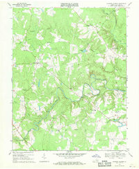
 1969 Ashland1970 Print · USGSHanover County in the late sixties shows the growth of Ashland around Randolph-Macon College and its dual-railroad corridors. Genealogists can trace family names at Mt Hope Ch or locate old community hubs like Gum Tree and Ashland Mill.4 unique versions available
 - 1969 Map of Hanover Academy, 1970 Print
 1969 Hanover Academy1970 Print · USGSHanover County at the end of the 1960s shows a landscape of river-bend settlements and rural crossroads. Local historians can trace family-named landmarks and old congregations like Scotchtown, Independence Ch, and the Fork Ch Cem.4 unique versions available
 - 1973 Map of Richmond, 1974 Print
 1973 Richmond1974 Print · USGSThe Virginia Tidewater and Piedmont come alive in the early seventies, showcasing a region defined by its great rivers and massive military installations. Researchers can trace the mid-century growth of Richmond or locate family sites near Amelia Court House and Highland Springs.2 unique versions available
 - 1974 Map of Yellow Tavern, 1977 Print
 1974 Yellow Tavern1977 Print · USGSNorthern Richmond and Hanover County are captured in 1974 during a period of rapid suburban transformation. This aerial study allows researchers to trace mid-century property lines and the early footprint of modern infrastructure alongside the Chickahominy.
 - 1984 Map of Richmond, 1986 Print
 1984 Richmond1986 Print · USGSCentral Virginia during the mid-eighties shows a landscape of rapid suburban expansion centered on the state capital and its historic riverfront. Genealogists and historians can trace institutional sites like Randolph-Macon College, the grounds of Fort Lee, and small community landmarks like Hebron Ch.3 unique versions available
 - 2022 Map of Hanover Academy, 2022 Print
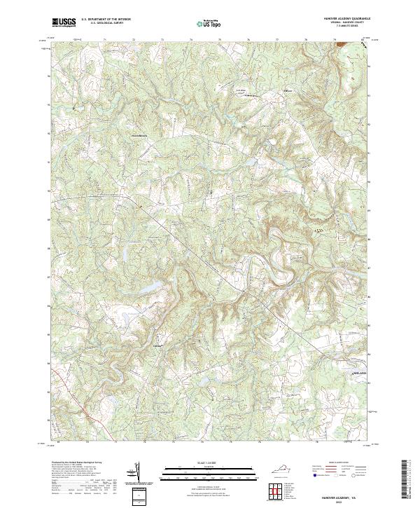 2022 Hanover Academy2022 Print · USGSHanover County at the start of the 2020s remains a landscape shaped by its river systems and deep-rooted settlements. Genealogists and historians can trace the rural tracts between Scotchtown and Ashland, locating landmarks like Cool Water Airport and Campbells Pond.
 - 2022 Map of Yellow Tavern, 2022 Print
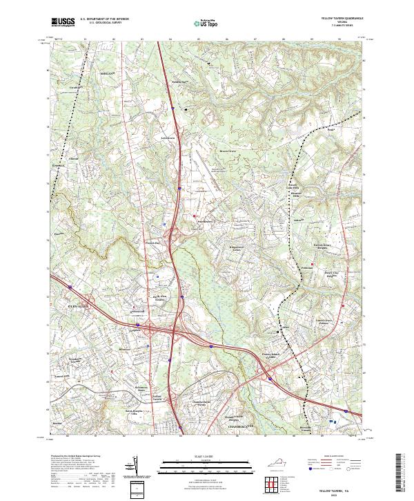 2022 Yellow Tavern2022 Print · USGSThe Hanover and Henrico borderlands are shown here in the contemporary era, marked by the dense interchange of modern interstates. Researchers can locate historic sites like Yellow Tavern, Saint Josephs Villa, and several family cemeteries including Lewiston Cem.
 - 2022 Map of Ashland, 2022 Print
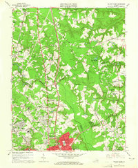
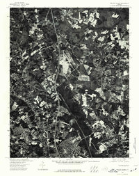
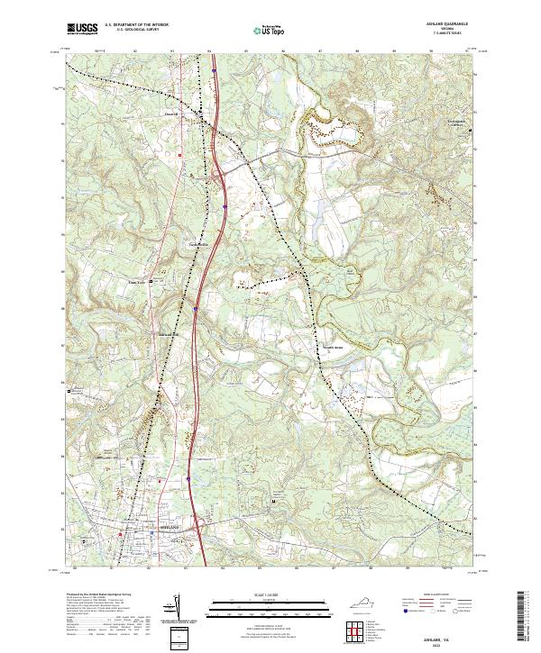 2022 Ashland2022 Print · USGSHanover County's academic and transit corridor is captured here in the early twenty-first century, centered on the growing town of Ashland. Researchers can trace local history through sites like Randolph Macon College, the Ashland Mill, and numerous family burial grounds including Randolph Cem.
End of results
Showing maps 1-22 of 22
Top cities near Ashland
- Richmond historical maps
- Tuckahoe historical maps
- Mechanicsville historical maps
- Short Pump historical maps
- Highland Springs historical maps
- Glen Allen historical maps
See more
Top neighborhoods of Ashland
Frequently asked questions
- What are the different types of historical maps available for Ashland?
- What is the oldest map of Ashland?
- Where can I purchase historical maps of Ashland for my home or office?
- Where can I download high-res historical maps of Ashland?
- Are there historical topographic maps available for Ashland?
- Is there historical aerial imagery available for Ashland?
- Where are historical maps of Ashland sourced from?