1990s Maps of Henrico County, Virginia
Explore 5 historic maps of Henrico County from the 1990s. These maps offer a rare glimpse into what life looked like during the 1990s — showing old roads, neighborhoods, homes, and landmarks that have changed or disappeared over time.
Whether you're researching your family's past, planning a metal detecting trip, or studying how Henrico County's landscape evolved across the 1990s, these high-resolution maps are a powerful tool for exploring the history of this region.
- Focus on a specific era: All maps on this page are from the 1990s, giving you a focused view of this time period.
- See what’s changed: Compare century-old streets, trails, and buildings to today's modern landscape using overlays and satellite layers.
- Research with precision: Use these maps for genealogy, historical research, land use analysis, or educational projects.
- View, download, or print: Maps are fully viewable online in high resolution, and can be downloaded or printed for your own records.
Start exploring Henrico County's history through authentic maps from the 1990s. This is your window into the past.
Henrico County, VA maps
(5)- 1994 Map of Hopewell, 1996 Print
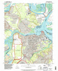 1994 Hopewell1996 Print · USGSCoastal Virginia during the 1990s shows a dense intersection of military, industrial, and historical sites at the river forks. Genealogists and historians can trace family locations in Screamersville, locate the National Cem, and explore the grounds of Bermuda Hundred.
 - 1994 Map of Roxbury, 1996 Print
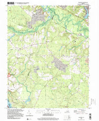
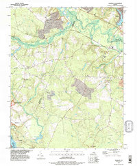 1994 Roxbury1996 Print · USGSCharles City and Henrico Counties appear here in the mid-1990s, balancing their Civil War heritage with quiet rural life. Genealogists and historians can locate Glendale National Cemetery, the Richmond National Battlefield Park, and old settlements like Nances Shop or Elko.
 - 1994 Map of Midlothian, 1996 Print
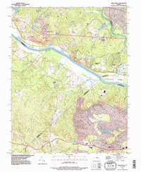 1994 Midlothian1996 Print · USGSThe James River corridor near the turn of the millennium shows a blend of historic river settlements and modern suburban growth. Genealogists and historians can trace family locations near Huguenot Springs Cem and old river landings at Vinita or Boscobel.
 - 1994 Map of Hylas, 1996 Print
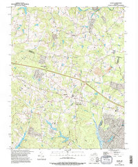 1994 Hylas1996 Print · USGSGoochland and Hanover counties come together in the mid-1990s along the banks of the South Anna River and Tuckahoe Creek. Genealogists and local historians can locate numerous family Cem sites and trace the rural road network connecting Rockville, Hylas, and Johnsons Spring.
 - 1999 Map of Roxbury, 2000 Print
 1999 Roxbury2000 Print · USGSCharles City and Henrico counties at the end of the millennium show a landscape deeply shaped by Civil War history and river geography. Researchers can trace historic boundaries and rural life through Glendale National Cemetery, Malvern Hill, and Ednas Mill.
End of results
Showing maps 1-5 of 5
Top cities of Henrico County
- Tuckahoe historical maps
- Short Pump historical maps
- Highland Springs historical maps
- Glen Allen historical maps
- Lakeside historical maps
- Dumbarton historical maps
See more
Frequently asked questions
- What are the different types of historical maps available for Henrico County?
- What is the oldest map of Henrico County?
- Where can I purchase historical maps of Henrico County for my home or office?
- Where can I download high-res historical maps of Henrico County?
- Are there historical topographic maps available for Henrico County?
- Is there historical aerial imagery available for Henrico County?
- Where are historical maps of Henrico County sourced from?