1960s Maps of Highland County, Virginia
Explore 15 historic maps of Highland County from the 1960s. These maps offer a rare glimpse into what life looked like during the 1960s — showing old roads, neighborhoods, homes, and landmarks that have changed or disappeared over time.
Whether you're researching your family's past, planning a metal detecting trip, or studying how Highland County's landscape evolved across the 1960s, these high-resolution maps are a powerful tool for exploring the history of this region.
- Focus on a specific era: All maps on this page are from the 1960s, giving you a focused view of this time period.
- See what’s changed: Compare century-old streets, trails, and buildings to today's modern landscape using overlays and satellite layers.
- Research with precision: Use these maps for genealogy, historical research, land use analysis, or educational projects.
- View, download, or print: Maps are fully viewable online in high resolution, and can be downloaded or printed for your own records.
Start exploring Highland County's history through authentic maps from the 1960s. This is your window into the past.
Highland County, VA maps
(15)- 1961 Map of Paddy Knob, 1964 Print
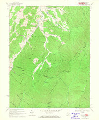
 1961 Paddy Knob1964 Print · USGSThe West Virginia and Virginia borderlands come to life in the early sixties, showing the remote high-country terrain of Pocahontas County. Researchers can find numerous family burial sites like Shinaberry Cem, the mountain chapel of Wesley Chapel, and the small settlement at Frost.2 unique versions available
 - 1961 Map of Sunrise, 1981 Print
 1961 Sunrise1981 Print · USGSThe Virginia and West Virginia borderlands appear here in the early sixties, centered on the high ridges and deep valleys of the national forests. Researchers can locate remote family landmarks like Doyle Cem, Zion Hill Ch, and the small settlement at Sunrise.2 unique versions available
 - 1967 Map of Deerfield, 1968 Print
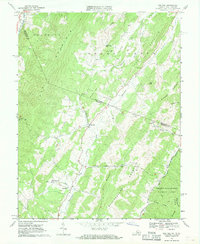
 1967 Deerfield1968 Print · USGSThe Deerfield Valley in the late 1960s was a landscape of river-bottom farms and steep forest ridges at the intersection of Augusta and Bath Counties. Genealogists and hikers can trace old homesteads and landmarks like Mt Mary Cem, Little Baltimore, and the Rocky Spring Ch.4 unique versions available
 - 1967 Map of West Augusta, 1991 Print
 1967 West Augusta1991 Print · USGSThe West Augusta area in the late 1960s is depicted as a landscape of deep hollows and high summits within the George Washington National Forest. Genealogists and local historians can trace family locations near West Augusta Cemetery or explore the mountain terrain surrounding Camp Todd and Braley Pond.2 unique versions available
 - 1968 Map of Doe Hill, 1970 Print
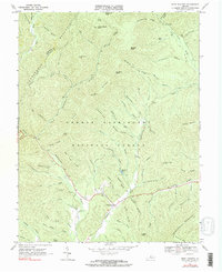
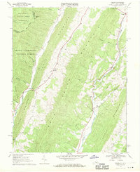
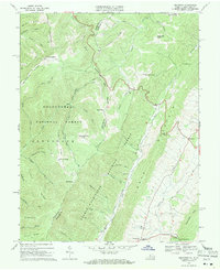
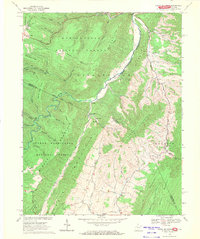
 1968 Doe Hill1970 Print · USGSHighland County and the West Virginia borderlands are documented here in the late sixties, showing a landscape of deep river valleys and high ridges. Researchers can locate remote rural landmarks like Sirons Mill, St Pauls Ch, and the high reaches of Sugar Grove Mountain.2 unique versions available
 - 1969 Map of Mustoe, 1970 Print
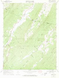
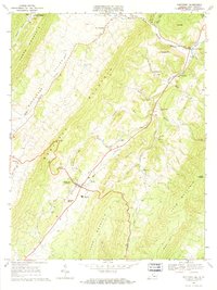
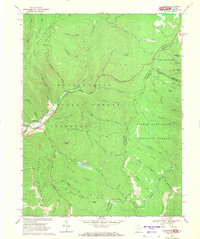
 1969 Mustoe1970 Print · USGSHighland County's mountain gaps and river valleys are captured here in the late sixties. Genealogists can trace family names and sites through several country churches and cemeteries, such as Wesley Chapel, Fairview Cem, and the settlement at Valley Center.3 unique versions available
 - 1969 Map of Burnsville, 1970 Print
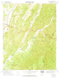
 1969 Burnsville1970 Print · USGSThe mountain valleys of the Virginia highlands are captured here in the late sixties, showcasing rural life along the Jackson River. Genealogists and hikers can trace old family sites like Cleek Cem or explore the trails around Burnsville and Bolar Gap.3 unique versions available
 - 1969 Map of Williamsville, 1971 Print
 1969 Williamsville1971 Print · USGSThe river valleys of Highland and Bath counties appear in the late 1960s as a quiet landscape of mountain gap settlements and forest ridges. Researchers can locate family landmarks and historic congregations like Mt Zion Ch near Flood or the Coursey Springs Fish Hatchery on the river.3 unique versions available
 - 1969 Map of Monterey SE, 1971 Print
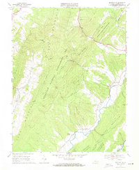 1969 Monterey SE1971 Print · USGSHighland County in the late sixties reveals a mountain landscape of tight-knit river communities and high-ridge conservation land. Genealogists and historians can trace family locations near Clover Creek, Hamilton Chapel, and the remote Seldom Seen Hollow.2 unique versions available
 - 1969 Map of Palo Alto, 1971 Print
 1969 Palo Alto1971 Print · USGSThe West Virginia and Virginia border comes alive in this late-sixties study of the ridges surrounding Palo Alto. Trace rural heritage through family-named landmarks like Puffenbarger Pond, old mountain churches including Wilfong Ch, and the many hollows of Shenandoah Mountain.3 unique versions available
 - 1969 Map of Hightown, 1971 Print
 1969 Hightown1971 Print · USGSThe high ridges of Highland County are captured in the late sixties, where the Virginia and West Virginia border meets. Genealogists can locate small community cemeteries, Pisgah Ch, and the high-elevation settlements of Hightown and Meadowdale.3 unique versions available
 - 1969 Map of Monterey, 1971 Print
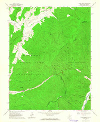
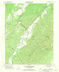
 1969 Monterey1971 Print · USGSHighland County's high-mountain valleys are shown here in the late sixties as the community of Monterey thrived alongside older settlements. Genealogists can trace family names through Seybert Chapel, Union Chapel, and Hannah Airfield, or locate the Fish Hatchery and Possum Trot.3 unique versions available
 - 1969 Map of Mc Dowell, 1971 Print
 1969 Mc Dowell1971 Print · USGSHighland and Augusta counties are surveyed here in the late sixties, showing the ridge-and-valley terrain between the Bullpasture and Cowpasture Rivers. Genealogists and historians can locate the Hiner Ch, several rural cemeteries, and the Columbia Union College Biological Station.2 unique versions available
 - 1969 Map of Snowy Mountain, 1971 Print
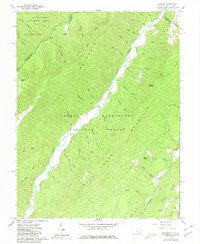
 1969 Snowy Mountain1971 Print · USGSThe West Virginia and Virginia borderlands were still characterized by remote mountain settlements and national forest tracts in the late sixties. Genealogists and hikers can trace the paths between Hardscrabble, Dry Run Ch, and the high peak of Snowy Mountain.2 unique versions available
 - 1969 Map of Thornwood, 1971 Print
 1969 Thornwood1971 Print · USGSThe West Virginia and Virginia borderlands come into focus in the late sixties, where the Greenbrier River headwaters meet national forest lands. Local historians can locate Thornwood, the Buffalo Fork Dam, and family landmarks like Rambottom or the Cem near Circleville.2 unique versions available
End of results
Showing maps 1-15 of 15
Top cities of Highland County
Frequently asked questions
- What are the different types of historical maps available for Highland County?
- What is the oldest map of Highland County?
- Where can I purchase historical maps of Highland County for my home or office?
- Where can I download high-res historical maps of Highland County?
- Are there historical topographic maps available for Highland County?
- Is there historical aerial imagery available for Highland County?
- Where are historical maps of Highland County sourced from?