Old Maps of Highland County, Virginia for Genealogy
Trace your family roots with 126 historic maps of Highland County. These high-res maps reveal old neighborhoods, homesites, landmarks, and streets — helping you uncover where your ancestors lived and how the area evolved over time.
- Explore historic neighborhoods: Identify where your relatives may have lived in the 1800s or 1900s.
- Compare maps over time: Trace the changes in streets, buildings, and landmarks for multi-generational research.
- Perfect for genealogy & ancestry research: Used by family historians and researchers to map out lineage and migration.
These maps are an incredible resource for exploring your personal connection to Highland County's past.
Highland County, VA maps
(126)- 1889 Map of Beverly
 1889 Beverly1889 Print · USGSThe high Allegheny ridges and river forks of West Virginia are mapped here in the late 1880s, highlighting the rugged settlement patterns of Randolph and Pocahontas counties. Researchers can trace early family-named locations such as Days Mills, locate the Boundary Line In Dispute, and find remote outposts like Traveller's Repose.
 - 1892 Map of Beverly
 1892 Beverly1892 Print · USGSCentral West Virginia's high-mountain settlements and disputed county lines are captured here in the late nineteenth century. Genealogists and historians can trace family locations and early industry near Beverly, Huttonsville, and the remote Days Mills.5 unique versions available
 - 1894 Map of Staunton, 1897 Print
 1894 Staunton1897 Print · USGSThe Shenandoah Valley was a hub of rail commerce and mountain industry in the 1890s, centered on the growing city of Staunton. Genealogists and historians can trace defunct rail stops and early industry at Giant Mills, Milnesville, and Stribling Spgs.8 unique versions available
 - 1901 Map of Monterey, 1905 Print
 1901 Monterey1905 Print · USGSThe high Allegheny ridges of Highland and Bath Counties are shown at the turn of the century when isolated valley settlements were linked by winding mountain gaps. Genealogists can trace early homesteads and commerce centers like Cleeks Mills, Mountaingrove, and New Hampden.8 unique versions available
 - 1922 Map of Spruce Knob
 1922 Spruce Knob1922 Print · USGSThe Potomac Highlands are seen here in the early 1920s, a period defined by small mountain gaps and high-altitude settlements. Researchers can trace rural life through dozens of sites like Osceola Po, Winterburn Station, and the isolated Ridge Church.3 unique versions available
 - 1922 Map of Cass
 1922 Cass1922 Print · USGSThe West Virginia highlands are shown here in the 1920s as a bustling corridor of mountain rail and timber industry. Genealogists can trace family roots through numerous country landmarks like Wanless Church, McLaughlin School, and the remote rail town of Spruce.4 unique versions available
 - 1923 Map of Warm Springs
 1923 Warm Springs1923 Print · USGSThe mountain border between West Virginia and Virginia comes into focus in the early 1920s, revealing a landscape of remote mountain gaps and hollows. Researchers can locate numerous local landmarks like Minnehaha Springs, Mt Carmel Church, and the Circle Hill School.2 unique versions available
 - 1924 Map of Cass
 1924 Cass1924 Print · USGSPocahontas County was a mountain landscape of timber and rail in the early 1920s, dominated by the Greenbrier River valley. Genealogists can locate family landmarks like Dilleys Mill, Hevener Church, and numerous schools including the Pine Grove School.3 unique versions available
 - 1924 Map of Mc Dowell
 1924 Mc Dowell1924 Print · USGSHighland County and the Allegheny borderlands are shown in the early twenties, a time of isolated mountain communities and high-ridge forests. Genealogists can trace family footprints at St Paul Church, Mt Hull School, and the remote Crummet Church.5 unique versions available
 - 1924 Map of Spruce Knob
 1924 Spruce Knob1924 Print · USGSThe Allegheny high country comes alive in the mid-twenties, centered on the heights of Spruce Knob and the North Fork River. Genealogists can trace family footprints at Osceola PO, Rexrode, and numerous mountain schools like Stark School.2 unique versions available
 - 1926 Map of Warm Springs
 1926 Warm Springs1926 Print · USGSThe West Virginia and Virginia borderlands come alive in this mid-1920s survey of the high Alleghenies. Researchers can trace rural life through landmarks like Minnehaha Springs, Westminster Church, and schools at Rimel and Sunset.5 unique versions available
 - 1941 Map of Monterey, 1963 Print
 1941 Monterey1963 Print · USGSHighland County at the start of the 1940s reveals a network of high-valley settlements and strategic turnpikes. Trace the locations of early schools and churches like Strait Creek School and Union Chapel near the South Branch of the Potomac.2 unique versions available
 - 1943 Map of Craigsville, 1961 Print
 1943 Craigsville1961 Print · USGSThe Virginia mountains in the early 1940s reveal a landscape of rail-dependent valley towns and isolated mountain gaps. You can trace family roots through rural landmarks like Griffin Ch, the Wilderness Sch, and the high peak at Elliott Knob.
 - 1944 Map of Monterey
 1944 Monterey1944 Print · USGSHighland County at the height of the Second World War remains a land of high ridges and isolated mountain valleys. Genealogists can trace family footprints across Bluegrass Valley and locate landmarks like Hamilton Chapel, Possum Trot, and the Strait Creek Sch.2 unique versions available
 - 1944 Map of Mc Dowell, 1960 Print
 1944 Mc Dowell1960 Print · USGSHighland and Augusta counties appear here during the mid-forties, capturing the remote mountain settlements and river gaps of the Alleghenies. Researchers can locate family landmarks like Siron's Mill and rural centers like Mc Dowell or Doe Hill.2 unique versions available
 - 1945 Map of Craigsville
 1945 Craigsville1945 Print · USGSAugusta and Bath counties are shown here in the mid-1940s, when the rail lines still dictated the growth of mountain valley towns. Researchers can trace the Chesapeake and Ohio RR through Craigsville or locate rural sites like Rocky Spring Ch and Wilderness Sch.2 unique versions available
 - 1946 Map of Mc Dowell
 1946 Mc Dowell1946 Print · USGSHighland and Augusta counties are shown in the 1940s as a landscape of ridge-top landmarks and valley crossroads. Genealogists and local historians can trace family-named sites like Simons Mill, the historic Staunton and Parkersburg Turnpike, and rural congregations at St Pauls Ch.2 unique versions available
 - 1946 Map of Warm Springs, 1962 Print
 1946 Warm Springs1962 Print · USGSBath County and the Allegheny borderlands are captured here in the mid-1940s, showing the early infrastructure of this resort and timber region. Researchers can trace family sites at Mountain Grove, rural pulpits like Mt Hope Ch, and the crossing at Moclintic Bridge.2 unique versions available
 - 1946 Map of Williamsville, 1964 Print
 1946 Williamsville1964 Print · USGSThe mountain valleys of Bath and Highland counties are captured here in the mid-1940s, showing a landscape of forest ridges and river settlements. Genealogists and hikers can locate old landmarks like Lockridge Memorial Ch, the Flood Sch, and the Duncan Knob Lookout Tower.
 - 1949 Map of Charlottesville
 1949 Charlottesville1949 Print · USGSThe Shenandoah Valley and Blue Ridge appear in the late 1940s as a thriving corridor of rail and river commerce. Researchers can trace the mid-century footprints of Harrisonburg, Staunton, and Culpeper alongside the historic routes of the Southern Railway.2 unique versions available
 - 1949 Map of Williamsville
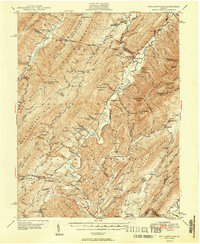 1949 Williamsville1949 Print · USGSThe ridges and valleys of Bath and Highland Counties come alive in this mid-century survey, documenting a time of remote mountain settlements and forest lookouts. Trace the locations of Starr Chapel, Flood Sch, and the high-elevation Duncan Knob Lookout Tower.2 unique versions available
 - 1949 Map of Warm Springs
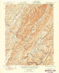 1949 Warm Springs1949 Print · USGSThe Virginia and West Virginia borderlands are documented here in the late 1940s, highlighting the famous resort springs and rugged Appalachian ridges. Genealogists can trace family locations near Warm Springs, Bacova, and the Chimney Run Ch or Zion Hill Ch.2 unique versions available
 - 1956 Map of Charlottesville, 1966 Print
 1956 Charlottesville1966 Print · USGSThe Shenandoah Valley and Blue Ridge are captured in detail during the mid-1960s as the modern interstate system began to emerge. Genealogists and historians can trace rail-connected hubs like Waynesboro or follow the river paths of the Rapidan River and Rivanna River.4 unique versions available
 - 1961 Map of Paddy Knob, 1964 Print
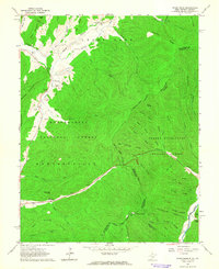 1961 Paddy Knob1964 Print · USGSThe West Virginia and Virginia borderlands come to life in the early sixties, showing the remote high-country terrain of Pocahontas County. Researchers can find numerous family burial sites like Shinaberry Cem, the mountain chapel of Wesley Chapel, and the small settlement at Frost.2 unique versions available
 - 1961 Map of Sunrise, 1981 Print
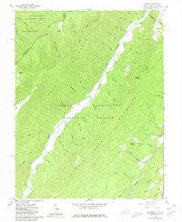 1961 Sunrise1981 Print · USGSThe Virginia and West Virginia borderlands appear here in the early sixties, centered on the high ridges and deep valleys of the national forests. Researchers can locate remote family landmarks like Doyle Cem, Zion Hill Ch, and the small settlement at Sunrise.2 unique versions available
Showing maps 1-25 of 126
Top cities of Highland County
Frequently asked questions
- What are the different types of historical maps available for Highland County?
- What is the oldest map of Highland County?
- Where can I purchase historical maps of Highland County for my home or office?
- Where can I download high-res historical maps of Highland County?
- Are there historical topographic maps available for Highland County?
- Is there historical aerial imagery available for Highland County?
- Where are historical maps of Highland County sourced from?