
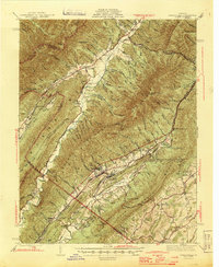
1945 Map of Craigsville
USGS Topo · Published 1945About this map
Great North Mountain and Little North Mountain dominate this mid-century topographic survey of the Virginia highlands. The rail-oriented economy of the era is anchored by the Chesapeake and Ohio RR, which threads through the valleys connecting industrial and transit points like Craigsville, Fordwick, and Bells Valley. This transport corridor along the Calfpasture River contrasts with the remote, ridge-enclosed hollows to the west, where family and community landmarks like Griffin Ch and Wilderness Sch served more isolated populations.
Find a feature on this map
115 named features on this map. Tap any name to fly to it.
Don’t see what you’re looking for? This feature index may not catch every label — zoom into the map to look around manually.
Map Details
Editions of this 1945 Craigsville Map
2 editions found
Other maps of this area

1894 · Staunton
USGS Topo · 1:125,000

1894 · Natural Bridge
USGS Topo · 1:125,000

1894 · Lexington
USGS Topo · 1:125,000

1901 · Monterey
USGS Topo · 1:125,000

1924 · Mc Dowell
USGS Topo · 1:62,500

1932 · Lexington
USGS Topo · 1:48,000

1936 · Vesuvius
USGS Topo · 1:48,000

1937 · Lexington
USGS Topo · 1:62,500

1941 · Vesuvius
USGS Topo · 1:62,500

1941 · Monterey
USGS Topo · 1:62,500