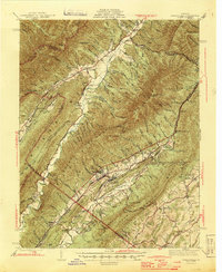
1945 Map of Craigsville
USGS Topo · Published 1945About this map
Great North Mountain and the Calfpasture River define the central corridor of this mid-century Virginia landscape, where the Chesapeake and Ohio railroad serves as the primary industrial artery. The line connects several tight-knit communities including Craigsville, Fordwick, and Augusta Springs, which sit positioned between the high ridges of Elliott Knob and Walker Mountain. In the northern stretches, the Cowpasture River valley supports the settlement of Deerfield near the junction of numerous drafts and hollows.
Find a feature on this map
97 named features on this map. Tap any name to fly to it.
Don’t see what you’re looking for? This feature index may not catch every label — zoom into the map to look around manually.
Map Details
Editions of this 1945 Craigsville Map
2 editions found

Other maps of this area

1894 · Staunton
USGS Topo · 1:125,000

1894 · Natural Bridge
USGS Topo · 1:125,000

1894 · Lexington
USGS Topo · 1:125,000

1901 · Monterey
USGS Topo · 1:125,000

1924 · Mc Dowell
USGS Topo · 1:62,500

1932 · Lexington
USGS Topo · 1:48,000

1936 · Vesuvius
USGS Topo · 1:48,000

1937 · Lexington
USGS Topo · 1:62,500

1941 · Vesuvius
USGS Topo · 1:62,500

1941 · Monterey
USGS Topo · 1:62,500