Old Maps of Longview, Virginia
Explore 13 old maps of Longview, spanning from 1919 to today. These high-resolution historic maps reveal how streets, neighborhoods, landmarks, and natural features evolved over time — perfect for genealogy, metal detecting, research, and local history exploration.
What you can do with these maps:
- See how Longview changed over time: Compare historical maps to modern-day views to trace roads, homesites, rail lines & more.
- View detailed metadata: Each map includes creators, publishers, year, scale, and archive source.
- Overlay maps with satellite & LiDAR: Visualize the past alongside modern tools to explore terrain & human change.
- Trusted historical sources: Maps sourced from the USGS, Library of Congress, and other archives.
- Access maps your way: View online, download high-res files, or order prints for personal or research use.
Start exploring old maps of Longview to uncover forgotten places, hidden landmarks, and the deep history beneath your feet.
Longview, VA maps
(13)- 1919 Map of Smithfield
 1919 Smithfield1919 Print · USGSCoastal Virginia during the late teens was a world of steamboat routes and swamp-edge settlements. Genealogists can trace family roots through numerous local landmarks like St Johns Church, Whitley Wharf, and the rural community of Chuckatuck.4 unique versions available
 - 1950 Map of Blackstone
 1950 Blackstone1950 Print · USGSMid-century Blackstone is captured here as a major military hub during the post-war era. Genealogists and historians can locate legacy sites like Nottoway Training School, the Cemetery, and the sprawling Camp Pickett complex.
 - 1951 Map of Blackstone, 1958 Print
 1951 Blackstone1958 Print · USGSBlackstone and the surrounding Nottoway County landscape are seen here during the height of the Cold War military expansion. Genealogists and historians can trace the transition from town life at Spring Hill Church to the sprawling barracks and ranges of Camp Pickett.
 - 1952 Map of Benns Church
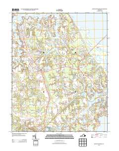
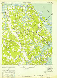 1952 Benns Church1952 Print · USGSCoastal Virginia during the mid-century was a landscape of tide-water marshes and bridge-linked communities. Genealogists can trace family names at The Old Brick Church, locate the Moonville Sch, and explore small settlements like Muddy Cross and Rescue.
 - 1953 Map of Norfolk, 1954 Print
 1953 Norfolk1954 Print · USGSCoastal Virginia and northeastern North Carolina appear here during the post-war industrial boom, showing the critical rail-and-sea connections of Hampton Roads. Genealogists can trace family roots through rural landmarks like Gethsemane Ch, the Caledonia State Prison Farm, and the vast interior of the Dismal Swamp.4 unique versions available
 - 1957 Map of Benns Church, 1960 Print
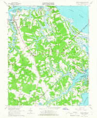
 1957 Benns Church1960 Print · USGSCoastal Isle of Wight County is shown here in the late fifties as a landscape of tidal marshes and rural crossroads. Genealogists and local historians can trace family locations near The Old Brick Ch, Muddy Cross, and the waterfront at Battery Park.
 - 1965 Map of Benns Church, 1966 Print
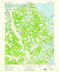
 1965 Benns Church1966 Print · USGSCoastal Isle of Wight County is captured here in the mid-sixties, showing a landscape of tidal creeks and historic riverfront villages. Genealogists and historians can trace local landmarks like St Lukes Ch (Old Brick Ch), the Battery Park Cem, and the rural crossroads at Wills Corner.7 unique versions available
 - 1985 Map of Norfolk, 1986 Print
 1985 Norfolk1986 Print · USGSThe Tidewater region in the mid-eighties shows the dense urban expansion of the coastal cities alongside the preservation of the Great Dismal Swamp. Researchers can trace rural family-named crossroads and historic transit routes like the Seaboard Coast Line or find Somerton and Lake Drummond.3 unique versions available
 - 2010 Map of Benns Church, 2010 Print
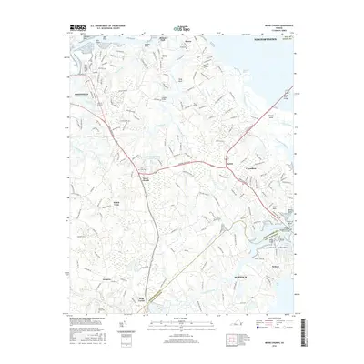
 2010 Benns Church2010 Print · USGSCovers Longview, including Smithfield, Carrollton, and other nearby areas
 - 2013 Map of Benns Church, 2013 Print
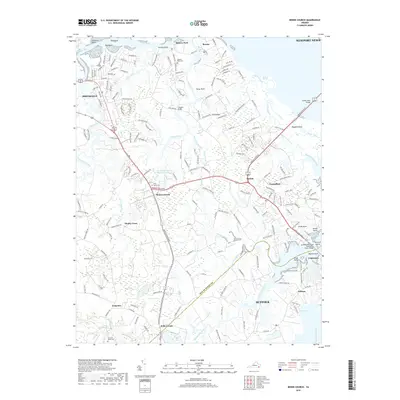
 2013 Benns Church2013 Print · USGSCovers Longview, including Smithfield, Carrollton, and other nearby areas
 - 2016 Map of Benns Church, 2016 Print
 2016 Benns Church2016 Print · USGSCovers Longview, including Smithfield, Carrollton, and other nearby areas
 - 2019 Map of Benns Church, 2019 Print
 2019 Benns Church2019 Print · USGSCovers Longview, including Smithfield, Carrollton, and other nearby areas
 - 2022 Map of Benns Church, 2022 Print
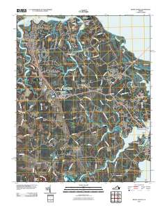
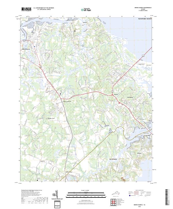 2022 Benns Church2022 Print · USGSCoastal Isle of Wight County comes into focus in this contemporary survey of the James River estuary. Genealogists and historians can locate family landmarks such as Saint Luke's Cem and trace the waterfront character of Battery Park and Crittenden.
End of results
Showing maps 1-13 of 13
Top cities near Longview
- Newport News historical maps
- Suffolk historical maps
- Smithfield historical maps
- Carrollton historical maps
- Bethel Manor historical maps
- Windsor historical maps
See more
Frequently asked questions
- What are the different types of historical maps available for Longview?
- What is the oldest map of Longview?
- Where can I purchase historical maps of Longview for my home or office?
- Where can I download high-res historical maps of Longview?
- Are there historical topographic maps available for Longview?
- Is there historical aerial imagery available for Longview?
- Where are historical maps of Longview sourced from?