Old Maps of Turner, Virginia for Genealogy
Trace your family roots with 11 historic maps of Turner. These high-res maps reveal old neighborhoods, homesites, landmarks, and streets — helping you uncover where your ancestors lived and how the area evolved over time.
- Explore historic neighborhoods: Identify where your relatives may have lived in the 1800s or 1900s.
- Compare maps over time: Trace the changes in streets, buildings, and landmarks for multi-generational research.
- Perfect for genealogy & ancestry research: Used by family historians and researchers to map out lineage and migration.
These maps are an incredible resource for exploring your personal connection to Turner's past.
Turner, VA maps
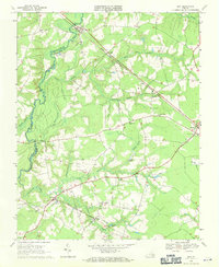
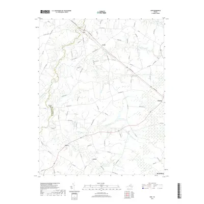
(11)- 1920 Map of Ivor
 1920 Ivor1920 Print · USGSCoastal plain life in Southampton and Isle of Wight counties is captured here just after the Great War, when rail and river travel still shaped the landscape. Genealogists can locate family landmarks like Tucker Swamp Church, Crumplers School, and Millfield Millpond.2 unique versions available
 - 1944 Map of Zuni, 1961 Print
 1944 Zuni1961 Print · USGSThe Virginia Coastal Plain along the Isle of Wight and Southampton border comes alive in this mid-1940s survey. Researchers can trace rural community life through numerous local landmarks, from Tucker Swamp Ch and Gay Sch to the wetlands of Burnt Mills Swamp.
 - 1945 Map of Zuni
 1945 Zuni1945 Print · USGSCoastal Virginia during the mid-1940s reveals a rural landscape defined by the Blackwater River and the competing Norfolk and Western and Virginian rail lines. Researchers can trace local heritage through landmarks like Antioch Ch and Cem and the crossroads at Zuni and Walters.
 - 1953 Map of Norfolk, 1954 Print
 1953 Norfolk1954 Print · USGSCoastal Virginia and northeastern North Carolina appear here during the post-war industrial boom, showing the critical rail-and-sea connections of Hampton Roads. Genealogists can trace family roots through rural landmarks like Gethsemane Ch, the Caledonia State Prison Farm, and the vast interior of the Dismal Swamp.4 unique versions available
 - 1969 Map of Zuni, 1971 Print
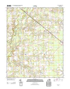
 1969 Zuni1971 Print · USGSCoastal plain Virginia life in the late sixties is centered on the rail-and-river network of the Blackwater River. Genealogists and historians can trace family locations near Collosse, rural churches like Morning Star Ch, and the State Prison Camp No 3.3 unique versions available
 - 1985 Map of Norfolk, 1986 Print
 1985 Norfolk1986 Print · USGSThe Tidewater region in the mid-eighties shows the dense urban expansion of the coastal cities alongside the preservation of the Great Dismal Swamp. Researchers can trace rural family-named crossroads and historic transit routes like the Seaboard Coast Line or find Somerton and Lake Drummond.3 unique versions available
 - 2010 Map of Zuni, 2010 Print
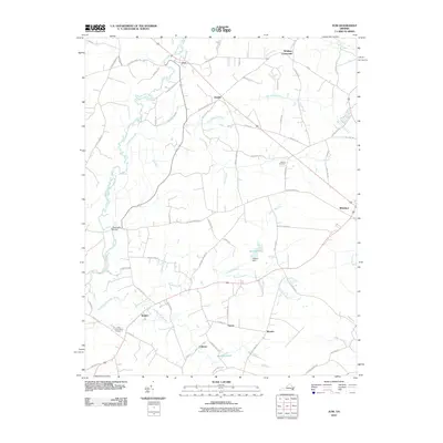 2010 Zuni2010 Print · USGSCovers Turner, including Windsor, Zuni, and other nearby areas
 - 2013 Map of Zuni, 2013 Print
 2013 Zuni2013 Print · USGSCovers Turner, including Windsor, Zuni, and other nearby areas
 - 2016 Map of Zuni, 2016 Print
 2016 Zuni2016 Print · USGSCovers Turner, including Windsor, Zuni, and other nearby areas
 - 2019 Map of Zuni, 2019 Print
 2019 Zuni2019 Print · USGSCovers Turner, including Windsor, Zuni, and other nearby areas
 - 2022 Map of Zuni, 2022 Print
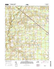
 2022 Zuni2022 Print · USGSCoastal Virginia's riverine landscape is meticulously detailed in this recent survey of the Isle of Wight and Southampton county line. Genealogists and researchers can trace the vicinity of Antioch Christian Church Cem or locate the rural crossroads of Zuni, Walters, and Collosse.
End of results
Showing maps 1-11 of 11
Top cities near Turner
- Franklin historical maps
- Smithfield historical maps
- Windsor historical maps
- Benns Church historical maps
- Wakefield historical maps
- Camptown historical maps
See more
Frequently asked questions
- What are the different types of historical maps available for Turner?
- What is the oldest map of Turner?
- Where can I purchase historical maps of Turner for my home or office?
- Where can I download high-res historical maps of Turner?
- Are there historical topographic maps available for Turner?
- Is there historical aerial imagery available for Turner?
- Where are historical maps of Turner sourced from?