Old Maps of Loudoun County, Virginia
Explore 112 old maps of Loudoun County, spanning from 1884 to today. These high-resolution historic maps reveal how streets, neighborhoods, landmarks, and natural features evolved over time — perfect for genealogy, metal detecting, research, and local history exploration.
What you can do with these maps:
- See how Loudoun County changed over time: Compare historical maps to modern-day views to trace roads, homesites, rail lines & more.
- View detailed metadata: Each map includes creators, publishers, year, scale, and archive source.
- Overlay maps with satellite & LiDAR: Visualize the past alongside modern tools to explore terrain & human change.
- Trusted historical sources: Maps sourced from the USGS, Library of Congress, and other archives.
- Access maps your way: View online, download high-res files, or order prints for personal or research use.
Start exploring old maps of Loudoun County to uncover forgotten places, hidden landmarks, and the deep history beneath your feet.
Loudoun County, VA maps
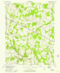
(112)- 1884 Map of Harpers Ferry
 1884 Harpers Ferry1884 Print · USGSCovers Loudoun County, including Leesburg, Martinsburg, and other nearby areas
 - 1890 Map of Mt. Vernon
 1890 Mt. Vernon1890 Print · USGSCovers Loudoun County, including Washington, Arlington, and other nearby areas
 - 1891 Map of Harpers Ferry
 1891 Harpers Ferry1891 Print · USGSCovers Loudoun County, including Leesburg, Martinsburg, and other nearby areas
 - 1891 Map of Mt. Vernon
 1891 Mt. Vernon1891 Print · USGSCovers Loudoun County, including Washington, Arlington, and other nearby areas
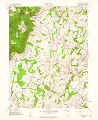
 - 1893 Map of Frederick
 1893 Frederick1893 Print · USGSCovers Loudoun County, including Germantown, Frederick, and other nearby areas
 - 1893 Map of Harpers Ferry, 1898 Print
 1893 Harpers Ferry1898 Print · USGSCovers Loudoun County, including Leesburg, Martinsburg, and other nearby areas7 unique versions available
 - 1894 Map of Warrenton
 1894 Warrenton1894 Print · USGSCovers Loudoun County, including Linton Hall, South Riding, and other nearby areas9 unique versions available
 - 1894 Map of Frederick
 1894 Frederick1894 Print · USGSCovers Loudoun County, including Germantown, Frederick, and other nearby areas5 unique versions available
 - 1894 Map of Mt. Vernon, 1904 Print
 1894 Mt. Vernon1904 Print · USGSCovers Loudoun County, including Washington, Arlington, and other nearby areas6 unique versions available
 - 1897 Map of Mt. Vernon
 1897 Mt. Vernon1897 Print · USGSCovers Loudoun County, including Washington, Arlington, and other nearby areas2 unique versions available
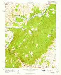
 - 1908 Map of Middletown
 1908 Middletown1908 Print · USGSCovers Loudoun County, including Brunswick, Middletown, and other nearby areas
 - 1908 Map of Seneca
 1908 Seneca1908 Print · USGSCovers Loudoun County, including Germantown, Gaithersburg, and other nearby areas7 unique versions available
 - 1908 Map of Ijamsville, 1921 Print
 1908 Ijamsville1921 Print · USGSCovers Loudoun County, including Frederick, Ballenger Creek, and other nearby areas
 - 1909 Map of Ijamsville
 1909 Ijamsville1909 Print · USGSCovers Loudoun County, including Frederick, Ballenger Creek, and other nearby areas9 unique versions available
 - 1910 Map of Antietam
 1910 Antietam1910 Print · USGSCovers Loudoun County, including Brunswick, Middletown, and other nearby areas6 unique versions available
 - 1914 Map of Martinsburg
 1914 Martinsburg1914 Print · USGSCovers Loudoun County, including Martinsburg, Charles Town, and other nearby areas3 unique versions available
 - 1915 Map of Fairfax
 1915 Fairfax1915 Print · USGSCovers Loudoun County, including Centreville, Reston, and other nearby areas4 unique versions available
 - 1916 Map of Martinsburg
 1916 Martinsburg1916 Print · USGSCovers Loudoun County, including Martinsburg, Charles Town, and other nearby areas4 unique versions available
 - 1916 Map of Berryville, 1920 Print
 1916 Berryville1920 Print · USGSCovers Loudoun County, including Berryville, Shannondale, and other nearby areas2 unique versions available
 - 1933 Map of Middleburg
 1933 Middleburg1933 Print · USGSCovers Loudoun County, including Linton Hall, South Riding, and other nearby areas
 - 1939 Map of Berryville
 1939 Berryville1939 Print · USGSCovers Loudoun County, including Berryville, Shannondale, and other nearby areas
 - 1942 Map of Frederick
 1942 Frederick1942 Print · USGSCovers Loudoun County, including Frederick, Ballenger Creek, and other nearby areas
 - 1943 Map of Arcola, 1957 Print
 1943 Arcola1957 Print · USGSCovers Loudoun County, including South Riding, Brambleton, and other nearby areas3 unique versions available
 - 1943 Map of Bluemont, 1960 Print
 1943 Bluemont1960 Print · USGSCovers Loudoun County, including Round Hill, Bluemont, and other nearby areas
 - 1943 Map of Ashby Gap, 1961 Print
 1943 Ashby Gap1961 Print · USGSCovers Loudoun County, including Berrys, Chilly Hollow Estates, and other nearby areas
Showing maps 1-25 of 112
Top cities of Loudoun County
- Leesburg historical maps
- Ashburn historical maps
- South Riding historical maps
- Sterling historical maps
- Brambleton historical maps
- Stone Ridge historical maps
See more
Frequently asked questions
- What are the different types of historical maps available for Loudoun County?
- What is the oldest map of Loudoun County?
- Where can I purchase historical maps of Loudoun County for my home or office?
- Where can I download high-res historical maps of Loudoun County?
- Are there historical topographic maps available for Loudoun County?
- Is there historical aerial imagery available for Loudoun County?
- Where are historical maps of Loudoun County sourced from?