Old Maps of Louisa County, Virginia for Metal Detecting
Plan your next treasure hunt with 177 historic maps of Louisa County. Find old homesites, ghost towns, trails, and gathering spots that may be lost to time — perfect for identifying promising metal detecting locations.
- Locate forgotten sites: Uncover places like long-lost settlements, abandoned rail lines, or gathering spots.
- Plan better hunts: Use map overlays combined with LiDAR or satellite views to narrow in on historically rich areas.
- Made for detectorists: Thousands of hobbyists use these maps to discover relics, coins, and hidden history.
Use these historic maps to boost your research and find new opportunities beneath the surface of Louisa County.
Louisa County, VA maps
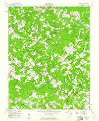
(177)- 1887 Map of Spottsylvania
 1887 Spottsylvania1887 Print · USGSCentral Virginia in the late 1880s remains a landscape of river fords and crossroads shops before modern development. Genealogists and historians can trace the locations of the Vaucluse Gold Mine, Wilderness Tavern, and the path of the Narrow Gauge Railroad.
 - 1890 Map of Goochland
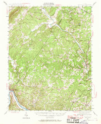
 1890 Goochland1890 Print · USGSGoochland and the surrounding Virginia Piedmont are captured here in the late nineteenth century as the river-and-rail economy thrived. Researchers can trace the paths of the Chesapeake and Ohio Railroad and find landmarks like Hopeful Church or the Coal Pits.
 - 1891 Map of Palmyra
 1891 Palmyra1891 Print · USGSCentral Virginia during the late nineteenth century was a landscape of river-driven industry and railroad expansion along the James. Genealogists and historians can locate old processing sites like Arvonia Slate Quarry, remote outposts like Boyds Tavern, and the track of the Richmond and Alleghany Railroad.
 - 1892 Map of Spottsylvania
 1892 Spottsylvania1892 Print · USGSCentral Virginia’s post-war landscape is captured here in the late nineteenth century, showing a rural economy defined by gold mining and river crossings. Genealogists can trace family footprints at Todds Tavern, the Vaucluse Gold Mine, and along the Narrow Gauge Railroad.6 unique versions available
 - 1892 Map of Goochland
 1892 Goochland1892 Print · USGSThe rural heart of central Virginia is captured here in the decade before the turn of the century, showing a landscape shaped by major rivers and early rail lines. Genealogists can trace family names and early settlements like Negro Foot, Mabelton, and the historic Hanover Academy.8 unique versions available
 - 1892 Map of Gordonsville, 1899 Print
 1892 Gordonsville1899 Print · USGSCentral Virginia’s railway hubs and mountain gaps come alive in this late nineteenth-century survey. Genealogists and historians can trace the foundations of Charlottesville and the bustling rail junctions at Gordonsville and Orange.6 unique versions available
 - 1895 Map of Palmyra
 1895 Palmyra1895 Print · USGSThe James and Rivanna River valleys of central Virginia are captured here in the 1890s, revealing a landscape of rail-connected river towns and rural mills. Researchers can trace the Richmond and Alleghany Railroad and locate landmarks like the Arvon Slate Quarry or Flanagan Mill.
 - 1897 Map of Palmyra
 1897 Palmyra1897 Print · USGSCentral Virginia during the late 1880s is defined by its deep river valleys and the industrial reach of the James and Rivanna. Genealogists and historians can trace the growth of river towns like Scottsville or explore industrial roots at the Slate Quarry and Union Mills.7 unique versions available
 - 1935 Map of Charlottesville
 1935 Charlottesville1935 Print · USGSAlbemarle County's landscape is meticulously detailed in the mid-1930s, centered on the historic crossroads and river forks surrounding the city. Genealogists and local historians can trace family-named landmarks and essential community sites like Monticello, the Rosenwald Sch, and the rail junction at Barboursville.2 unique versions available
 - 1939 Map of Charlottesville
 1939 Charlottesville1939 Print · USGSAlbemarle and Orange Counties come alive in the late 1930s, showing a Piedmont landscape defined by the Southwest Mountains and historic river valleys. Genealogists can locate family landmarks from Monticello to the Rosenwald Sch, alongside dozens of rural churches like Bethany Ch.3 unique versions available
 - 1942 Map of Mineral
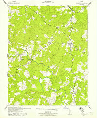
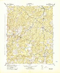
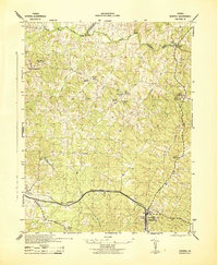 1942 Mineral1942 Print · USGSLouisa County during the early years of the war shows a landscape of rural crossroads and established rail hubs. Trace local history through family landmarks like Bibbs Store, Holladay Mill, and the many churches like Miners Chapel along the Chesapeake and Ohio line.2 unique versions available
 - 1942 Map of Lahore
 1942 Lahore1942 Print · USGSOrange County and the surrounding borderlands were a network of rural hamlets and airway navigation markers during the early 1940s. Genealogists can locate family landmarks like Terrells Store, North Pamunkey Church, and the Isabella Lightfoot Training School.2 unique versions available
 - 1942 Map of Partlow
 1942 Partlow1942 Print · USGSSpotsylvania County during the early years of the war remained a landscape of rural general stores and winding river crossings. Genealogists and local historians can trace family locations near Duerson Store, Wallers Church, and Partlow.2 unique versions available
 - 1942 Map of Contrary Creek
 1942 Contrary Creek1942 Print · USGSSpotsylvania and Louisa counties appear here in the early 1940s as a landscape of rural crossroads and river bottomlands. Researchers can trace historic family locations near Poindexters Store, Good Hope Church, and the winding North Anna River.2 unique versions available
 - 1942 Map of Pendleton, 1958 Print
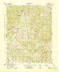
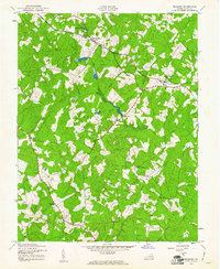
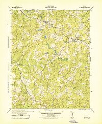
 1942 Pendleton1958 Print · USGSLouisa County in the early 1940s was a landscape of small crossroads and river crossings. Genealogists and historians can trace the foundations of Yanceyville, locate the Chesapeake and Ohio tracks at Pendleton, and find rural landmarks like Goodwins Store.
 - 1942 Map of Buckner, 1961 Print
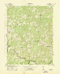
 1942 Buckner1961 Print · USGSLouisa County at the start of the forties shows a landscape of rail-dependent hamlets and timbered river bottoms. Researchers can trace the Chesapeake and Ohio line through Fredericks Hall or locate rural landmarks like Rising Sun Ch and Wickham Corner.
 - 1942 Map of Beaverdam, 1961 Print
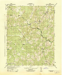
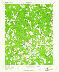 1942 Beaverdam1961 Print · USGSHanover and Louisa counties were largely defined by the rail and river network of the early 1940s. Researchers can trace the layout of small crossroads communities and family-named landmarks such as Greenes Corner, Lazarus Chapel, and the Beaverdam Sch.
 - 1943 Map of Mabelton
 1943 Mabelton1943 Print · USGSHanover County during the early 1940s is shown here as a landscape of rural crossroads and river-bottom milling. Researchers can trace family sites near Helltown Store, locate St Peters Church, or find the old Taylors Creek Mill.2 unique versions available
 - 1943 Map of Perkinsville
 1943 Perkinsville1943 Print · USGSGoochland County at the height of the Second World War remains a landscape of rural stores and riverside rail transport. Genealogists and historians can trace the foundations of State Farm, find old community hubs like Gammons Store, or locate country parishes such as Hebron Church.2 unique versions available
 - 1943 Map of Pendleton
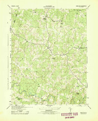
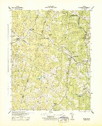
 1943 Pendleton1943 Print · USGSLouisa County’s rural landscape is captured here during the Second World War, showing the agricultural heart of the Virginia Piedmont. Researchers can trace historic church sites like Gilboa Church and Yanceyville Church or locate landmarks like Goodwins Store and Smiths Mill.
 - 1943 Map of Buckner
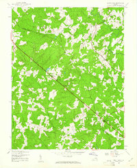
 1943 Buckner1943 Print · USGSMid-century Louisa County was a landscape of rail-side hamlets and family-named crossroads connected by the Chesapeake and Ohio. Genealogists and local historians can trace legacy landmarks like Fredericks Hall, Gardners Cross Roads, and the Lumber Mill at Buckner.
 - 1943 Map of Beaverdam
 1943 Beaverdam1943 Print · USGSMid-century Hanover and Louisa counties revolve around the railroad and timber trades during the early years of the war. Genealogists and historians can trace the local hubs of Beaverdam and Bumpass, alongside rural anchors like Lazarus Chapel and Harris Store.
 - 1943 Map of South Anna, 1961 Print
 1943 South Anna1961 Print · USGSCentral Virginia's rural landscape is captured here during the early 1940s as small farming communities thrived across the Piedmont. Genealogists can locate family landmarks like Jackson Memorial Sch, New Line Ch, and the hamlet of Gum Spring.
 - 1943 Map of Dabneys, 1961 Print
 1943 Dabneys1961 Print · USGSInland Louisa County and the surrounding tri-county area are captured here during the 1940s as rural agriculture defined the landscape. Genealogists and local historians can trace scattered communities and numerous small congregations including Fork Ch, Shelfar, and Dabneys.
 - 1943 Map of Scottsville, 1969 Print
 1943 Scottsville1969 Print · USGSCentral Virginia’s river valleys and historic estates are preserved in this mid-century portrait of the Albemarle and Fluvanna borderlands. Researchers can trace ancestral locations at Ash Lawn, follow the Chesapeake and Ohio line through Nicholas Siding, or locate rural landmarks like Jefferson Mill.
Showing maps 1-25 of 177
Top cities of Louisa County
Frequently asked questions
- What are the different types of historical maps available for Louisa County?
- What is the oldest map of Louisa County?
- Where can I purchase historical maps of Louisa County for my home or office?
- Where can I download high-res historical maps of Louisa County?
- Are there historical topographic maps available for Louisa County?
- Is there historical aerial imagery available for Louisa County?
- Where are historical maps of Louisa County sourced from?