Old Maps of Plum Tree, Virginia for Metal Detecting
Plan your next treasure hunt with 15 historic maps of Plum Tree. Find old homesites, ghost towns, trails, and gathering spots that may be lost to time — perfect for identifying promising metal detecting locations.
- Locate forgotten sites: Uncover places like long-lost settlements, abandoned rail lines, or gathering spots.
- Plan better hunts: Use map overlays combined with LiDAR or satellite views to narrow in on historically rich areas.
- Made for detectorists: Thousands of hobbyists use these maps to discover relics, coins, and hidden history.
Use these historic maps to boost your research and find new opportunities beneath the surface of Plum Tree.
Plum Tree, VA maps
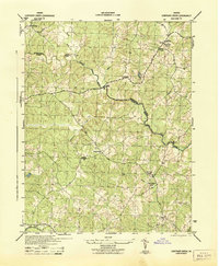
(15)- 1887 Map of Spottsylvania
 1887 Spottsylvania1887 Print · USGSCentral Virginia in the late 1880s remains a landscape of river fords and crossroads shops before modern development. Genealogists and historians can trace the locations of the Vaucluse Gold Mine, Wilderness Tavern, and the path of the Narrow Gauge Railroad.
 - 1892 Map of Spottsylvania
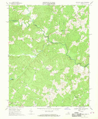
 1892 Spottsylvania1892 Print · USGSCentral Virginia’s post-war landscape is captured here in the late nineteenth century, showing a rural economy defined by gold mining and river crossings. Genealogists can trace family footprints at Todds Tavern, the Vaucluse Gold Mine, and along the Narrow Gauge Railroad.6 unique versions available
 - 1942 Map of Contrary Creek
 1942 Contrary Creek1942 Print · USGSSpotsylvania and Louisa counties appear here in the early 1940s as a landscape of rural crossroads and river bottomlands. Researchers can trace historic family locations near Poindexters Store, Good Hope Church, and the winding North Anna River.2 unique versions available
 - 1948 Map of Washington
 1948 Washington1948 Print · USGSThe Potomac and Chesapeake regions in the late 1940s reveal a landscape of expanding military reach and deep-rooted Tidewater settlements. Trace old rail corridors like the Richmond Fredericksburg & Potomac RR or locate landmarks like the Wakefield Washington Monument and St. Marys College.2 unique versions available
 - 1957 Map of Washington, 1966 Print
 1957 Washington1966 Print · USGSThe mid-Atlantic region during the mid-fifties and early sixties reveals a landscape of growing suburbs and vital military outposts. Researchers can trace historic river towns and shorelines from Alexandria to the Hooper Islands and St Clements Island.5 unique versions available
 - 1961 Map of Washington
 1961 Washington1961 Print · USGSThe mid-Atlantic region in the late fifties is presented in remarkable detail, from the Blue Ridge foothills to the Chesapeake Eastern Shore. Researchers can trace historic river landings and military sites like Mount Vernon, Fort Belvoir, and Point Lookout.2 unique versions available
 - 1968 Map of Contrary Creek, 1970 Print
 1968 Contrary Creek1970 Print · USGSThe North Anna River valley at the border of Louisa and Spotsylvania Counties appears here in the late sixties as a landscape of rural crossroads and millponds. Genealogists can locate family landmarks like Bethel Ch, Whitlock Millpond, and several unnamed cemeteries near Glenora.
 - 1973 Map of Lake Anna West, 1975 Print
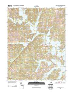
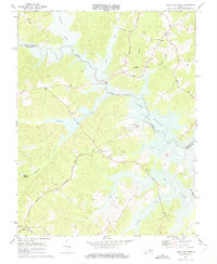 1973 Lake Anna West1975 Print · USGSAs the North Anna River was impounded in the early seventies, this landscape transformed into a major reservoir. Genealogists can locate rural congregations like Laurel Hill Ch and trace the original paths of Pigeon Run and Elk Creek before the flooding of Lake Anna.3 unique versions available
 - 1983 Map of Fredericksburg, 1984 Print
 1983 Fredericksburg1984 Print · USGSThe Virginia and Maryland tidewater region comes into sharp focus during the early 1980s, centered on the historic Rappahannock and Potomac river valleys. Researchers can trace the boundaries of the Fredericksburg-Spotsylvania National Military Park alongside growing residential areas and military sites like Fort A.P. Hill Military Reservation.2 unique versions available
 - 1989 Map of Washington
 1989 Washington1989 Print · USGSThe Potomac River valley and Chesapeake Bay are shown in comprehensive detail during the late 1980s. Genealogists and historians can trace the transition from urban Alexandria to the rural Northern Neck, locating landmarks like Mount Vernon and Stratford Hall.
 - 2010 Map of Lake Anna West, 2010 Print
 2010 Lake Anna West2010 Print · USGSCovers Plum Tree, including Glenora, Centreville, and other nearby areas
 - 2013 Map of Lake Anna West, 2013 Print
 2013 Lake Anna West2013 Print · USGSCovers Plum Tree, including Glenora, Centreville, and other nearby areas
 - 2016 Map of Lake Anna West, 2016 Print
 2016 Lake Anna West2016 Print · USGSCovers Plum Tree, including Glenora, Centreville, and other nearby areas
 - 2019 Map of Lake Anna West, 2019 Print
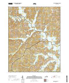 2019 Lake Anna West2019 Print · USGSCovers Plum Tree, including Glenora, Centreville, and other nearby areas
 - 2022 Map of Lake Anna West, 2022 Print
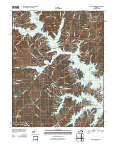
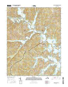
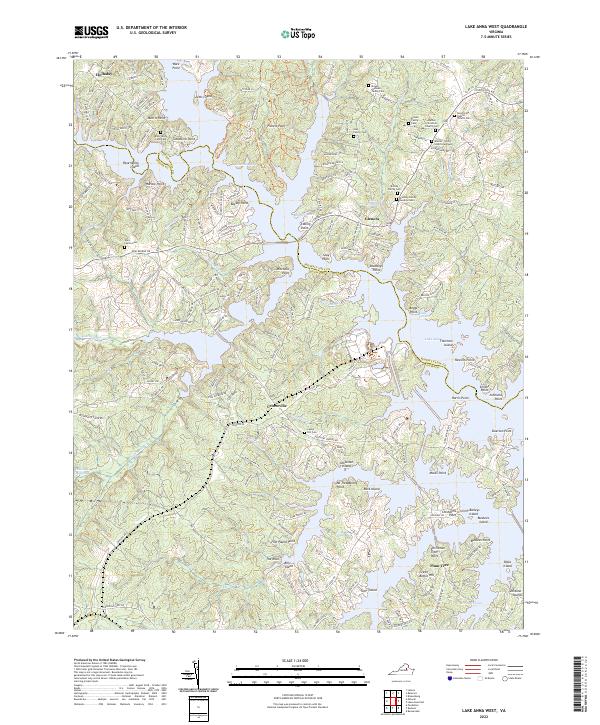 2022 Lake Anna West2022 Print · USGSThe Lake Anna shoreline in the early twenty-first century reveals a landscape of modern waterfront communities layered over deep-rooted family lands. Researchers can locate numerous private graveyards like the Brooks - Simms - Lloyd Graveyard or trace the geography of Whitlock Millpond.
End of results
Showing maps 1-15 of 15
Top cities near Plum Tree
- Spotsylvania Courthouse historical maps
- Lake Land'Or historical maps
- Lake Caroline historical maps
- Louisa historical maps
- Mineral historical maps
Frequently asked questions
- What are the different types of historical maps available for Plum Tree?
- What is the oldest map of Plum Tree?
- Where can I purchase historical maps of Plum Tree for my home or office?
- Where can I download high-res historical maps of Plum Tree?
- Are there historical topographic maps available for Plum Tree?
- Is there historical aerial imagery available for Plum Tree?
- Where are historical maps of Plum Tree sourced from?