1990s Maps of Manassas, Virginia
Explore 5 historic maps of Manassas from the 1990s. These maps offer a rare glimpse into what life looked like during the 1990s — showing old roads, neighborhoods, homes, and landmarks that have changed or disappeared over time.
Whether you're researching your family's past, planning a metal detecting trip, or studying how Manassas's landscape evolved across the 1990s, these high-resolution maps are a powerful tool for exploring the history of this region.
- Focus on a specific era: All maps on this page are from the 1990s, giving you a focused view of this time period.
- See what’s changed: Compare century-old streets, trails, and buildings to today's modern landscape using overlays and satellite layers.
- Research with precision: Use these maps for genealogy, historical research, land use analysis, or educational projects.
- View, download, or print: Maps are fully viewable online in high resolution, and can be downloaded or printed for your own records.
Start exploring Manassas's history through authentic maps from the 1990s. This is your window into the past.
Manassas, VA maps
(5)- 1990 Map of Manassas, 1996 Print
 1990 Manassas1996 Print · USGSNorthern Virginia was undergoing rapid suburbanization in the 1990s, as traditional rural landscapes gave way to modern residential developments. Genealogists and historians can trace the growth of London Towne, Yorkshire, and Clifton alongside the preserved Manassas National Battlefield Park.
 - 1994 Map of Nokesville, 1997 Print
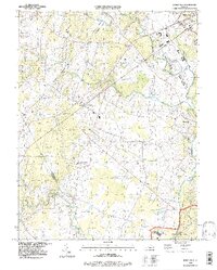 1994 Nokesville1997 Print · USGSPrince William County and the outskirts of Manassas are documented here in the mid-1990s as suburban growth began to meet rural Virginia history. Genealogists and local historians can trace family burial sites like Valley View Cem and old crossings such as Carriage Ford.
 - 1994 Map of Gainesville, 1998 Print
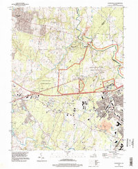 1994 Gainesville1998 Print · USGSNorthern Virginia in the late nineties shows a landscape where suburban growth meets the commemorative grounds of Manassas National Battlefield Park. Researchers can trace the legacy of the region through landmarks like the Groveton Confederate Cem and the Norfolk Southern rail line.
 - 1994 Map of Independent Hill, 1998 Print
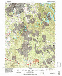 1994 Independent Hill1998 Print · USGSPrince William County in the mid-nineties shows a mix of rapid suburban growth and deep-rooted rural crossroads. Genealogists can trace family burial sites like Hixson Cem while historians locate the southern reaches of Manassas and the winding banks of Lake Jackson.
 - 1994 Map of Manassas, 1998 Print
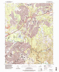 1994 Manassas1998 Print · USGSFairfax and Prince William counties are shown during a period of rapid suburban growth in the nineties. Researchers can trace the sprawling residential tracts of London Towne alongside landmarks like Clifton and Manassas National Battlefield Park.
End of results
Showing maps 1-5 of 5
Top cities of Manassas
Frequently asked questions
- What are the different types of historical maps available for Manassas?
- What is the oldest map of Manassas?
- Where can I purchase historical maps of Manassas for my home or office?
- Where can I download high-res historical maps of Manassas?
- Are there historical topographic maps available for Manassas?
- Is there historical aerial imagery available for Manassas?
- Where are historical maps of Manassas sourced from?