Old Maps of Manassas, Virginia for Academic Research
Study the evolution of Manassas with 45 high-resolution historic maps. Whether you're teaching, researching, or modeling changes in land use, these maps provide essential visual documentation of urban, environmental, and geographic change.
- Analyze long-term change: Track patterns in development, transportation, and natural features.
- Ideal for environmental or urban studies: Support academic projects with primary historical map data.
- Use in the classroom or lab: Educators and researchers rely on these maps to bring historical context to life.
These maps are a powerful tool for teaching, research, and visualizing how Manassas has changed over the decades.
Manassas, VA maps
(45)- 1890 Map of Mt. Vernon
 1890 Mt. Vernon1890 Print · USGSCovers Manassas, including Washington, Arlington, and other nearby areas
 - 1891 Map of Mt. Vernon
 1891 Mt. Vernon1891 Print · USGSCovers Manassas, including Washington, Arlington, and other nearby areas
 - 1894 Map of Warrenton
 1894 Warrenton1894 Print · USGSCovers Manassas, including Linton Hall, South Riding, and other nearby areas9 unique versions available
 - 1894 Map of Mt. Vernon, 1904 Print
 1894 Mt. Vernon1904 Print · USGSCovers Manassas, including Washington, Arlington, and other nearby areas6 unique versions available
 - 1897 Map of Mt. Vernon
 1897 Mt. Vernon1897 Print · USGSCovers Manassas, including Washington, Arlington, and other nearby areas2 unique versions available
 - 1915 Map of Fairfax
 1915 Fairfax1915 Print · USGSCovers Manassas, including Centreville, Reston, and other nearby areas4 unique versions available
 - 1927 Map of Quantico
 1927 Quantico1927 Print · USGSCovers Manassas, including Dale City, Lake Ridge, and other nearby areas
 - 1933 Map of Middleburg
 1933 Middleburg1933 Print · USGSCovers Manassas, including Linton Hall, South Riding, and other nearby areas
 - 1940 Map of Quantico
 1940 Quantico1940 Print · USGSCovers Manassas, including Dale City, Lake Ridge, and other nearby areas2 unique versions available
 - 1943 Map of Quantico
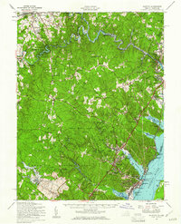
 1943 Quantico1943 Print · USGSCovers Manassas, including Dale City, Lake Ridge, and other nearby areas
 - 1943 Map of Catlett, 1955 Print
 1943 Catlett1955 Print · USGSCovers Manassas, including Bealeton, Nokesville, and other nearby areas2 unique versions available
 - 1944 Map of Fairfax
 1944 Fairfax1944 Print · USGSCovers Manassas, including Centreville, Reston, and other nearby areas
 - 1948 Map of Washington
 1948 Washington1948 Print · USGSCovers Manassas, including Washington, Arlington, and other nearby areas2 unique versions available
 - 1951 Map of Manassas, 1952 Print
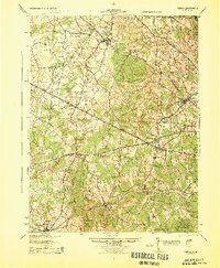
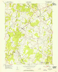
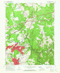
 1951 Manassas1952 Print · USGSCovers Manassas, including Centreville, Sudley, and other nearby areas
 - 1951 Map of Independent Hill, 1953 Print
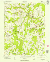
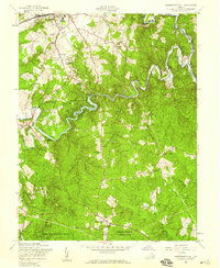
 1951 Independent Hill1953 Print · USGSCovers Manassas, including Buckhall, Independent Hill, and other nearby areas
 - 1953 Map of Gainesville, 1954 Print
 1953 Gainesville1954 Print · USGSCovers Manassas, including Linton Hall, Gainesville, and other nearby areas2 unique versions available
 - 1953 Map of Nokesville, 1954 Print
 1953 Nokesville1954 Print · USGSCovers Manassas, including Nokesville, Daniels Mill, and other nearby areas
 - 1956 Map of Independent Hill, 1959 Print
 1956 Independent Hill1959 Print · USGSCovers Manassas, including Buckhall, Independent Hill, and other nearby areas
 - 1957 Map of Manassas, 1958 Print
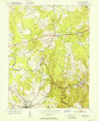
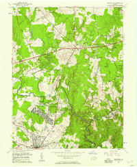 1957 Manassas1958 Print · USGSCovers Manassas, including Centreville, Sudley, and other nearby areas2 unique versions available
 - 1957 Map of Quantico, 1961 Print
 1957 Quantico1961 Print · USGSCovers Manassas, including Dale City, Lake Ridge, and other nearby areas2 unique versions available
 - 1957 Map of Washington, 1966 Print
 1957 Washington1966 Print · USGSCovers Manassas, including Washington, Arlington, and other nearby areas5 unique versions available
 - 1961 Map of Washington
 1961 Washington1961 Print · USGSCovers Manassas, including Washington, Arlington, and other nearby areas2 unique versions available
 - 1966 Map of Manassas, 1967 Print
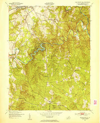
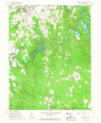
 1966 Manassas1967 Print · USGSCovers Manassas, including Centreville, Sudley, and other nearby areas4 unique versions available
 - 1966 Map of Independent Hill, 1968 Print
 1966 Independent Hill1968 Print · USGSCovers Manassas, including Buckhall, Independent Hill, and other nearby areas5 unique versions available
 - 1966 Map of Nokesville, 1969 Print
 1966 Nokesville1969 Print · USGSCovers Manassas, including Nokesville, Daniels Mill, and other nearby areas5 unique versions available
Showing maps 1-25 of 45
Top cities of Manassas
Frequently asked questions
- What are the different types of historical maps available for Manassas?
- What is the oldest map of Manassas?
- Where can I purchase historical maps of Manassas for my home or office?
- Where can I download high-res historical maps of Manassas?
- Are there historical topographic maps available for Manassas?
- Is there historical aerial imagery available for Manassas?
- Where are historical maps of Manassas sourced from?