1960s Maps of Blacksburg, Virginia
Explore 3 historic maps of Blacksburg from the 1960s. These maps offer a rare glimpse into what life looked like during the 1960s — showing old roads, neighborhoods, homes, and landmarks that have changed or disappeared over time.
Whether you're researching your family's past, planning a metal detecting trip, or studying how Blacksburg's landscape evolved across the 1960s, these high-resolution maps are a powerful tool for exploring the history of this region.
- Focus on a specific era: All maps on this page are from the 1960s, giving you a focused view of this time period.
- See what’s changed: Compare century-old streets, trails, and buildings to today's modern landscape using overlays and satellite layers.
- Research with precision: Use these maps for genealogy, historical research, land use analysis, or educational projects.
- View, download, or print: Maps are fully viewable online in high resolution, and can be downloaded or printed for your own records.
Start exploring Blacksburg's history through authentic maps from the 1960s. This is your window into the past.
Blacksburg, VA maps
(3)- 1961 Map of Bluefield
 1961 Bluefield1961 Print · USGSThe coalfields and mountain ridges of southern West Virginia and southwest Virginia are captured in the early sixties. Genealogists can trace family ties through rail-linked towns like Princeton and Richlands or along the shores of Bluestone Reservoir.
 - 1965 Map of Blacksburg, 1966 Print
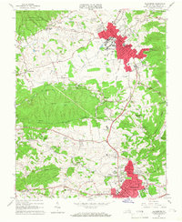 1965 Blacksburg1966 Print · USGSBlacksburg and Christiansburg are captured here in the mid-sixties during a period of significant collegiate and civic expansion. Researchers can trace the early footprint of the Virginia Polytechnic Institute campus or locate historic sites like Kanodes Mill, Yellow Sulphur Springs, and Belmont Ch.5 unique versions available
 - 1965 Map of Newport, 1966 Print
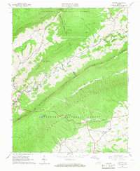 1965 Newport1966 Print · USGSThe Montgomery and Craig County lines meet among the high ridges and hollows of southwest Virginia in the mid-sixties. Researchers can locate family landmarks like Clover Hollow Cem, the Covered Bridge at Newport, and trace the Appalachian Trail along the mountain crests.3 unique versions available
End of results
Showing maps 1-3 of 3
Top cities near Blacksburg
- Christiansburg historical maps
- Radford historical maps
- Merrimac historical maps
- Fairlawn historical maps
- Plum Creek historical maps
- Prices Fork historical maps
See more
Top neighborhoods of Blacksburg
- The Mill at Blacksburg historical maps
- Pheasant Run Crossing historical maps
- Tremont Estates historical maps
- Collegiate Suites historical maps
- University Terrace historical maps
- Sundance Village historical maps
See more
Frequently asked questions
- What are the different types of historical maps available for Blacksburg?
- What is the oldest map of Blacksburg?
- Where can I purchase historical maps of Blacksburg for my home or office?
- Where can I download high-res historical maps of Blacksburg?
- Are there historical topographic maps available for Blacksburg?
- Is there historical aerial imagery available for Blacksburg?
- Where are historical maps of Blacksburg sourced from?