1940s Maps of Blacksburg, Virginia
Explore 1 historic maps of Blacksburg from the 1940s. These maps offer a rare glimpse into what life looked like during the 1940s — showing old roads, neighborhoods, homes, and landmarks that have changed or disappeared over time.
Whether you're researching your family's past, planning a metal detecting trip, or studying how Blacksburg's landscape evolved across the 1940s, these high-resolution maps are a powerful tool for exploring the history of this region.
- Focus on a specific era: All maps on this page are from the 1940s, giving you a focused view of this time period.
- See what’s changed: Compare century-old streets, trails, and buildings to today's modern landscape using overlays and satellite layers.
- Research with precision: Use these maps for genealogy, historical research, land use analysis, or educational projects.
- View, download, or print: Maps are fully viewable online in high resolution, and can be downloaded or printed for your own records.
Start exploring Blacksburg's history through authentic maps from the 1940s. This is your window into the past.
Blacksburg, VA maps
(1)- 1944 Map of Waiteville
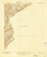 1944 Waiteville1944 Print · USGSThe borderlands of Giles and Craig counties are captured here in the early twentieth century, showing a transition from rail-dependent industry to rural isolation. Genealogists and historians can trace family locations near Mt Olivet Ch, the settlement at Waiteville, and the now-silent tracks of the Norfolk and Western Ry.
End of results
Showing maps 1-1 of 1
Top cities near Blacksburg
- Christiansburg historical maps
- Radford historical maps
- Merrimac historical maps
- Fairlawn historical maps
- Plum Creek historical maps
- Prices Fork historical maps
See more
Top neighborhoods of Blacksburg
- The Mill at Blacksburg historical maps
- Pheasant Run Crossing historical maps
- Tremont Estates historical maps
- Collegiate Suites historical maps
- University Terrace historical maps
- Sundance Village historical maps
See more
Frequently asked questions
- What are the different types of historical maps available for Blacksburg?
- What is the oldest map of Blacksburg?
- Where can I purchase historical maps of Blacksburg for my home or office?
- Where can I download high-res historical maps of Blacksburg?
- Are there historical topographic maps available for Blacksburg?
- Is there historical aerial imagery available for Blacksburg?
- Where are historical maps of Blacksburg sourced from?