Old Maps of Den Hill, Virginia for Academic Research
Study the evolution of Den Hill with 13 high-resolution historic maps. Whether you're teaching, researching, or modeling changes in land use, these maps provide essential visual documentation of urban, environmental, and geographic change.
- Analyze long-term change: Track patterns in development, transportation, and natural features.
- Ideal for environmental or urban studies: Support academic projects with primary historical map data.
- Use in the classroom or lab: Educators and researchers rely on these maps to bring historical context to life.
These maps are a powerful tool for teaching, research, and visualizing how Den Hill has changed over the decades.
Den Hill, VA maps
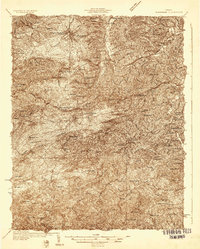
(13)- 1890 Map of Christiansburg
 1890 Christiansburg1890 Print · USGSSouthwestern Virginia in the late nineteenth century centers on the emerging rail and resort economy. Trace the Norfolk and Western Railroad through Christiansburg and find historic resorts like Alleghany Springs.10 unique versions available
 - 1932 Map of Blacksburg
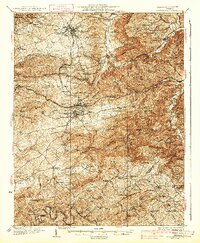
 1932 Blacksburg1932 Print · USGSMontgomery and Floyd Counties are documented here in the early thirties as the regional rail and coal economy thrived. Genealogists can trace family homesteads near landmarks like the Virginia Polytechnic Institute, Merrimac Mines, and Christiansburg Industrial Sch.2 unique versions available
 - 1937 Map of Blacksburg
 1937 Blacksburg1937 Print · USGSMontgomery County was a hub of higher education, coal mining, and rail transport in the 1930s. Researchers can trace the early grounds of the Virginia Polytechnic Institute and locate numerous rural landmarks like Merrimac Mines, Kanodee Mill, and Yellow Sulphur Springs.3 unique versions available
 - 1955 Map of Bluefield
 1955 Bluefield1955 Print · USGSThe Central Appalachian borderlands come alive in the mid-fifties, showing the coal and rail networks connecting Bluefield to Beckley. Researchers can trace the industrial landscape of the New River Ordnance Plant and the terrain of Burkes Garden.
 - 1957 Map of Bluefield, 1967 Print
 1957 Bluefield1967 Print · USGSThe heart of Central Appalachia in the mid-fifties is defined by the winding rail lines and river valleys of the coalfields. Researchers can trace the industrial footprints of towns like Welch and Princeton or locate landmarks such as the Bluestone Reservoir and Claytor Lake.2 unique versions available
 - 1961 Map of Bluefield
 1961 Bluefield1961 Print · USGSThe coalfields and mountain ridges of southern West Virginia and southwest Virginia are captured in the early sixties. Genealogists can trace family ties through rail-linked towns like Princeton and Richlands or along the shores of Bluestone Reservoir.
 - 1965 Map of Ironto, 1968 Print
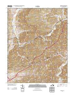
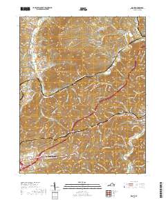
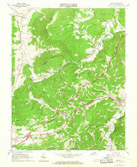 1965 Ironto1968 Print · USGSIn the mid-1960s, the railroad and river valleys of Montgomery County show a landscape of growing infrastructure and deep-rooted rural identity. Researchers can trace family sites and community centers from Alleghany Springs and Shawsville to rural landmarks like Den Hill Church and Lusters Gate.5 unique versions available
 - 1982 Map of Radford, 1983 Print
 1982 Radford1983 Print · USGSThe New River Valley and surrounding highlands are shown during a period of significant regional growth in the early eighties. Genealogists and historians can trace the development of VPI, locate historic sites like Yellow Sulphur Springs, and follow the Norfolk and Western rail lines through the gaps.2 unique versions available
 - 2010 Map of Ironto, 2010 Print
 2010 Ironto2010 Print · USGSCovers Den Hill, including Christiansburg, Ellett, and other nearby areas
 - 2013 Map of Ironto, 2013 Print
 2013 Ironto2013 Print · USGSCovers Den Hill, including Christiansburg, Ellett, and other nearby areas
 - 2016 Map of Ironto, 2016 Print
 2016 Ironto2016 Print · USGSCovers Den Hill, including Christiansburg, Ellett, and other nearby areas
 - 2019 Map of Ironto, 2019 Print
 2019 Ironto2019 Print · USGSCovers Den Hill, including Christiansburg, Ellett, and other nearby areas
 - 2022 Map of Ironto, 2022 Print
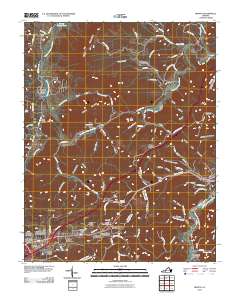
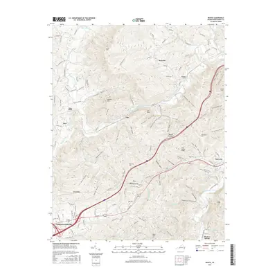
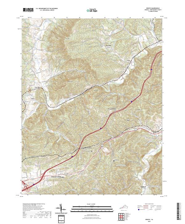 2022 Ironto2022 Print · USGSModern Montgomery County remains shaped by its river valleys and mountain gaps as seen in this recent survey. Genealogists and historians can trace family roots through the Preston Family Cem or explore the geography of Ironto, Shawsville, and Alleghany Springs.
End of results
Showing maps 1-13 of 13
Top cities near Den Hill
- Blacksburg historical maps
- Christiansburg historical maps
- Merrimac historical maps
- Plum Creek historical maps
- Prices Fork historical maps
- Belview historical maps
See more
Frequently asked questions
- What are the different types of historical maps available for Den Hill?
- What is the oldest map of Den Hill?
- Where can I purchase historical maps of Den Hill for my home or office?
- Where can I download high-res historical maps of Den Hill?
- Are there historical topographic maps available for Den Hill?
- Is there historical aerial imagery available for Den Hill?
- Where are historical maps of Den Hill sourced from?