Old Maps of White Rock, Virginia for Genealogy
Trace your family roots with 17 historic maps of White Rock. These high-res maps reveal old neighborhoods, homesites, landmarks, and streets — helping you uncover where your ancestors lived and how the area evolved over time.
- Explore historic neighborhoods: Identify where your relatives may have lived in the 1800s or 1900s.
- Compare maps over time: Trace the changes in streets, buildings, and landmarks for multi-generational research.
- Perfect for genealogy & ancestry research: Used by family historians and researchers to map out lineage and migration.
These maps are an incredible resource for exploring your personal connection to White Rock's past.
White Rock, VA maps
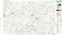
(17)- 1894 Map of Lexington, 1900 Print
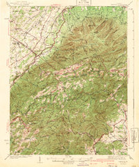
 1894 Lexington1900 Print · USGSAmherst and the surrounding Blue Ridge foothills are captured in the late nineteenth century during a period of rural expansion and early rail development. Genealogists can locate family homesteads near Clifford P.O. or trace landmarks like Cornerstone Ch. and Massies Mill.7 unique versions available
 - 1936 Map of Vesuvius
 1936 Vesuvius1936 Print · USGSThe Blue Ridge mountain front meets the Shenandoah Valley in the 1930s, showing a land of rail junctions and high-country mines. Researchers can trace the Appalachian Trail past peaks like The Priest and find local history at Steeles Tavern or Old Providence Cem.
 - 1941 Map of Vesuvius
 1941 Vesuvius1941 Print · USGSThe Blue Ridge highlands at the start of the 1940s reveal a landscape of mountain mines and early parkway development. Genealogists and hikers can trace the Appalachian Trail past the Irish Creek Mission and forgotten sites like Mill Creek Sch.2 unique versions available
 - 1947 Map of Roanoke, 1948 Print
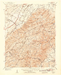
 1947 Roanoke1948 Print · USGSCentral Virginia in the late 1940s reveals a region defined by its great mountain ridges and the powerful river-and-rail economy connecting Roanoke to Lynchburg. Researchers can trace the path of the Virginian RR and locate historic county seats like Charlotte Court House.2 unique versions available
 - 1950 Map of Vesuvius, 1960 Print
 1950 Vesuvius1960 Print · USGSThe Blue Ridge high country of Augusta and Nelson counties comes alive in the mid-twentieth century, showing a landscape of remote mountain missions and state institutions. Genealogists and hikers can trace the Appalachian Trail past Irish Creek Mission, Montebello, and the State Prison Camp No 10.2 unique versions available
 - 1951 Map of Vesuvius
 1951 Vesuvius1951 Print · USGSThe Blue Ridge foothills of Augusta and Rockbridge Counties are shown here in the early fifties, capturing a landscape of mountain missions and remote mines. Trace family history through Old Providence Ch, the Irish Creek Mission, and Massies Mill.2 unique versions available
 - 1959 Map of Roanoke
 1959 Roanoke1959 Print · USGSCentral Virginia and the Blue Ridge appear in great detail during the late fifties, showcasing the transition from mountain industry to Piedmont farmland. Trace the path of the Norfolk and Western railroad or find old river towns like Appomattox and Amelia Court House.
 - 1963 Map of Roanoke
 1963 Roanoke1963 Print · USGSCentral Virginia and the Blue Ridge front appear here in the early sixties, caught between their deep railroad roots and new postwar developments. Genealogists and historians can trace the rail lines of the Norfolk and Western through towns like Bedford and Altavista, or locate family landmarks near Smith Mountain Lake.
 - 1965 Map of Big Levels, 1967 Print
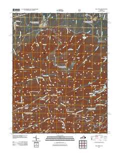
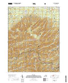
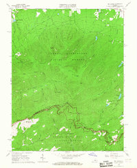 1965 Big Levels1967 Print · USGSThe Blue Ridge high country in the mid-1960s shows a landscape of federal forest land, mountain overlooks, and seasonal campgrounds. Trace local history through the White Rock Cemetery, the village of Love, and various landmarks along the Blue Ridge Parkway.4 unique versions available
 - 1971 Map of Roanoke, 1977 Print
 1971 Roanoke1977 Print · USGSThe Virginia Piedmont and Blue Ridge mountains meet in this early 1970s landscape of river valleys and rail hubs. Researchers can trace historic transportation routes and landmarks like the Appomattox Court House Nat Hist Pk, the Peaks of Otter, and Amelia Court House.2 unique versions available
 - 1986 Map of Buena Vista
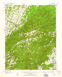
 1986 Buena Vista1986 Print · USGSThe mid-eighties landscape around Rockbridge County comes alive in this survey of the Blue Ridge and Allegheny foothills. Researchers can trace the legacy of institutions like Washington and Lee University or follow the historic Chesapeake and Ohio Railway through Clifton Forge.2 unique versions available
 - 1999 Map of Big Levels, 2000 Print
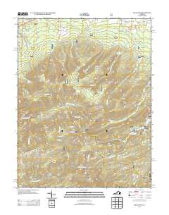
 1999 Big Levels2000 Print · USGSAugusta County mountain life and the high ridges of the Blue Ridge come into focus in this late-twentieth-century study. Genealogists and hikers can trace the winding Blue Ridge Parkway, the small settlement of Love, and historical mountain Mines.
 - 2011 Map of Big Levels, 2011 Print
 2011 Big Levels2011 Print · USGSCovers White Rock, including Love, Augusta County, and other nearby areas
 - 2013 Map of Big Levels, 2013 Print
 2013 Big Levels2013 Print · USGSCovers White Rock, including Love, Augusta County, and other nearby areas
 - 2016 Map of Big Levels, 2016 Print
 2016 Big Levels2016 Print · USGSCovers White Rock, including Love, Augusta County, and other nearby areas
 - 2019 Map of Big Levels, 2019 Print
 2019 Big Levels2019 Print · USGSCovers White Rock, including Love, Augusta County, and other nearby areas
 - 2022 Map of Big Levels, 2022 Print
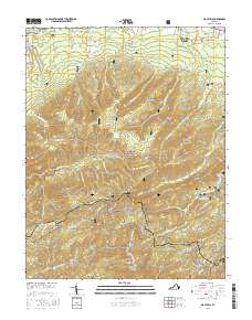
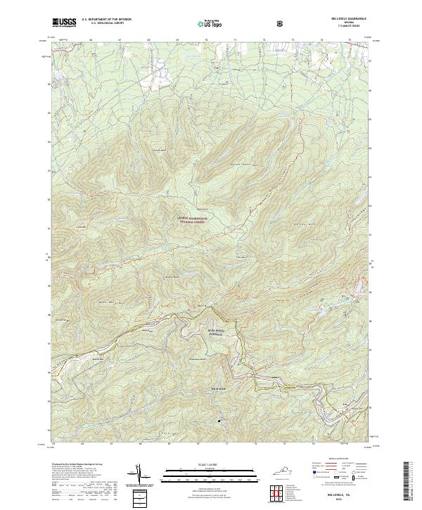 2022 Big Levels2022 Print · USGSThe high ridges of the Blue Ridge Mountains overlook the Augusta and Nelson county line in the early twenty-first century. Hikers and historians can trace the paths to Sherando Lake, the settlement of Love, and the isolated White Rock Cem.
End of results
Showing maps 1-17 of 17
Top cities near White Rock
- Waynesboro historical maps
- Stuarts Draft historical maps
- Lyndhurst historical maps
- Dooms historical maps
- Nellysford historical maps
- Jolivue historical maps
See more
Frequently asked questions
- What are the different types of historical maps available for White Rock?
- What is the oldest map of White Rock?
- Where can I purchase historical maps of White Rock for my home or office?
- Where can I download high-res historical maps of White Rock?
- Are there historical topographic maps available for White Rock?
- Is there historical aerial imagery available for White Rock?
- Where are historical maps of White Rock sourced from?