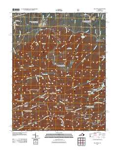
2011 Map of Big Levels
USGS Topo · Published 2011About this map
Big Levels serves as a high-altitude plateau overlooking a complex network of Blue Ridge watercourses and early industrial sites. The landscape is defined by its recreation and natural resource history, featuring the Kennedy Mine and Red Mountain Mine alongside established camps like Camp Thunderbird and the Kennedy Fields Campgrounds. Water management is prominent throughout the quadrangle, evidenced by the Coles Run Reservoir and multiple dams such as the South River Number 27 Dam.
Find a feature on this map
70 named features on this map. Tap any name to fly to it.
Don’t see what you’re looking for? This feature index may not catch every label — zoom into the map to look around manually.
Map Details
Editions of this 2011 Big Levels Map
This is the sole edition of this map. No revisions or reprints were ever made.
Other maps of this area

1892 · Buckingham
USGS Topo · 1:125,000

1892 · Harrisonburg
USGS Topo · 1:125,000

1894 · Staunton
USGS Topo · 1:125,000

1894 · Lexington
USGS Topo · 1:125,000

1934 · Waynesboro
USGS Topo · 1:48,000

1936 · Vesuvius
USGS Topo · 1:48,000

1939 · Waynesboro
USGS Topo · 1:62,500

1941 · Vesuvius
USGS Topo · 1:62,500

1943 · Lovingston
USGS Topo · 1:62,500

1944 · Staunton
USGS Topo · 1:62,500