Old Maps of Orange, Virginia for Metal Detecting
Plan your next treasure hunt with 16 historic maps of Orange. Find old homesites, ghost towns, trails, and gathering spots that may be lost to time — perfect for identifying promising metal detecting locations.
- Locate forgotten sites: Uncover places like long-lost settlements, abandoned rail lines, or gathering spots.
- Plan better hunts: Use map overlays combined with LiDAR or satellite views to narrow in on historically rich areas.
- Made for detectorists: Thousands of hobbyists use these maps to discover relics, coins, and hidden history.
Use these historic maps to boost your research and find new opportunities beneath the surface of Orange.
Orange, VA maps
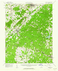
(16)- 1892 Map of Gordonsville, 1899 Print
 1892 Gordonsville1899 Print · USGSCentral Virginia’s railway hubs and mountain gaps come alive in this late nineteenth-century survey. Genealogists and historians can trace the foundations of Charlottesville and the bustling rail junctions at Gordonsville and Orange.6 unique versions available
 - 1949 Map of Charlottesville
 1949 Charlottesville1949 Print · USGSThe Shenandoah Valley and Blue Ridge appear in the late 1940s as a thriving corridor of rail and river commerce. Researchers can trace the mid-century footprints of Harrisonburg, Staunton, and Culpeper alongside the historic routes of the Southern Railway.2 unique versions available
 - 1956 Map of Charlottesville, 1966 Print
 1956 Charlottesville1966 Print · USGSThe Shenandoah Valley and Blue Ridge are captured in detail during the mid-1960s as the modern interstate system began to emerge. Genealogists and historians can trace rail-connected hubs like Waynesboro or follow the river paths of the Rapidan River and Rivanna River.4 unique versions available
 - 1961 Map of Gordonsville, 1962 Print
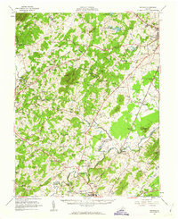
 1961 Gordonsville1962 Print · USGSCentral Virginia in the early sixties remains a landscape of deep historical roots and rail-based commerce. Genealogists and researchers can trace family names through landmarks like Boswells Tavern, the James Madison Grave, and rural sites like Liberty Mills.2 unique versions available
 - 1961 Map of Rapidan, 1963 Print
 1961 Rapidan1963 Print · USGSMadison and Culpeper Counties during the early sixties show a transition from a traditional mill-based economy to a modern rural landscape. Genealogists can trace family names at Waylands Mill, Achsah, and Thorofare Mtn Chapel along the Piedmont rivers.2 unique versions available
 - 1970 Map of Orange, 1972 Print
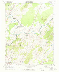
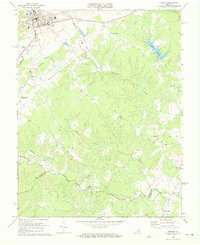 1970 Orange1972 Print · USGSOrange and its surrounding Piedmont countryside are captured in the early seventies as a rail-centered community. Genealogists can locate family landmarks like Pierces Shop, Vawter Corner, and historic congregations at Shady Grove Ch.3 unique versions available
 - 1970 Map of Gordonsville, 1972 Print
 1970 Gordonsville1972 Print · USGSGordonsville and the surrounding Virginia Piedmont are captured here in the early seventies as a vital rail crossroads. Researchers can trace family history through sites like James Madison Sch, Blue Run Ch, and the many cemeteries near Old Somerset.3 unique versions available
 - 1971 Map of Rapidan, 1972 Print
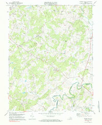
 1971 Rapidan1972 Print · USGSOrange and Culpeper Counties meet at the river forks in the early 1970s, showing a landscape defined by the Southern rail line and traditional rural crossroads. Researchers can locate local landmarks like Woodberry Forest Sch, Emmanuel Ch, and the quarries near Buzzard Mountain.2 unique versions available
 - 1971 Map of Madison Mills, 1984 Print
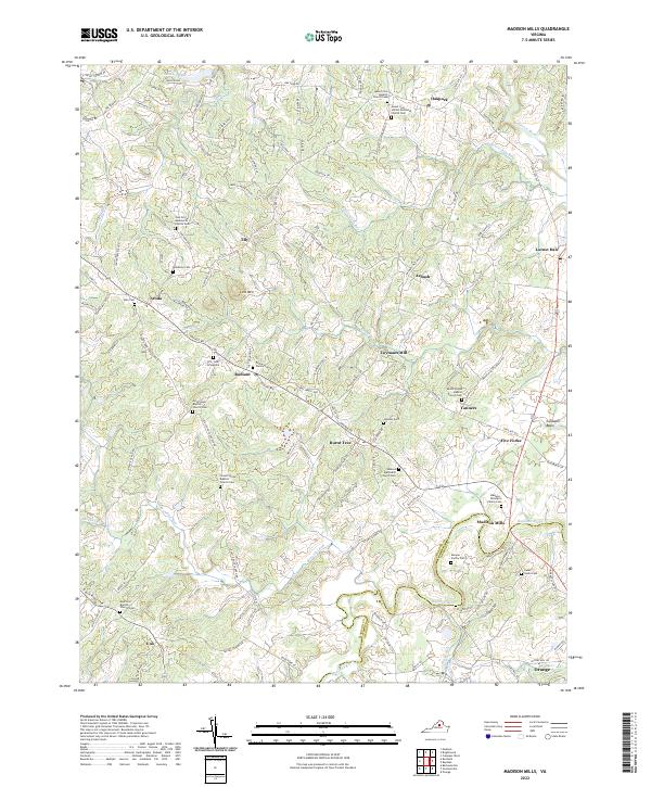
 1971 Madison Mills1984 Print · USGSMadison and Orange Counties are captured in the early 1970s along the winding banks of the Rapidan River. Genealogists and local historians can trace rural roots through landmarks like Prices Shop, Twymans Mill, and the Grymes Sch.2 unique versions available
 - 1977 Map of Gordonsville, 1982 Print
 1977 Gordonsville1982 Print · USGSGordonsville and the surrounding Virginia Piedmont appear in sharp detail during the late seventies, showing the area's rural character and rail-town roots. Researchers can trace land tracts near Gordonsville and Somerset or locate family sites along Blue Run.
 - 1986 Map of Charlottesville
 1986 Charlottesville1986 Print · USGSCentral Virginia in the mid-eighties shows a landscape balanced between the growing city centers of the Piedmont and the protected ridges of the Blue Ridge. Trace the historic rail lines of the Chesapeake and Ohio Railway or locate local landmarks like Monticello Mountain and Bridgewater College.3 unique versions available
 - 1994 Map of Orange, 1997 Print
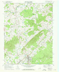
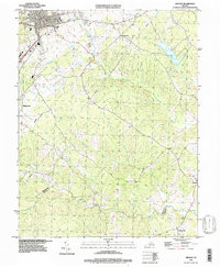 1994 Orange1997 Print · USGSThe town of Orange and its surrounding rural crossroads are captured here in the mid-1990s as the regional landscape transitioned into the modern era. Genealogists and local historians can trace family locations near Pierces Shop, Daniel, and Vawter Corner.
 - 2022 Map of Rapidan, 2022 Print
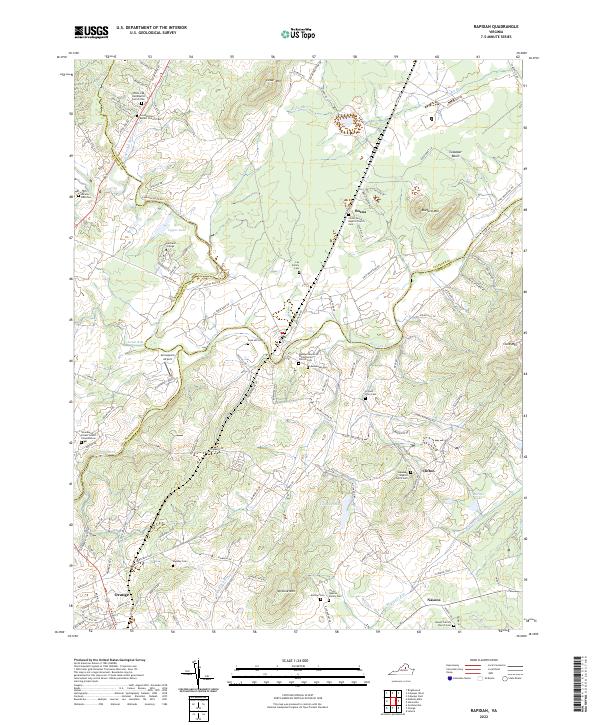 2022 Rapidan2022 Print · USGSThe Piedmont countryside at the meeting of Culpeper and Orange Counties remains a landscape of family legacy and river junctions. Researchers can trace ancestral roots through dozens of local sites like Jerdone Cem, Taylor-Quarles Family Cem, and the Waddell Memorial Presbyterian Church.
 - 2022 Map of Madison Mills, 2022 Print
 2022 Madison Mills2022 Print · USGSMadison and Orange Counties come together along the Rapidan River in this modern survey of central Virginia. Researchers can trace ancestral lines through numerous family plots like the Madison - Taliaferro Family Cem and Dade - Cason Cem near Madison Mills.
 - 2022 Map of Gordonsville, 2022 Print
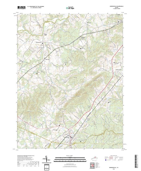 2022 Gordonsville2022 Print · USGSGordonsville and the surrounding Piedmont country are captured here in the early twenty-first century, showing a landscape of family estates and transit hubs. Researchers can trace ancestral roots through numerous local burial sites like Maplewood Cem, Woodbury Cem, and the Augustine Webb Cem.
 - 2022 Map of Orange, 2022 Print
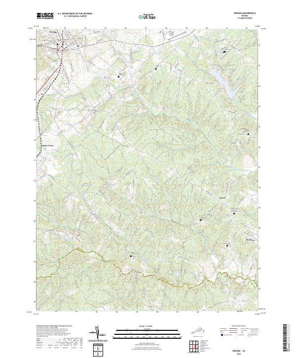 2022 Orange2022 Print · USGSThis Piedmont landscape centered on Orange, Virginia, shows the area’s evolution into the twenty-first century. Researchers can trace deep family roots through numerous burial sites like the Finnell Family Cem or locate community centers such as Shady Grove Baptist Church.
End of results
Showing maps 1-16 of 16
Top cities near Orange
- Culpeper historical maps
- Louisa historical maps
- Gordonsville historical maps
- Brightwood historical maps
- Blue Ridge Shores historical maps
- Madison historical maps
See more
Top neighborhoods of Orange
Frequently asked questions
- What are the different types of historical maps available for Orange?
- What is the oldest map of Orange?
- Where can I purchase historical maps of Orange for my home or office?
- Where can I download high-res historical maps of Orange?
- Are there historical topographic maps available for Orange?
- Is there historical aerial imagery available for Orange?
- Where are historical maps of Orange sourced from?