1970s Maps of Orange, Virginia
Explore 5 historic maps of Orange from the 1970s. These maps offer a rare glimpse into what life looked like during the 1970s — showing old roads, neighborhoods, homes, and landmarks that have changed or disappeared over time.
Whether you're researching your family's past, planning a metal detecting trip, or studying how Orange's landscape evolved across the 1970s, these high-resolution maps are a powerful tool for exploring the history of this region.
- Focus on a specific era: All maps on this page are from the 1970s, giving you a focused view of this time period.
- See what’s changed: Compare century-old streets, trails, and buildings to today's modern landscape using overlays and satellite layers.
- Research with precision: Use these maps for genealogy, historical research, land use analysis, or educational projects.
- View, download, or print: Maps are fully viewable online in high resolution, and can be downloaded or printed for your own records.
Start exploring Orange's history through authentic maps from the 1970s. This is your window into the past.
Orange, VA maps
(5)- 1970 Map of Orange, 1972 Print
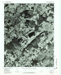
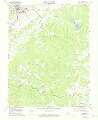 1970 Orange1972 Print · USGSOrange and its surrounding Piedmont countryside are captured in the early seventies as a rail-centered community. Genealogists can locate family landmarks like Pierces Shop, Vawter Corner, and historic congregations at Shady Grove Ch.3 unique versions available
 - 1970 Map of Gordonsville, 1972 Print
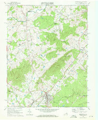 1970 Gordonsville1972 Print · USGSGordonsville and the surrounding Virginia Piedmont are captured here in the early seventies as a vital rail crossroads. Researchers can trace family history through sites like James Madison Sch, Blue Run Ch, and the many cemeteries near Old Somerset.3 unique versions available
 - 1971 Map of Rapidan, 1972 Print
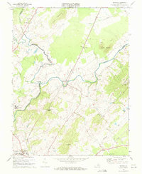 1971 Rapidan1972 Print · USGSOrange and Culpeper Counties meet at the river forks in the early 1970s, showing a landscape defined by the Southern rail line and traditional rural crossroads. Researchers can locate local landmarks like Woodberry Forest Sch, Emmanuel Ch, and the quarries near Buzzard Mountain.2 unique versions available
 - 1971 Map of Madison Mills, 1984 Print
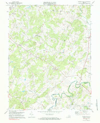 1971 Madison Mills1984 Print · USGSMadison and Orange Counties are captured in the early 1970s along the winding banks of the Rapidan River. Genealogists and local historians can trace rural roots through landmarks like Prices Shop, Twymans Mill, and the Grymes Sch.2 unique versions available
 - 1977 Map of Gordonsville, 1982 Print
 1977 Gordonsville1982 Print · USGSGordonsville and the surrounding Virginia Piedmont appear in sharp detail during the late seventies, showing the area's rural character and rail-town roots. Researchers can trace land tracts near Gordonsville and Somerset or locate family sites along Blue Run.
End of results
Showing maps 1-5 of 5
Top cities near Orange
- Culpeper historical maps
- Louisa historical maps
- Gordonsville historical maps
- Brightwood historical maps
- Blue Ridge Shores historical maps
- Madison historical maps
See more
Top neighborhoods of Orange
Frequently asked questions
- What are the different types of historical maps available for Orange?
- What is the oldest map of Orange?
- Where can I purchase historical maps of Orange for my home or office?
- Where can I download high-res historical maps of Orange?
- Are there historical topographic maps available for Orange?
- Is there historical aerial imagery available for Orange?
- Where are historical maps of Orange sourced from?