Old Maps of Eldon Knolls, Virginia for Hiking & Exploration
Hike through history with 13 historic maps of Eldon Knolls. Explore old trails, ghost towns, and forgotten backroads — perfect for outdoor adventurers and local explorers.
- Rediscover forgotten places: Map out old mining camps, roads, and footpaths that no longer exist on modern maps.
- Layer with modern tools: Combine with LiDAR or satellite views to plan hikes through historical terrain.
- Made for exploration: Popular among hikers, overlanders, and local history lovers.
Use these maps to find adventure and explore the hidden past of Eldon Knolls.
Eldon Knolls, VA maps
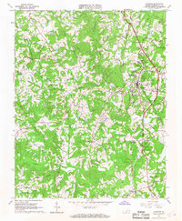
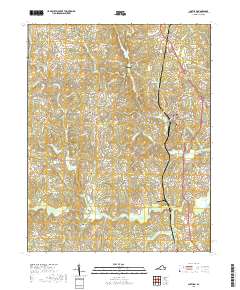
(13)- 1921 Map of Chatham
 1921 Chatham1921 Print · USGSPittsylvania County's rural heartland is captured here in the early twenties, anchored by the railway and the ridge of White Oak Mountain. Genealogists and historians can locate dozens of country landmarks like Tight Squeeze, Whittles Depot, and Mountain Spring Church.
 - 1923 Map of Chatham
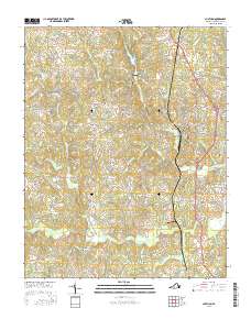
 1923 Chatham1923 Print · USGSPittsylvania County's rural heartland is captured here in the early twenties, centered on the strategic rail hub of Chatham. Researchers can trace the heritage of local industry and community life through sites like Bennett Mine, Tight Squeeze, and the County Poor Farm.3 unique versions available
 - 1953 Map of Greensboro, 1981 Print
 1953 Greensboro1981 Print · USGSThe Piedmont borderlands of North Carolina and Virginia show a landscape defined by new reservoirs and old rail lines. Trace family roots and the changing river geography through Elon College, the John H Kerr Reservoir, and South Boston.
 - 1954 Map of Greensboro
 1954 Greensboro1954 Print · USGSThe Piedmont borderlands of North Carolina and Virginia come alive in this mid-fifties study of a region defined by its rivers and rails. Researchers can trace the growing Buggs Island Lake or follow the paths of the Southern Ry and Seaboard Air Line RR through towns like Oxford and Reidsville.
 - 1962 Map of Greensboro
 1962 Greensboro1962 Print · USGSThe Piedmont region along the Virginia and North Carolina border comes alive in the early 1960s, showing a landscape defined by industry and new reservoirs. Trace the path of the Virginian RR or explore the early development of Greensboro and Durham.
 - 1965 Map of Chatham, 1968 Print
 1965 Chatham1968 Print · USGSPittsylvania County in the mid-1960s was an area defined by its educational institutions and deep tobacco-farming roots. Researchers can trace the grounds of Hargrave Military Academy, the community at Tight Squeeze, and the Banister River watershed.3 unique versions available
 - 1966 Map of Greensboro
 1966 Greensboro1966 Print · USGSThe North Carolina and Virginia Piedmont thrives during the mid-sixties, showcasing a landscape of textile hubs and expanding river reservoirs. Researchers can trace the rail corridors of the Southern Railway, find local landmarks like Elon College, or locate the extensive Camp Butner Military Reservation.
 - 1984 Map of Danville
 1984 Danville1984 Print · USGSThe Virginia and North Carolina borderlands in the mid-1980s reveal a landscape of industrial river towns and rural Piedmont crossroads. Genealogists and historians can trace family sites near Highland Burial Park, find local landmarks like the Patrick Henry Monument, and locate old settlements like Callands or Milton.
 - 2011 Map of Chatham, 2011 Print
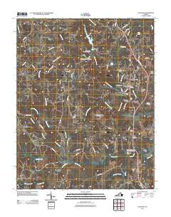 2011 Chatham2011 Print · USGSCovers Eldon Knolls, including Chatham, Hollywood, and other nearby areas
 - 2013 Map of Chatham, 2013 Print
 2013 Chatham2013 Print · USGSCovers Eldon Knolls, including Chatham, Hollywood, and other nearby areas
 - 2016 Map of Chatham, 2016 Print
 2016 Chatham2016 Print · USGSCovers Eldon Knolls, including Chatham, Hollywood, and other nearby areas
 - 2019 Map of Chatham, 2019 Print
 2019 Chatham2019 Print · USGSCovers Eldon Knolls, including Chatham, Hollywood, and other nearby areas
 - 2022 Map of Chatham, 2022 Print
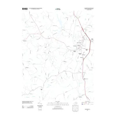
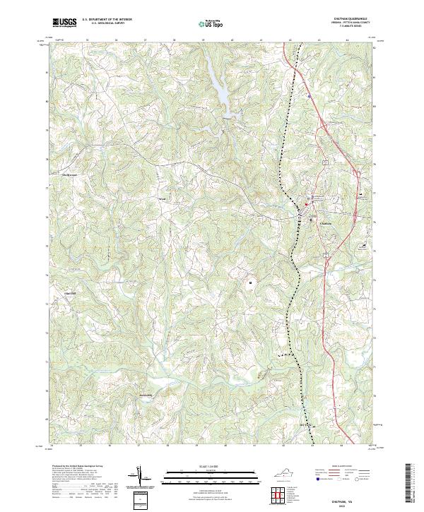 2022 Chatham2022 Print · USGSPittsylvania County's seat of government and its surrounding rural hamlets are captured here in the early twenty-first century. Genealogists can trace family landmarks like Jones Mill and the Pittsylvania County Courthouse or locate burials at Hillcrest Burial Park.
End of results
Showing maps 1-13 of 13
Top cities near Eldon Knolls
Frequently asked questions
- What are the different types of historical maps available for Eldon Knolls?
- What is the oldest map of Eldon Knolls?
- Where can I purchase historical maps of Eldon Knolls for my home or office?
- Where can I download high-res historical maps of Eldon Knolls?
- Are there historical topographic maps available for Eldon Knolls?
- Is there historical aerial imagery available for Eldon Knolls?
- Where are historical maps of Eldon Knolls sourced from?