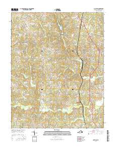
2016 Map of Chatham
USGS Topo · Published 2016About this map
The Banister River winds through the southern portion of this landscape, anchoring a network of tributaries that includes Pudding Creek and Dry Fork. The town of Chatham serves as the central hub, where numerous local routes converge and residential patterns are most dense. Significant commemorative spaces like Chatham Burial Park and Hillcrest Memorial Park are established here, alongside the Rawley White Martin Memorial Bridge which crosses the river.
Find a feature on this map
108 named features on this map. Tap any name to fly to it.
Don’t see what you’re looking for? This feature index may not catch every label — zoom into the map to look around manually.
Map Details
Editions of this 2016 Chatham Map
This is the sole edition of this map. No revisions or reprints were ever made.
Other maps of this area

1921 · Chatham
USGS Topo · 1:48,000

1922 · Callands
USGS Topo · 1:48,000

1923 · Danville
USGS Topo · 1:48,000

1923 · Chatham
USGS Topo · 1:62,500

1924 · Draper
USGS Topo · 1:48,000

1924 · Callands
USGS Topo · 1:62,500

1925 · Danville
USGS Topo · 1:62,500

1926 · Draper
USGS Topo · 1:62,500

1944 · Draper
USGS Topo · 1:62,500

1944 · Callands
USGS Topo · 1:62,500