Old Maps of Green Pond, Virginia for Academic Research
Study the evolution of Green Pond with 14 high-resolution historic maps. Whether you're teaching, researching, or modeling changes in land use, these maps provide essential visual documentation of urban, environmental, and geographic change.
- Analyze long-term change: Track patterns in development, transportation, and natural features.
- Ideal for environmental or urban studies: Support academic projects with primary historical map data.
- Use in the classroom or lab: Educators and researchers rely on these maps to bring historical context to life.
These maps are a powerful tool for teaching, research, and visualizing how Green Pond has changed over the decades.
Green Pond, VA maps
(14)- 1922 Map of Callands
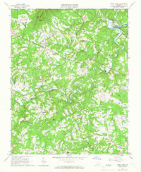
 1922 Callands1922 Print · USGSIn the early 1920s, this pocket of rural Virginia was a landscape of river fords, local stores, and family-named mills. Researchers can trace the roots of small communities at Callands and Swansonville or locate long-standing landmarks like Boones Chapel and La Prades Mill.
 - 1924 Map of Callands
 1924 Callands1924 Print · USGSSouthern Virginia in the early twenties shows a landscape of ridges and river bends at the borders of Franklin, Henry, and Pittsylvania counties. Researchers can trace old family sites and rural infrastructure including Swansons Mill, Burnt Chimney, and the Fralin Bridge over the Pigg River.3 unique versions available
 - 1944 Map of Callands
 1944 Callands1944 Print · USGSThe rural Virginia Piedmont comes to life in the 1940s as schools, mills, and mountain gaps define the landscape near the Pigg River. Researchers can trace ancestral home sites and community hubs like Union Hall, Giles Mill, and the Mayflower Sch.
 - 1953 Map of Greensboro, 1981 Print
 1953 Greensboro1981 Print · USGSThe Piedmont borderlands of North Carolina and Virginia show a landscape defined by new reservoirs and old rail lines. Trace family roots and the changing river geography through Elon College, the John H Kerr Reservoir, and South Boston.
 - 1954 Map of Greensboro
 1954 Greensboro1954 Print · USGSThe Piedmont borderlands of North Carolina and Virginia come alive in this mid-fifties study of a region defined by its rivers and rails. Researchers can trace the growing Buggs Island Lake or follow the paths of the Southern Ry and Seaboard Air Line RR through towns like Oxford and Reidsville.
 - 1962 Map of Greensboro
 1962 Greensboro1962 Print · USGSThe Piedmont region along the Virginia and North Carolina border comes alive in the early 1960s, showing a landscape defined by industry and new reservoirs. Trace the path of the Virginian RR or explore the early development of Greensboro and Durham.
 - 1965 Map of Sandy Level, 1966 Print
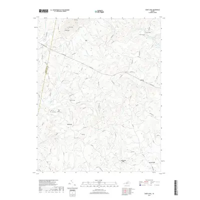
 1965 Sandy Level1966 Print · USGSThe rural border of Franklin and Pittsylvania counties is captured in the mid-1960s during a period of significant hydraulic change. Genealogists and historians can trace family locations near Museville, Andersons Mill, and Carter Cem.3 unique versions available
 - 1966 Map of Greensboro
 1966 Greensboro1966 Print · USGSThe North Carolina and Virginia Piedmont thrives during the mid-sixties, showcasing a landscape of textile hubs and expanding river reservoirs. Researchers can trace the rail corridors of the Southern Railway, find local landmarks like Elon College, or locate the extensive Camp Butner Military Reservation.
 - 1984 Map of Danville
 1984 Danville1984 Print · USGSThe Virginia and North Carolina borderlands in the mid-1980s reveal a landscape of industrial river towns and rural Piedmont crossroads. Genealogists and historians can trace family sites near Highland Burial Park, find local landmarks like the Patrick Henry Monument, and locate old settlements like Callands or Milton.
 - 2011 Map of Sandy Level, 2011 Print
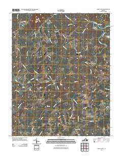 2011 Sandy Level2011 Print · USGSCovers Green Pond, including Ajax, Museville, and other nearby areas
 - 2013 Map of Sandy Level, 2013 Print
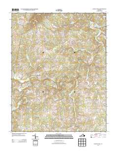 2013 Sandy Level2013 Print · USGSCovers Green Pond, including Ajax, Museville, and other nearby areas
 - 2016 Map of Sandy Level, 2016 Print
 2016 Sandy Level2016 Print · USGSCovers Green Pond, including Ajax, Museville, and other nearby areas
 - 2019 Map of Sandy Level, 2019 Print
 2019 Sandy Level2019 Print · USGSCovers Green Pond, including Ajax, Museville, and other nearby areas
 - 2022 Map of Sandy Level, 2022 Print
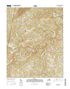
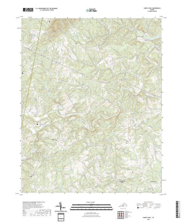 2022 Sandy Level2022 Print · USGSThe rural boundary of Franklin and Pittsylvania counties remains a land of winding river bends and family homesteads. Researchers can locate ancestral sites like the Five Forks Church Cem, the historic Andersons Mill, and the small settlement of Museville.
End of results
Showing maps 1-14 of 14
Top cities near Green Pond
- Mount Hermon historical maps
- Altavista historical maps
- North Shore historical maps
- Chatham historical maps
- Union Hall historical maps
- Gretna historical maps
See more
Frequently asked questions
- What are the different types of historical maps available for Green Pond?
- What is the oldest map of Green Pond?
- Where can I purchase historical maps of Green Pond for my home or office?
- Where can I download high-res historical maps of Green Pond?
- Are there historical topographic maps available for Green Pond?
- Is there historical aerial imagery available for Green Pond?
- Where are historical maps of Green Pond sourced from?