Old Maps of Disputanta, Virginia for Academic Research
Study the evolution of Disputanta with 16 high-resolution historic maps. Whether you're teaching, researching, or modeling changes in land use, these maps provide essential visual documentation of urban, environmental, and geographic change.
- Analyze long-term change: Track patterns in development, transportation, and natural features.
- Ideal for environmental or urban studies: Support academic projects with primary historical map data.
- Use in the classroom or lab: Educators and researchers rely on these maps to bring historical context to life.
These maps are a powerful tool for teaching, research, and visualizing how Disputanta has changed over the decades.
Disputanta, VA maps
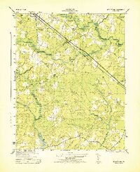
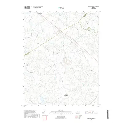
(16)- 1919 Map of Disputanta
 1919 Disputanta1919 Print · USGSCoastal Virginia during the late teens is characterized by a landscape of tidal creeks and rail-connected agricultural towns. Genealogists can locate family landmarks like Sycamore Church, Star Hill School, and the scattered hamlets of Newville and Garysville.3 unique versions available
 - 1943 Map of Richmond, 1972 Print
 1943 Richmond1972 Print · USGSCoastal Virginia and the state capital are shown in detail during the mid-century era of infrastructure expansion. Genealogists and historians can trace the grounds of Richmond Nat Battlefield Park, locate the Yorktown Nat Cem, or follow the many rural routes through Amelia Court House and Tappahannock.
 - 1944 Map of Nebletts Mill
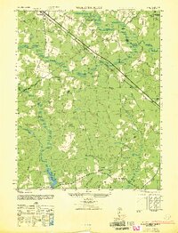
 1944 Nebletts Mill1944 Print · USGSCoastal plain wetlands and small rail-side settlements define this part of Sussex County during the mid-forties. Genealogists and local historians can trace the rural landscape surrounding Disputanta, the grounds of Newville Church, and the waters of Nebletts Mill Pond.
 - 1947 Map of Nebletts Mills
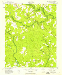
 1947 Nebletts Mills1947 Print · USGSCoastal Virginia during the late 1940s reveals a landscape of dense swamps and vital rail corridors connecting rural communities. Genealogists and local historians can trace the foundations of Disputanta and Newville, or locate landmarks like Cinema Church and Nebletts Millpond.
 - 1949 Map of Richmond, 1951 Print
 1949 Richmond1951 Print · USGSCoastal Virginia in the years following World War II remained a landscape of historic river towns and expanding military bases. Genealogists and historians can trace the rail lines of the Southern Ry and locate established landmarks from Camp Lee to the remote reaches of Dragon Swamp.
 - 1956 Map of Disputanta South, 1958 Print
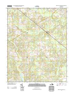
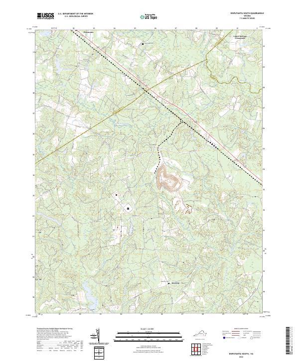
 1956 Disputanta South1958 Print · USGSThe coastal plain of Southeast Virginia in the 1950s was a landscape of dense swamps and quiet crossroads where three counties converged. Researchers can trace rural life through the locations of Centerville Ch, Wilburn Sch, and the Norfolk and Western rail line.
 - 1959 Map of Richmond
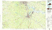
 1959 Richmond1959 Print · USGSMid-century Virginia is captured here at its most vital rail and river junctions, from the capital city to the Chesapeake Bay. Genealogists and historians can trace the development of colonial settlements like Williamsburg and military landmarks including Fort Monroe and Camp Lee.
 - 1964 Map of Richmond
 1964 Richmond1964 Print · USGSCoastal and central Virginia are mapped during the mid-twentieth century, showing the critical intersection of rail, river, and military life. Genealogists can trace family roots through rural county seats like Amelia or find vanished coastal neighborhoods near Phoebus and Hilton Village.
 - 1968 Map of Disputanta South, 1970 Print
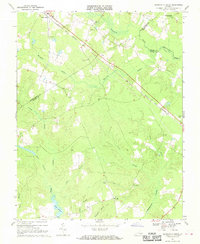 1968 Disputanta South1970 Print · USGSSussex and Prince George counties were characterized by vast wetlands and rail-side villages in the late sixties. Researchers can trace rural church locations like Wilburn Church and follow the Norfolk and Western line through Disputanta.3 unique versions available
 - 1973 Map of Richmond, 1974 Print
 1973 Richmond1974 Print · USGSThe Virginia Tidewater and Piedmont come alive in the early seventies, showcasing a region defined by its great rivers and massive military installations. Researchers can trace the mid-century growth of Richmond or locate family sites near Amelia Court House and Highland Springs.2 unique versions available
 - 1984 Map of Petersburg, 1985 Print
 1984 Petersburg1985 Print · USGSCentral Virginia in the mid-eighties shows a complex landscape of growing suburban centers and significant military installations. Researchers can trace historic boundaries and civic sites from Amelia Court House to the Glendale Nat Cem and Virginia State College.2 unique versions available
 - 2011 Map of Disputanta South, 2011 Print
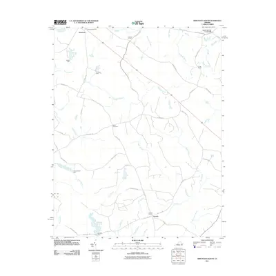 2011 Disputanta South2011 Print · USGSCovers Disputanta, including Newville, Laurel Springs Crossroads, and other nearby areas
 - 2013 Map of Disputanta South, 2013 Print
 2013 Disputanta South2013 Print · USGSCovers Disputanta, including Newville, Laurel Springs Crossroads, and other nearby areas
 - 2016 Map of Disputanta South, 2016 Print
 2016 Disputanta South2016 Print · USGSCovers Disputanta, including Newville, Laurel Springs Crossroads, and other nearby areas
 - 2019 Map of Disputanta South, 2019 Print
 2019 Disputanta South2019 Print · USGSCovers Disputanta, including Newville, Laurel Springs Crossroads, and other nearby areas
 - 2022 Map of Disputanta South, 2022 Print
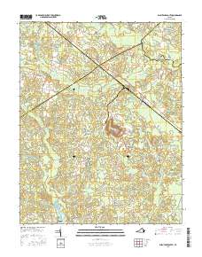
 2022 Disputanta South2022 Print · USGSSoutheastern Virginia's water-rich interior is captured here in the early twenty-first century, showing the rural networks of Sussex and Prince George Counties. Genealogists and historians can trace family locations near Newville, Laurel Springs Crossroads, and the grounds of Centerville Cem.
End of results
Showing maps 1-16 of 16
Top cities near Disputanta
- Petersburg historical maps
- Hopewell historical maps
- Colonial Heights historical maps
- Fort Gregg-Adams historical maps
- Ettrick historical maps
- Enon historical maps
See more
Frequently asked questions
- What are the different types of historical maps available for Disputanta?
- What is the oldest map of Disputanta?
- Where can I purchase historical maps of Disputanta for my home or office?
- Where can I download high-res historical maps of Disputanta?
- Are there historical topographic maps available for Disputanta?
- Is there historical aerial imagery available for Disputanta?
- Where are historical maps of Disputanta sourced from?