1970s Maps of Rappahannock County, Virginia
Explore 6 historic maps of Rappahannock County from the 1970s. These maps offer a rare glimpse into what life looked like during the 1970s — showing old roads, neighborhoods, homes, and landmarks that have changed or disappeared over time.
Whether you're researching your family's past, planning a metal detecting trip, or studying how Rappahannock County's landscape evolved across the 1970s, these high-resolution maps are a powerful tool for exploring the history of this region.
- Focus on a specific era: All maps on this page are from the 1970s, giving you a focused view of this time period.
- See what’s changed: Compare century-old streets, trails, and buildings to today's modern landscape using overlays and satellite layers.
- Research with precision: Use these maps for genealogy, historical research, land use analysis, or educational projects.
- View, download, or print: Maps are fully viewable online in high resolution, and can be downloaded or printed for your own records.
Start exploring Rappahannock County's history through authentic maps from the 1970s. This is your window into the past.
Rappahannock County, VA maps
(6)- 1971 Map of Massies Corner, 1972 Print
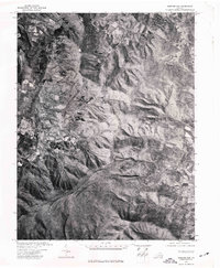
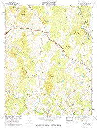 1971 Massies Corner1972 Print · USGSThe rural Virginia Piedmont comes to life in the early seventies, centered on the historic crossroads of Massies Corner and Amissville. Genealogists and historians can locate family cemeteries, country churches like Mt Moriah Ch, and the mills along the Thornton River.3 unique versions available
 - 1971 Map of Castleton, 1972 Print
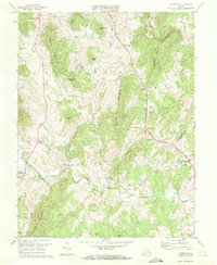
 1971 Castleton1972 Print · USGSThe Virginia Piedmont at the turn of the 1970s remained a landscape of riverside hamlets and country parishes along the Hazel River. Genealogists and local historians can trace family locations near Monumental Mills, Eggbornsville, and the Gourdvine Ch.2 unique versions available
 - 1971 Map of Woodville, 1972 Print
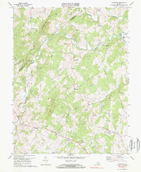
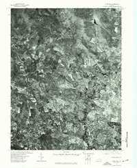
 1971 Woodville1972 Print · USGSRappahannock County in the early seventies remains a landscape of tucked-away mills and family crossroads. Genealogists can locate legacy sites like Peola Mills, Slate Mills, and Revercombs Corner among the peaks of Bessie Bell Mountain.3 unique versions available
 - 1971 Map of Washington, 1986 Print
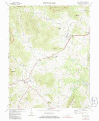 1971 Washington1986 Print · USGSThe foothills of Rappahannock County come alive in this early 1970s survey as the mountains of the Blue Ridge meet valley settlements. Researchers can trace rural life through landmarks like Fletcher Mill, Reynolds Ch, and the crossroads at Rediviva.
 - 1972 Map of Chester Gap, 1977 Print
 1972 Chester Gap1977 Print · USGSThe Blue Ridge foothills of northern Virginia are captured in this early 1970s aerial survey just as the landscape was beginning a new chapter of growth. Researchers can trace rural property lines and historic road patterns around Browntown and Chester Gap.
 - 1972 Map of Flint Hill, 1977 Print
 1972 Flint Hill1977 Print · USGSRappahannock and Fauquier counties are captured in the early seventies during a period of steady agricultural tradition. Researchers can trace the layout of historic crossroads settlements like Flint Hill and Hume through detailed aerial orthophotography.
End of results
Showing maps 1-6 of 6
Top cities of Rappahannock County
- Chester Gap historical maps
- Flint Hill historical maps
- Sperryville historical maps
- Washington historical maps
Frequently asked questions
- What are the different types of historical maps available for Rappahannock County?
- What is the oldest map of Rappahannock County?
- Where can I purchase historical maps of Rappahannock County for my home or office?
- Where can I download high-res historical maps of Rappahannock County?
- Are there historical topographic maps available for Rappahannock County?
- Is there historical aerial imagery available for Rappahannock County?
- Where are historical maps of Rappahannock County sourced from?